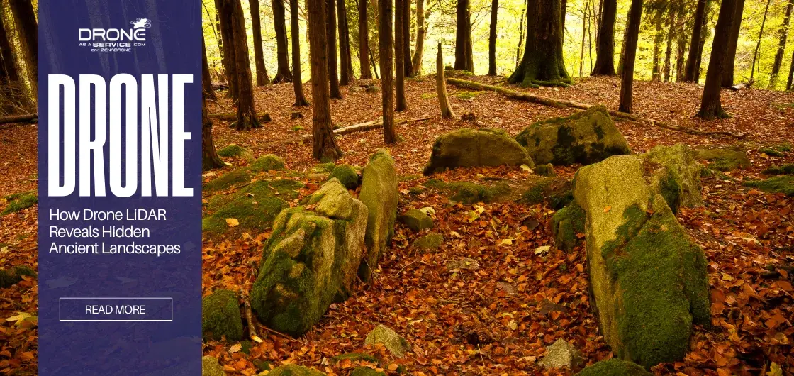
What Is LiDAR Archaeology & How Drone LiDAR Works to Reveal Hidden Sites
TL;DR
- Drone LiDAR archaeology reveals ancient landscapes hidden beneath dense forest canopies
- Non-invasive drone surveys detect roads, terraces, and buried structures without ground disturbance
- Active laser pulses generate accurate bare-earth terrain models, unlike photogrammetry
- Active laser pulses generate accurate bare-earth terrain models, unlike photogrammetry
Introduction
For decades, the discovery of ancient civilizations was severely limited by the physical barriers of the environment, particularly in dense tropical regions. The use of traditional excavation and satellite imagery could not easily penetrate heavy canopy covers and concealed large city-states and infrastructure, as the naked eye could not see.
As documented by National Geographic , “With the development of LiDAR archaeology, this paradigm changed radically, providing a tool to digitally strip away vegetation and reveal human-made landscape features beneath it “
This technology has transitioned from a niche experiment to a core pillar of modern archaeological research. By integrating Light Detection and Ranging (LIDAR) sensors onto Unmanned Aerial Vehicles (UAVs), researchers can now map sites with unprecedented resolution and speed.
This article explains how drone-mounted LiDAR systems work, why they outperform traditional archaeological survey methods, and when researchers should use them.
What Is LiDAR Archaeology?
LiDAR archaeology is an active remote sensing technique that uses laser pulses from drones to digitally remove vegetation and reveal the underlying terrain.
The sensor sends out hundreds of thousands of laser pulses every second towards the ground in order to calculate accurate distances. This system produces an exact 3D image of the surface beneath when installed on a drone and is usable in any lighting conditions.
The advantage of LiDAR archaeology is the capability of registering many returns in the path of a single laser pulse across foliage gaps. When the beam goes through a canopy of trees, little light is reflected off the leaves, and the rest of the energy still falls to the forest floor.
It enables the researchers who use drone archaeology technology to filter the vegetation data and access the underlying bare-earth model.
Key Insight: LiDAR does not “see through trees”; it mathematically separates vegetation from terrain using multi-return laser data.
How Does Drone LiDAR Work in Archaeological Surveys?
LIDAR Sensors and Laser Pulses
The sensor starts by producing high-speed pulses of light, usually on the near-infrared spectrum.
What makes LiDAR accurate?
→ Time-of-Flight calculations + IMU + RTK GPS
The system calculates the actual Time of Flight (ToF) of each beam between the drone and the surface and vice versa. The calculation of the distance of each object that the laser passes relies on this timing data.
To make all these measurements geographically accurate, the system uses an onboard Inertial Measurement Unit (IMU) and a high-precision GPS. The IMU measures the pitch, roll, and yaw angle of the drone at the point in time when each pulse is discharged.
These elements are combined to estimate the actual X, Y, and Z values of each point of reflection in the data.
Multi-Return Technology Explained
A single laser pulse in dense vegetation would not simply strike a solid wall; it would strike a lattice of leaves and branches.
The laser beam is physically limited by diameter, and thus, it may break apart when going through the holes in the canopy. These broken reflections are sensitive enough to be reflected by the sensor as discrete data points called returns.
The first return is usually the highest point of the tree canopy and gives information regarding the height of the vegetation.
Intermediate returns can also be shrubbery or lower branches. The most important of the returns to an archaeologist is the last return, as it usually defines the solid ground or terrain modeling on which archaeology is focused.
Why this matters for archaeology: Last-return data is what allows archaeologists to identify subtle features like ancient roads, platforms, and collapsed walls beneath forests.
From Point Clouds to Terrain Models
Raw data that is recorded on a flight is held up as a huge point cloud of millions of separate spatial measurements. In this dataset, all the things that the laser struck are present, such as the bird wings and ancient stone walls.
Advanced geospatial analysis lets the analysts classify these points so that they distinguish between the vegetation noise and the ground data. After the vegetation has been virtually removed, the remaining ground points are then used to create a Digital Terrain Model (DTM).
In practical drone LiDAR archaeology projects, high-density point clouds consistently reveal terrain features that are impossible to identify through ground surveys alone.
This particular model brings out micro-topography, such as eroded roads or building platforms, which would not be apparent in a regular digital surface model. This processing step is what differentiates accurate LiDAR analysis from simple aerial photography.
Why LiDAR Is a Game-Changer for Archaeology
The adoption of remote sensing archaeology utilizing LiDAR has solved several logistical problems inherent to the discipline.
The primary differentiator is vegetation penetration, which allows researchers to “see” through the jungle without cutting down a single tree. This capability is critical for preserving the environmental integrity of sensitive heritage sites.
Moreover, LiDAR enables landscape-scale analysis, shifting the emphasis from individual locations to regions. Archaeologists are also able to survey hundreds of square kilometers in one season, showing how settlements are related through roads and hydraulic systems.
This macro-perspective plays a critical role in comprehending the political and economic magnitude of the ancient civilizations.
Another significant ethical and practical advantage of this technology is non-invasive surveying. Traditional techniques usually involved excavation of test pits or clearing lines of view, which may be devastating.
LiDAR archaeological landscape mapping produces millions of data points without disturbing the soil or the archaeological environment.
Finally, the precision elevation mapping capabilities of modern sensors are unmatched. Drone-based LiDAR is capable of recording vertical features just a few centimeters. Such detail also enables one to spot tiny agricultural terraces and boundary walls that have been worn away by centuries of weathering.
Summary Insight: LiDAR shifts archaeology from site-by-site discovery to full landscape interpretation.)
Drone LiDAR vs Traditional Archaeological Methods
In order to comprehend the particular utility of LiDAR aerial archaeology, it should be contrasted with existing survey techniques. The use of traditional methods has been very useful to the field, but has limitations in speed and coverage.
Comparison of Archaeological Survey Methods
The following comparison explains why archaeologists increasingly choose drone-based LiDAR surveys over conventional methods.
|
Feature |
Ground Survey |
Satellite Imagery |
Photogrammetry |
Drone-Based LiDAR |
|
Canopy Penetration |
High (Visual) |
None |
Low |
High (Active Laser) |
|
Coverage Area |
Very Low |
Very High |
Medium |
Medium/High |
|
Resolution |
Variable |
Low/Medium |
High |
Very High |
|
Cost |
High (Labor) |
Low/Medium |
Medium |
Medium/High |
|
Data Type |
Notes/Sketches |
2D Images |
3D Surface (DSM) |
3D Terrain (DTM) |
Ground survey is labor-intensive, slow, and can be hazardous in rugged land. Satellite images offer a wide but generally low-resolution image that is unable to differentiate fine details or to see through clouds and trees.
Archaeological LiDAR survey methodology fills this gap with high-resolution, canopy-penetrating data in an efficient manner
LiDAR vs Photogrammetry in Archaeology
A common confusion arises between LIDAR and photogrammetry in archaeology.
Photogrammetry uses overlapping photographs to reconstruct 3D models using triangulation algorithms.
It is excellent for recording the texture and color of visible structures, such as standing ruins or excavated trenches. However, photogrammetry relies entirely on “line of sight” and passive light.
If the camera cannot see the ground due to vegetation, the software cannot model it. Drone LiDAR archaeology is essential in forested environments because the active laser pulses physically push through gaps to reach the surface.
Decision Rule: If the ground is visible, photogrammetry is sufficient. If vegetation blocks visibility, LiDAR becomes mandatory.
Technical Comparison—LiDAR vs. Photogrammetry
|
Technical Attribute |
Photogrammetry |
LiDAR |
|
Light Source |
Passive (Sunlight) |
Active (Laser Pulse) |
|
Vegetation Removal |
Poor (Models top of canopy) |
Excellent (Multi-return filtering) |
|
Output Texture |
Photo-realistic (Color) |
Monochromatic (Intensity) |
|
Night Operation |
Impossible |
Possible (Active sensor) |
|
Primary Use Case |
Excavation recording, 3D artifacts |
Landscape mapping, hidden ruins |
Understanding this distinction is vital for project planning. While photogrammetry is more cost-effective for clear sites, it fails in the dense jungles where many undiscovered sites remain. Therefore, LiDAR is the mandatory choice for uncovering hidden landscapes.

What Can LiDAR Reveal That Other Methods Cannot?
Archaeological discoveries have been among the most important in the 21st century due to the introduction of terrain modeling archaeology through the use of LiDAR.
This technology in the Maya lowlands showed that the urban centers were not isolated, as seen before, by extensive causeways and road networks. These sacbeob roads are usually not visible on the ground due to erosion and overgrowth.
As reported by The Guardian , “A recent example is the discovery of the lost Maya city of Valeriana in Mexico, where drone-mounted LiDAR revealed temples, pyramids, and plazas hidden beneath dense jungle canopy”.
LiDAR has redefined the books of history in relation to the population density of ancient civilizations in terms of urban planning.
In Cambodia, around Angkor Wat, complex grid systems and peri-urban sprawl were revealed by surveys that stretched miles beyond the central temple complexes. This information indicates that such cities had much larger populations than those already estimated.
Another vital high-resolution LiDAR capability is buried structure detection. Although it does not penetrate into the ground, it can identify the slight topological mounds and depressions that are formed by collapsing walls or dug-up ditches. These anomalies lead archeologists to definite sites to conduct physical excavations.
Agricultural engineering can also be observed in the vegetation. Andes and Central American farming terraces and irrigation canals have been mapped to an exact degree, showing how ancient societies had altered their surroundings to support agriculture. These hydraulic systems were, in most cases, an elaborate engineering marvel that is important in the comprehension of societal resilience.
Lastly, drone LiDAR applications in Uzbekistan to map earthworks are required in high-altitude projects along the Silk Road. These long-distance bastions are usually in a rough landscape that is hard and perilous to walk through. Aerial surveys ensure complete documentation without jeopardizing the security of the research team.
Accuracy, Resolution, and Data Outputs
For academic research, the reliability of data and centimeter-level accuracy are of utmost importance.
Modern drone LiDAR can be used with vertical accuracy of 2-5 centimeters. This accuracy is essential in the checking of the size of possible archaeological features without any physical touch.
Point cloud density is often used to define the quality of the data. The denser it is (100 or more points per square meter), the more likely the laser pulses will pass into tiny cracks in the foliage. It produces a greater resolution DTM that detects even the weakest archaeological traces.
The resulting datasets are fully compatible with GIS integration. LiDAR data can be combined with historical maps, satellite images, and excavation records by the researchers. It enables a detailed geospatial analysis that puts the new findings into their historical and environmental perspective, which can be further enhanced through advanced night drone mapping.
Limitations of LiDAR in Archaeology
Despite its strength, LiDAR is not a magic wand but has limitations of its own. To start with, it does not see underground. LiDAR is a surface scan of the ground; it does not reach down to image buried objects in the soil or rock.
One of the significant obstacles facing smaller research projects is cost. LiDAR cameras of high quality and the drones that are heavy enough to carry them are costly to purchase. It is usually the reason why projects contract the services of specialized service providers instead of buying the equipment.
Another challenge to traditional archeologists is processing complexity. The transformation of the raw point clouds to useful archaeological maps should be performed with the help of specialized software and a lot of computing resources. The learning curve of classifying point clouds and noise removal may be steep.
Lastly, flying drones may be complicated in terms of legal permissions. A commercial-grade drone must be operated under rigid compliance with aviation standards, including Part 107 of the FAA in the US or the EASA Open/Specific in Europe.
The pilots will be required to have a valid Remote Pilot Certificate, which will indicate that they are aware of the types of airspace and emergency responses.
Moreover, large-scale archaeological surveys often involve Beyond Visual Line of Sight flying (BVLOS), which involves complicated operational waivers and strong safety cases to demonstrate that the drone is capable of detecting and avoiding other drones.
Balanced View: Despite these limitations, LiDAR remains the most efficient non-invasive method for large-scale archaeological landscape documentation.
When Should Archaeologists Use Drone LiDAR Surveys?
Deciding when to deploy a LiDAR drone survey for archaeology depends on the specific environment and research goals. LiDAR is the correct tool when surveying dense forests where ground visibility is near zero. In these environments, no other remote sensing method can provide a reliable map of the ground.
It is also highly effective in rescue archaeology scenarios. When development projects threaten to destroy a site, rapid documentation of the landscape is required.
Drone LiDAR can map hundreds of hectares in a few days, ensuring the data is preserved before the bulldozers arrive. For large-scale mapping, drone LiDAR provides the perfect balance between the low resolution of satellites and the slow speed of ground teams.
It allows for the documentation of entire valleys or watersheds. However, for small, clear sites with standing architecture, photogrammetry may remain the more cost-effective option.
The Future of LiDAR Archaeology
The future of this field is the combination of Artificial Intelligence and machine learning archaeology. Algorithms are being trained to discover datasets that are too large to examine manually.
LiDAR data to identify potential structures, kilns, or burial mounds can be scanned automatically over gigabytes of data in real-time.
Semantic segmentation of terrain enables computers to respond to the classification of various portions of the terrain automatically. This technology can identify natural rock formations and walls with greater precision as it goes.
It liberates the researchers to concentrate on interpretation instead of manual data processing.
LiDAR data is also being used in predictive archaeological modeling. Models can be used to ascertain the likelihood of undiscovered sites by examining the terrain attributes (commonly slope, aspect, and closeness to water) and determining the most probable locations.
It aids teams in laying out priorities for future areas of survey and excavation. Lastly, we are heading into the future of autonomous UAV surveys. Drones will one day be able to cover large regions with minimal human pilot effort.
They will also make the large-scale archeological research less costly and logistically involved.
Conclusion
LiDAR archaeology has fundamentally revolutionized the discipline, shifting our understanding of the scale and complexity of ancient human activity.
It has earned its place as an indispensable tool in modern research, bridging the gap between traditional fieldwork and advanced geospatial science. By offering a non-invasive method to document vast landscapes, it allows researchers to preserve sensitive heritage sites that were once obscured by impenetrable jungle or rugged terrain.
As the technology matures, it propels the field toward a future of data-rich, sustainable analysis, ensuring we can uncover history without destroying the context that makes it valuable.
For research teams without in-house equipment, specialized Drone as a Service (DaaS) providers offer complete LiDAR survey, processing, and GIS interpretation workflows.
For teams looking to integrate this technology into their research, professional drone archaeology services can provide the specialized equipment and processing expertise required to reveal these hidden landscapes.
Last sentence change to For teams looking to integrate this technology into their research, professional drone LiDAR archaeology services provide the expertise required to reveal hidden ancient landscapes with accuracy and care.
FAQS
Can LiDAR see underground structures?
No, LiDAR cannot penetrate the soil to see underground objects directly. It reveals archaeology by detecting topographic anomalies on the surface that indicate buried structures, such as mounds or ditches.
How deep can LiDAR detect archaeology?
LiDAR does not have a “depth” detection capability like ground-penetrating radar. Its detection capability is based on the resolution of surface relief; if a buried wall causes a 5cm rise in the ground level, high-resolution LiDAR can detect it.
Is LiDAR accepted in academic research?
Yes, LiDAR is now considered a gold standard in landscape archaeology. It is widely published in peer-reviewed scientific journals and is accepted as a valid methodology for site documentation.
Is LiDAR better than excavation?
It is not a replacement for excavation but a complementary tool. LiDAR provides the macro context and identifies where to dig, while excavation provides the dating evidence and material culture that LiDAR cannot see.
What is the cost of LiDAR archaeology surveys?
The cost is generally higher than standard photography due to the specialized sensors required. However, the efficiency and data quality often justify the investment, especially for large-scale projects in rugged terrain.
Why Drone as a Service (DaaS) Is the Preferred Model for LiDAR Archaeology
Large-scale LiDAR archaeology projects require more than just advanced sensors. They demand precise flight planning, regulatory compliance, high-density data acquisition, and expert-level point cloud processing to ensure scientific accuracy.
Drone as a Service (DaaS) addresses these requirements by providing a fully managed operational model. Instead of investing in specialized hardware, training pilots, and maintaining complex processing workflows, archaeology teams can access experienced operators, calibrated LiDAR systems, and proven geospatial analysis pipelines on demand.
This approach reduces logistical risk, accelerates project timelines, and ensures that the resulting terrain models meet academic and research-grade standards. For institutions and research teams seeking reliable, non-invasive landscape documentation, DaaS offers a scalable and methodologically sound solution.