Advanced digital elevation model with Drones
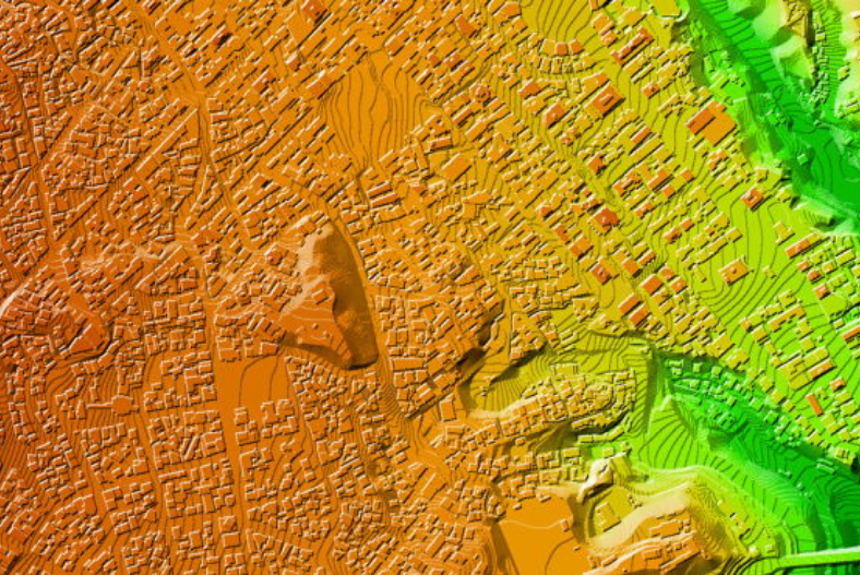
Digital Terrain Model (DTM)
DAAS’s digital terrain model streamlines the process of mapping and surveying land by automating the data collection process using drone technology. Digital terrain models are created by taking images from a drone and then using software to stitch the photos into a 3D model that can be used for various purposes such as land management, infrastructure planning, and disaster relief efforts.
Digital terrain models can help site planners and managers make better decisions by providing accurate data about the land. They can also be used to assess the damage after a natural disaster or to plan for future disasters.
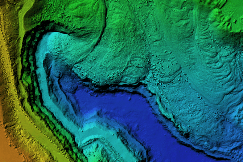
Digital Surface Model (DSM)
DAAS’ digital surface model (DSM) includes the heights of natural and manufactured features. A DSM represents the bare ground where it is devoid of vegetation and infrastructure. It captured an aerial image of the surface view, including all the visible things, like the tree canopies and buildings. These images represent the human-made elevations and natural features.
It helps create 3D models, which can be helpful for visualization and orthomosaics. Users may utilize these geometrically corrected and photomosaic images in mapping applications. Furthermore, it is beneficial for analysis purposes, such as calculating the height of a building or the shadow it casts at a particular time of day.
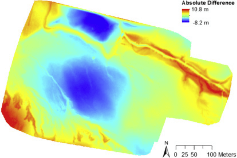
Digital Elevation Model (DEM)
Digital elevation monitors can collect the data you need, analyze it to the smallest detail, and build the digital elevation model in a much more realistic and efficient amount of time.
Drones consist of radar, video cameras, multispectral sensors, machine learning systems, and other tools to collect the data needed for your digital elevation model. This top-of-the-line technology is combined with the fastest DAAS analysis software to get the best possible results in the shortest amount of time.