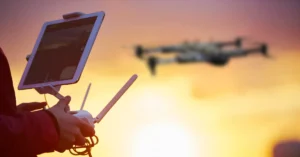
Managed drone operations give businesses access to high-quality aerial data through trusted Drone as a Service providers, supporting smarter decisions. These end-to-end solutions cover pilot certification, compliance, and equipment maintenance, ensuring every flight is safe, efficient, and fully regulated.
Implementing drone services means that your business can use advanced technology without having to acquire costly and complicated hardware. The flexible drone services provided by professionals are available to accommodate your project requirements whilst ensuring optimal functional performance.
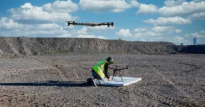
Why Traditional Site Inspections Are Costing You More
Traditional methods rely on manual labor and outdated tools that drain your budget while increasing overall project safety risks.
- Manual inspections involve use of costly scaffolding and risky climbing that expose your staff to unwarranted risk when performing routine site visits.
- Traditional methods are usually slow and capital intensive and they only present static information to be used in modern projects.
- An in-house team creates immense overhead due to constant training and also maintaining hardware that becomes outdated very quickly.
- When businesses are engrossed with obscured flight records and stringent insurance issues, they lose sight of their main goals.
- With professional aerial data services, you can remove logistical overheads and receive access to high-quality terrain modeling and photogrammetry mapping.
Why Drone as a Service Solves Scalability Challenges
Businesses attempting to build in-house drone capabilities often struggle to keep up with rapid technological shifts and evolving aviation safety regulations. Advanced aerial data solutions deal with challenging logistics and compliance so your team can concentrate fully on its strategic priorities.
At the same time, inconsistent data processing can lead to results that are difficult to integrate into existing workflows. Drone as a Service(DaaS) providers address this challenge by delivering standardized, high-quality data, and maintaining reliable, repeatable mission schedules, ensuring outputs are both consistent and easy to use.
How Geospatial Drone Services Improve Surveying Efficiency
Recent market data indicates that geospatial drone services significantly reduce surveying timelines by nearly seventy percent compared to ground teams, as highlighted in a Use of Drones in Construction Industries: A Review.
High-precision lidar topographic survey tools capture millions of data points to create a highly accurate digital elevation model (DEM). This level of efficiency allows firms to complete large-scale land surveying and mapping projects within hours rather than weeks.
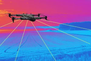
How AI-Powered Drone Insights Improve Decision Making
The current drone inspection solutions turn raw aerial into actionable intelligence to assist managers in making quicker and smarter decisions.
The ways to use AI-powered drone insights to achieve high operational performance and data-driven project outcomes include the following:
- Real-time crop monitoring: The technology identifies possible health problems in crops in real-time to convert raw images into actionable data.
- Visibility on construction progress: Project managers are equipped with the visibility of the current site conditions to ensure that all the phases remain on track.
- Predictive thermal: Advanced machine learning detects trends in thermal data to provide warnings about equipment failure, prior to any expensive malfunctions.
- Lifespan extension of assets: Maintenance costs are minimized and valuable assets in the energy and manufacturing industrial sectors are safeguarded through forecasting abilities.
How Remote Monitoring Drones Ensure Safer Operations
Utilizing remote monitoring drones ensures safer drone operations by removing human inspectors from dangerous environments like high-voltage power lines. These flexible drone services adapt to various weather conditions to maintain consistent data collection schedules throughout the entire year.
Reducing the need for physical site visits lowers the carbon footprint of your operations while improving overall worker safety. Safety officers can review high-definition video feeds from a secure central office without ever stepping onto a hazardous site.
Strategic Use Cases for Advanced Mapping
Topographic Survey Methods and Accuracy
Topographic mapping provides accurate 3D terrain data, which enables teams to identify site constraints early and optimize grading and drainage layouts. This high-resolution spatial awareness enables the project managers to simulate earthwork scenarios prior to any physical equipment on the site.
During the drone mapping technology process, different onboard sensors are used for various tasks to capture high-resolution imagery. These sensors, including LiDAR, generate diverse datasets that can be processed into accurate topographic models, as demonstrated in Remote Sensing.
Engineers use these detailed datasets to calculate earthwork volumes and design drainage systems that prevent flooding during heavy rain. Accurate ground data is the foundation of every successful land development project, regardless of the total size or scope.
Photogrammetry Mapping vs. LiDAR
Photogrammetry mapping is a technique to create detailed 3D models with the help of photographic mapping and sophisticated computer vision programs. The process usually entails contour mapping to represent the change in elevation across large areas of land with an accurate and clear contour map.
| Technology | Definition | Industrial Benefit |
| Photogrammetry | Creating 3D models from overlapping 2D high-resolution images. | Provides superior visual detail for site progress. |
| LiDAR | Using pulsed laser light to measure variable distances. | Penetrates dense vegetation to find the ground. |
Photographic mapping relies on light from the sun to create visual models, whereas LiDAR technology uses active laser pulses. LiDAR topographic survey technology cuts through the dense canopies of the forest and presents the actual surface of the ground in difficult environments and terrain.
- Photogrammetry mapping can offer realistic visual textures of the 3D site and monitor progress to all stakeholders.
- Lidar topographic survey systems employ active sensors to map terrain irrespective of the light conditions and dense tree cover.
- Orthomosaic maps provide an ideal top-down perspective for measuring distances and areas with both geographical precision and accuracy.
- Digital elevation model (DEM) assists planners in learning the patterns of water runoffs and the possible environmental effects of the site.
You may like to read also: How Drone Photogrammetry and LiDAR Work Together.
The True Value of Drone Mapping Technology
Modern drone mapping technology utilizes advanced topographic survey methods to deliver high-resolution data faster than traditional land-based equipment. Professional teams employ topographic mapping and land surveying and mapping techniques to support large-scale infrastructure development and conservation.
This technology does not even require surveyors to walk on the rough terrain or move through dense, swampy lands. Real-time data processing enables the stakeholders to see updated maps within hours after a pilot has completed a flight.
Implementing Terrain Modeling and Digital Twins
Effective terrain modeling requires specialized sensors and software to convert aerial images into actionable intelligence for engineering and architecture. Top companies are using geospatial drone services to incorporate aerial images into existing Geographic Information Systems to manage their assets.
Developing a digital twin of a physical space allows architects to simulate and identify potential design defects early in the design process. This proactive approach would save millions of dollars in reconstruction costs and ensure that the projects are on track.
Finding the Right Drone as a Service(DaaS) Solutions for Your Sector
Each industry contains specific data needs that demand a specialized approach to aerial data gathering and advanced analytics processing. Agriculture benefits from multispectral sensors, while the telecommunications sector requires high-resolution zoom cameras for detailed tower inspections and audits.
- Construction: Track daily progress and verify that subcontractors are following the approved blueprints and safety protocols precisely.
- Agriculture: Monitor crop health and optimize irrigation schedules to increase total yields while reducing the use of fertilizer.
- Mining: Determine stockpile volumes and check highwall stability to make sure that all workers are safe on the ground.
- Energy: Check wind turbines and solar panels with high-resolution thermal and visual sensors to ensure they are not damaged or not working efficiently.
Case Study: Enhancing Solar Farm Efficiency
A solar energy provider recently implemented flexible drone services to conduct thermal inspections across several thousand acres of panels. The team used photogrammetry mapping to identify failing cells, which resulted in a fifteen percent (15%) increase in total energy. This rapid identification allowed the maintenance crew to replace specific faulty components without having to test every single panel.
You can read the full technical breakdown in the ‘Measure UAS Solar Inspection Case Study’ regarding how these thermal insights directly improve operational ROI.
Source: Increasing Solar Inspection Efficiency with Drones – Case Study
Conclusion
Implementing managed drone operations allows your organization to harness the full power of aerial intelligence without any technical burden. These data-driven industrial markets are able to survive on these professional drone as a service models that have the scalability and precision required to succeed.
Selecting professional drone as a service solutions means that your projects will be supported with the most recent drone mapping and survey tools. Through AI-powered drone insights, you can enjoy safer drone operations and better project delivery.
Looking to implement drones as a service for your business? Contact our team today to get started.