How Businesses Use Drone as a Service (DaaS) Solutions for Mapping, Inspections, and Monitoring
Executive Summary
Drone as a Service (DaaS) enables organizations to access professional drone inspections, mapping, surveying, monitoring, and aerial analytics without managing aircraft, pilot development, software platforms, or operational workflows internally. Businesses across construction, agriculture, infrastructure, energy, and mining use Drone as a Service solutions to improve data collection, site visibility, operational efficiency, and decision-making while maintaining flexibility and scalability.
What Is Drone as a Service (DaaS)?
Drone as a Service (DaaS) is a service-based model that allows organizations to access professional drone operations without investing in aircraft, pilot development, software platforms, maintenance programs, and compliance workflows internally.
Rather than building and managing an in-house drone program, businesses can work with specialized providers that deliver drone inspections, mapping, surveying, monitoring, and aerial analytics on demand. This approach gives organizations access to advanced drone technology, experienced operators, and actionable aerial intelligence while reducing operational complexity.
Today, Drone as a Service solutions support a wide range of industries including construction, agriculture, infrastructure, energy, and mining, helping organizations improve visibility, data collection, and decision-making across critical operations.
Why Are Businesses Choosing Drone as a Service Solutions?
Drone as a service (DaaS) solutions allow organizations access to top-of-the-line equipment and data processing without the upfront investment. Hiring external service providers will make organizations avoid buying advanced sensors and special aircraft.
On top of that, other reasons drone services are popular for businesses include:
- No fleet management: The professional service handles every equipment and firmware management to keep the drones operational and ready to use.
- Compliance handled: Expert teams ensure complex authorisation requirements and local flight restrictions are met, guaranteeing mission compliance and safety.
- Scalable operations: Aerial operations can be scaled up in different sites without necessarily hiring or training pilots.
Through outsourced drone operations, businesses only pay for data collected and not spend money on equipment maintenance and downtime.
How Are Drones Used in Construction?
Drone construction monitoring is changing construction sites by allowing project managers to monitor large sites and detect logistical bottlenecks simultaneously. Here are the ways drones see use in construction:
Site progress tracking
Scheduled aerial flights allow construction teams to record project milestones and make sure that each phase is followed. Such visual updates will enable the stakeholders to communicate better and give a clear historical record of the whole building process.
Surveying
Drones with specialized sensors are used to collect precise geospatial data to develop highly accurate maps to be used in engineering and planning. Current drone inspection services combine these aerial surveys to determine topographical issues before heavy machinery arrives on site.
Volumetric measurement
The specialized software allows project managers to calculate the volume of stockpiles and excavation pits fast and with digital accuracy. This automated activity substitutes manual measurements and is faster in managing inventory and confirming earthwork amounts.
Safety inspections
UAVs check the structural integrity of the area, which is dangerous or difficult to reach by a human worker. Continuous aerial audits ensure high safety standards by identifying the hazards that may be invisible from the ground level.
For organizations managing multiple projects, Drone as a Service provides a scalable approach to construction monitoring, surveying, and inspections without requiring an internal drone team. This enables consistent site visibility, recurring progress tracking, and more efficient project oversight across multiple locations.
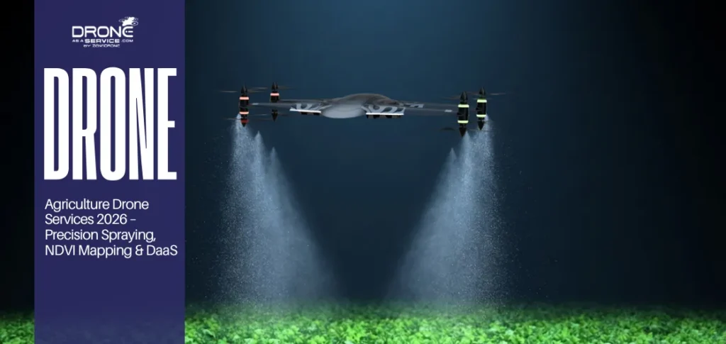
How Do Agricultural Businesses Use Drone Services?
Agricultural businesses outsource to third-party agricultural drone services to collect high-resolution data. The following are some of the uses of drone services:
Crop health analysis
Multispectral sensors can identify early signs of plant stress by measuring the light reflection that is invisible to the human eye. This proactive data enables farmers to use exact treatment on certain sections before pests or diseases develop in the entire crop.
Field mapping
Drones also create digital maps that help growers understand the unique topography and drainage of a landscape as a whole. These maps will be essential to precision agriculture, enabling farmers to save on using fertilizers and pesticides.
Irrigation monitoring
Thermal imaging can identify leaks or low watering zones within irrigation systems, ensuring that plants receive adequate watering and irrigation. These identification allows farmers to both save water resources and prevent losses from moisture stress or flooding.
Yield optimization
Drones’ data helps farmers predict yields more accurately and improve their crop yields. Drone monitoring solutions provide regular flights, and birds-eye view of large fields to detect subtle changes in plant health and soil.
Through outsourced agricultural drone services, farms and agribusinesses can implement recurring crop monitoring programs without purchasing drone equipment or managing flight operations internally. This service model provides ongoing field intelligence, aerial visibility, and operational flexibility throughout the growing season.
How Are Drone Services Used in Infrastructure Inspections?
Modern infrastructure management depends on drone inspection services to assess the integrity of key public assets without disrupting regular services.
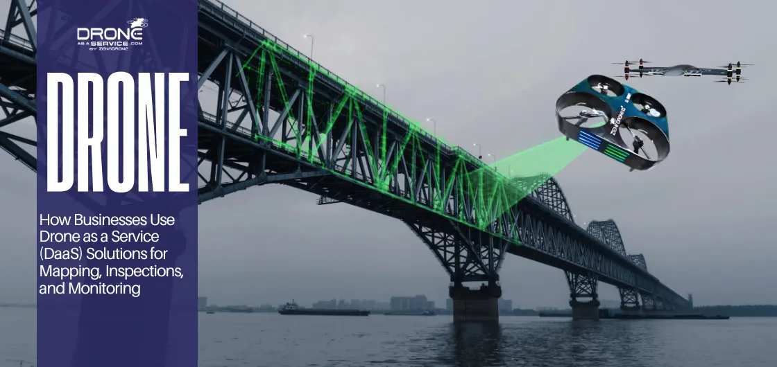
Bridge inspections
Drones can fly under the bridge spans to capture high-resolution images of bearings and joints, which are traditionally difficult to access. It provides a comprehensive visual record of the structure and doesn’t require the use of heavy machinery or lane closures.
Road inspections
Aerial sensors survey highway surfaces to locate cracks and potholes across hundreds of miles of pavement with precision. Automated surveys enable the transportation departments to schedule maintenance activities according to the actual state of the available road network.
Structural analysis
Engineers use aerial data to create digital twins of towers and buildings to perform detailed stress and load-bearing assessments. LiDAR drone services offer high-fidelity data, which engineers use to identify structural weaknesses before they become a costly safety hazard.
Asset documentation
Full aerial photography builds a permanent digital record of the infrastructure state to be used in the future. Streamlining complex documents guarantees insurance payments and ensures that state authorities receive unambiguous evidence to plan and budget long-term.
Infrastructure owners often require recurring inspections across geographically dispersed assets. Drone as a Service supports these programs by providing scalable inspection workflows, aerial documentation, and drone monitoring solutions without requiring organizations to manage internal drone resources.
How Do Energy Companies Use Drone Services?
Energy suppliers are adopting advanced flight technology to keep power lines running and dependable. Current powerline drone inspection methods enable teams to see frayed wires or overgrown vegetation at a safe distance.
Powerline inspections
High-voltage lines frequently extend through rough terrain where manual verification is not only slow but also hazardous to the technicians. By hiring professional drone surveying services, all insulators and pylons will be subjected to a visual inspection without disconnecting the current.
Solar inspections
Technicians use drones to survey solar panels within minutes to identify failed cells, causing a decrease in overall energy output. This quick evaluation can assist maintenance staff in prioritizing repairs to the particular units that are costing lost productivity.
Wind turbine monitoring
Large turbine blades need to be carefully monitored to identify hairline fractures or lightning damage that might cause engine failure. Drones fly around these tall structures to capture high-definition imagery that are safer and quicker than putting a person up.
Thermal inspections
Thermal sensors on aircraft enable energy companies to observe heat patterns that denote broken transformers or overloaded electrical systems. Early identification of hotspots will prevent localized fires and save the grid from experiencing expensive outages.
Many energy organizations use managed drone operations to support recurring inspections of power lines, substations, solar facilities, and wind assets. This service-based approach helps teams collect consistent inspection data while minimizing operational disruption and improving asset visibility.
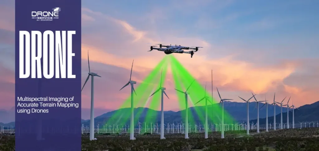
How Are Drones Used in Mining Operations?
Mining companies are modernizing through advanced drones that keep workers safe and data accurate. Using mining drone mapping allows site managers to visualize complex pits and haul roads without stepping into dangerous blast zones.
Terrain mapping
Creating a digital replica of a massive mine site is now possible in hours rather than the several weeks required. Drone mapping services offer high-resolution topographic data, which is required to design an efficient excavation path and water runoff.
Stockpile measurement
Special software is capable of computing the volume of ore piles with high accuracy. Aerial sensors provide thousands of data points to guarantee that inventory levels are always reported properly with each financial audit.
Safety checks
Drones serve as an initial defense mechanism by flying over high walls and dangerous spots to detect possible structural instability. Air surveillance ensures that the workers do not suffer any rockfalls, but still adhere strictly to the industrial safety regulations.
Site planning
Having detailed aerial images, engineers and geologists plan the following stage of expansion and reduce the total impact on the environment. This eye viewpoint makes sure that infrastructure like tailings dams and access roads are located in the best possible locations.
For mining operators, Drone as a Service provides access to drone mapping services, volumetric analysis, and recurring site monitoring without the burden of fleet ownership. This allows organizations to scale aerial intelligence programs as operational requirements evolve.
What Technologies Make DaaS More Effective?
Aerial solutions use new hardware and software to deliver insights that were once unattainable or too expensive. The technology enables users to penetrate heavy vegetation and foliage so that they can map the terrain accurately.
- LiDAR: LiDAR uses light pulses to determine distance and create high-resolution 3D representations of land and man-made structures.
- Thermal imaging: Heat-sensing cameras detect changes in temperature. It’s important for finding a faulty electrical component or monitoring a herd of animals spread out in a large pasture.
- AI analytics: AI can scan thousands of images and look for specific items, calculate volumes or detect structural cracks without human error.
- Automation: Missions with autonomous drones are pre-programmed so that companies receive consistent data collection, enabling repetition of missions with the same precision.
- BVLOS: BVLOS drone services allow the pilot to fly beyond visual line of sight for linear infrastructure over vast distances.
Drone as a Service (DaaS) vs. Building an In-House Drone Program
Choosing between internal ownership and hiring experts involves weighing the costs of expertise against hardware costs. When evaluating drone services vs. buying drones, businesses must consider these factors for a better business approach:
| Comparison Factor | In-House Ownership | Drone as a Service (DaaS) |
| Ownership vs. Service | The company owns all assets and manages all internal flight logistics. | The company pays for data delivery while the provider owns assets. |
| Cost Comparison | Large initial capital including maintenance and insurance costs. | A certain operating cost without having to invest in flight hardware. |
| Operational Flexibility | Only includes the sensors and aircraft available in inventory. | Availability of different types of specialized sensors for different project needs. |
| Scalability | Slow growth due to the hiring and training requirement. | Quick deployment of several professional teams to different locations. |
While ownership may make sense for organizations with continuous drone utilization and dedicated internal resources, many businesses prefer Drone as a Service because it provides operational flexibility, access to specialized expertise, and predictable deployment costs.
When evaluating drone services vs. buying drones, organizations should consider pilot development, maintenance requirements, software platforms, compliance workflows, data processing, and long-term scalability in addition to hardware costs.
Why Organizations Choose Drone as a Service Instead of Building Internal Drone Programs
Many organizations recognize the value of aerial intelligence but do not want to manage aircraft procurement, pilot development, maintenance programs, software platforms, and operational workflows internally.
Drone as a Service allows businesses to access specialized expertise and scalable drone operations without committing to long-term fleet ownership.
Common reasons organizations choose outsourced drone operations include:
- Access to specialized sensors and equipment
- Reduced operational complexity
- Faster deployment across multiple locations
- Consistent aerial data collection workflows
- Support for operational compliance requirements
- Scalable inspection and monitoring programs
- Access to experienced drone operations teams
For organizations focused on inspections, mapping, surveying, and monitoring, the service model often provides greater operational flexibility than building an internal drone department.
How Can Businesses Get Started With DaaS?
Choosing where to get started with drone services involves understanding where it can add the most value.
Enterprise Drone Services can help companies break away from the traditional digital workflow while not disrupting regular operations. Businesses can begin utilizing drone services by following these steps:
1. Identify Your Use Case
Organizations must first need to decide if they require high-resolution mapping, thermal analysis or frequent drone asset inspection. Establishing goals will make sure that the data collected is used for a specific problem or to improve a critical business process.
2. Run Pilot Project
A small-scale test allows the teams to evaluate the aerial deliverables and then invest in large-scale contracts. This trial stage assists the stakeholders in learning about the technical requirements and the possible payback in their industry.
3. Choose a Provider
For selecting the appropriate partner, evaluating pilot qualifications, operational experience, insurance coverage, safety procedures, and support for applicable compliance requirements is required. A good provider can offer a consistent data delivery platform which can easily merge with your company’s current software.
You may read also: How to Choose a Drone Service Provider?
4. Scale Operations
Once the pilot project is successful, the businesses can extend the drone surveying service to other sites to maximize benefits. Consistent data collection allows for future long-term trends analysis and more effective infrastructure and resources planning.
What Does the Future of Drone Services Look Like?
The aerial intelligence landscape is changing towards fully autonomous systems that need minimal human intervention to accomplish complex tasks. The future drone as a service solutions will have the following:
- Autonomous operations: Aircraft will soon be able to navigate complex environments with advanced onboard sensors to avoid obstacles even without pilot control.
- Recurring inspections: Automated flight schedules will offer a consistent check of the key assets to identify long-term structural changes.
- Integrated analytics: More advanced drone analytic services will provide business intelligence from raw imagery using cloud-based AI.
- Scalable enterprise adoption: Large Enterprise clients will use standardized service models to handle fleets across the globe in a variety of industrial sectors.
The technological innovations, including real-time data streaming and predictive modelling, are now elevating aerial insights as a necessity for businesses. Companies that adopt recurring aerial inspection programs are better positioned to identify risks early and maintain consistent operational standards.
Explore Drone as a Service (DaaS) Solutions for Your Operations
Whether your organization requires drone inspections, mapping, surveying, monitoring, or aerial analytics, a Drone as a Service model can provide access to specialized expertise without the complexity of managing an internal drone program.
From construction and infrastructure projects to agriculture, energy, and mining operations, scalable drone services help organizations collect actionable data while maintaining operational efficiency.
Contact our team to discuss your operational requirements and explore how Drone as a Service solutions can support your business objectives.