


Industrial Drone Services for Harsh and Challenging Conditions
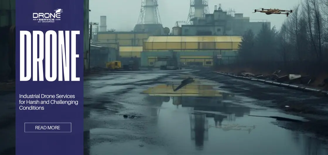
Industrial drone services deliver a revolutionary solution which enables organizations to handle intricate tasks in locations that humans cannot reach because of danger. The use of specialized aerial platforms enables companies to achieve high safety standards while obtaining accurate data from the most challenging areas of the globe.
The development of industrial drone services progressed from basic photography challenges to advanced field execution of extreme condition drone operations. towards an advanced field that enables drone operations under extreme conditions to execute highly reliable missions. Industrial drones are revolutionizing operations in extreme environments. From mining and construction to oil, gas, and disaster zones, they provide fast, safe, and precise data collection. This guide explores applications, technology, safety, regulations, and data-driven advantages of drones in harsh conditions.
Autonomous drones transformed mining, energy, and construction operations by enabling new methods for managing assets and improving reliability. These advanced drones enable organizations to repeatedly collect precise data in remote areas without requiring ongoing human operation.
It allows industries immediate access to structural health assessments and environmental monitoring data without interrupting production activities. The combination of Artificial Intelligence (AI) and Internet of Things (IoT) technology improves these services by transforming basic flight to extensive data collection.
Types of Industrial Drones for Extreme Conditions
Industrial operations depend on ruggedized drones, which have been engineered to endure dust storms and heavy rain and strong wind, and freezing temperatures. The machines used in this application have different characteristics from consumer models. These different machines differ in internal heating systems, and they have reinforced frames, and they possess high IP (Ingress Protection) ratings.
- Fixed-wing drones: Ideal for long-range coverage and large-scale mapping in open, harsh terrains. These drones operate like small airplanes, allowing them to fly longer distances and stay in the air much longer than most other models, which makes them perfect for surveying pipelines, mines, or expansive infrastructure.
- Multi-rotor drones: Best for precision tasks requiring stable hovering and maneuverability in tight, obstructed spaces. Their vertical takeoff and landing capability allows operators to inspect structures, towers, or confined industrial areas while maintaining steady positioning for accurate data capture.
- Hybrid drones: Combine the endurance of fixed-wing models with the vertical takeoff agility needed for rugged sites. They can launch vertically like a multi-rotor and then transition into efficient forward flight, making them useful for projects that require both long coverage and controlled inspection.
- Sensor-heavy platforms: Carry payloads such as LiDAR, drone inspection tools, and multispectral cameras for subsurface and structural analysis. These platforms are designed to support advanced data collection, helping industries generate high-resolution maps, 3D models, and detailed analytics for decision-making.
- Weatherproof units: Built with sealed compartments and hydrophobic coatings to operate during active precipitation or extreme heat. Their reinforced construction and environmental protection systems ensure reliable performance in challenging industrial environments where standard consumer drones would fail.
Key Applications in Challenging Environments
Site inspections and volumetric analysis are considered a major application wherein professional drones thrive in scanning unstable pit walls and stockpiles. These usually characterize high dust levels and steep gradients that prohibit safe manual surveying by ground teams with traditional tools.
With the ability to fly above danger, drones are able to calculate the volume of extracted material for reporting. This is delivered in hours rather than the days needed for manual GPS walking surveys, and with it comes a huge uptick in site efficiency.
Here are some key applications:
- Oil & Gas: Drones are widely used to monitor long pipeline networks that run through deserts, forests, and other remote regions. Equipped with advanced gas-sniffer sensors, they can detect methane leaks and other emissions early. This helps companies respond faster, reduce environmental impact, and avoid costly shutdowns or regulatory issues.
- Power and Utilities: Energy companies use drones to inspect wind turbines, substations, and power transmission lines. Even during rough weather, rugged drones can capture detailed images and thermal data from difficult angles. This allows maintenance teams to identify faults quickly and helps keep the power grid stable and reliable.
- Disaster Response: During floods, earthquakes, or wildfires, drones provide rapid aerial mapping of affected areas. Emergency responders use this data to understand damage levels and locate blocked roads or dangerous zones. The fast insights help authorities plan rescue operations and distribute resources more efficiently.
- Construction: In large or remote construction projects, drones help track site progress and survey terrain that is difficult to access on foot. They collect aerial images and topographic data for project planning and reporting. This improves decision-making and keeps stakeholders updated with accurate visual progress reports.
- Agriculture: Farmers use drones to map large agricultural fields and monitor crop health across thousands of acres. With automated flight paths and multispectral sensors, drones analyze soil conditions and irrigation efficiency. The collected data helps farmers make smarter decisions about fertilization, watering, and overall crop management.
Drone Technology and Innovations
AI-powered flight planning will enable drones to hover around the harshest environment, computing in real time the safest path with maximum efficiency. And that’s where new innovations come in, an aircraft’s ability to adjust to sudden wind or unexpected obstacles without human intervention.
For safety, modern drones now use a mix of radar and ultrasonic sensors to avoid crashing into things. Long endurance missions over remote areas are now possible thanks to high-capacity batteries and solar-assisted systems that let the aircraft stay in the air longer.
More importantly, live data is streamed directly to cloud platforms, enabling off-site engineers to make immediate decisions upon on-site conditions. These leaps in technology ensure that even the most isolated industrial assets remain under constant, high-quality surveillance.
Data Collection and Analytics
Typically, the output of a current drone mission is the capturing of 3D models as well as topographical maps. This digitization of physical assets is a procedure that assists project managers in visualizing the sites from anywhere in the world with accuracy of centimeters.
Drone data analytics transform images into reports that automatically detect issues like cracks in structures or deficiencies in stock levels using machine learning. For instance, data analytics using LiDAR drone inspection can generate detailed images that can actually see through foliage to expose the terrain beneath.
Thermal images are equally crucial in detecting hotspots in electrical grids or hidden leaks in pressurized tanks. These data analytics assist in predictive maintenance, where problems are detected before they escalate out of control and become costly disasters.
Safety Protocols and Risk Management
The process of conducting pre-flight procedures and environmental hazard assessments is a mandatory procedure to ensure the success of every mission in these difficult climatic conditions. The process helps to address the risks of flying heavy machinery in and around sensitive infrastructure.
Also, in extreme condition drone operations, it will incorporate fail-safe mechanisms to ensure safety, including emergency landing procedures and communication links. Trained and certified pilots are the foundation of drone operations for efficiency in dealing with signal interference and mechanical stress.
Data security also involves the use of encrypted signals to prevent unauthorized access to critical company or topographical data. By applying strict risk management measures, companies can effectively utilize drones without compromising their safety.
Regulatory Compliance and Legal Considerations
Approvals are required from local aviation authorities for conducting all kinds of industrial drone flights, especially at sites near airports or restricted airspaces. This is important for following airspace rules and regulations, which protect both manned aircraft and drones.
There are safety guidelines that regulatory authorities have set for different activities considered high-risk, such as operating the drones beyond the visual line of sight (BVLOS). Organizations also need to comply with the stringent laws on privacy while taking images of properties that belong to individuals or governments. It is also important to make environmental reports for those drones that operate in specific ecological zones, like the forest or the coastline.
Lastly, keeping up with the ever-changing environment, as far as the laws are concerned, is essential in operations.
Challenges and Limitations
The main factor that still keeps aerial industrial services at bay is, of course, operational risks related to the weather. Sudden dust storms or heavy snow could be extremely prohibitive. Even for the most advanced rugged drones, which also have physical limitations concerning wind speed and temperature thresholds that could ground a mission.
- Battery Life: Cold temperatures can significantly reduce drone battery efficiency, causing power to drain much faster than expected. This limits flight duration, especially during long-distance inspections or missions in remote regions. As a result, operators often need backup batteries or carefully planned flight schedules to complete tasks safely.
- Sensor Calibration: Industrial drones carry highly sensitive sensors such as LiDAR, thermal cameras, and inspection equipment. Continuous vibration, altitude shifts, and sudden temperature changes can affect sensor accuracy. Regular calibration is necessary to maintain reliable data collection and ensure the results are suitable for analysis and reporting.
- Data Transmission: Many industrial sites are located in remote areas where high-speed internet or stable network coverage is limited. This makes it difficult to stream live drone footage or upload large datasets instantly. In many cases, teams must store the data onboard and process or upload it later once a stronger connection is available.
- Costs of Equipment: Industrial-grade drones, advanced sensors, and specialized software can be expensive to purchase and maintain. For smaller companies, the initial investment and ongoing upgrades may create financial challenges. However, over time, the efficiency and data insights often justify the cost for larger operations.
- Maintenance Needs: Harsh environments such as coastal areas, deserts, or mining sites expose drones to salt, dust, moisture, and debris. These conditions increase wear and tear on motors, sensors, and protective components. Regular cleaning, inspections, and part replacements are necessary to keep drones operating safely and reliably.
Future Trends in Industrial Drone Services
Fully autonomous fleets of drones with AI capability for making decisions are the next frontier. This will open up opportunities for “drone in a box,” a completely pilotless proposition. It means these drones will live on site, working automatically to make routine inspections before returning to their docking stations.
One can see that thermal drone surveillance will enable even better resolution, enabling the detection of the microscopic leaks of gas at high altitudes. Also, there will be the ability to interact with the smart factory infrastructure, allowing drones to effectively communicate with ground sensors.
Lastly, there is the potential for drones to be integrated in new industries, like maritime and deep forest. As the endurance of these devices continues to grow due to better energy densities. Essentially, the drones will be in the environment forever and will be invisible.
Case Studies
In practice, the deployments demonstrate that drone services for industry have a high return on investment (ROI). Given that drone operations eliminate operational downtime and improve workplace safety. The scenarios illustrate the application of harsh environment drones that convert technology into industrial success.
Mining Site Surveys
In a large open-pit mining operation, unstable slopes and continuous heavy equipment movement created serious safety risks for survey teams. After a major storm impacted the region, site managers needed a fast and safe way to assess slope stability and overall site conditions. Rugged industrial drones were deployed to capture high-resolution aerial data and terrain models across the affected areas.
Traditionally, completing this type of survey would take around five days and require personnel to enter potentially hazardous zones. Using drone-based surveying, the entire assessment was completed within just a few hours of flight time. The collected data allowed engineers to quickly evaluate slope conditions, identify risk zones, and verify that key operational areas were stable. As a result, the mining company was able to resume operations nearly 48 hours earlier than expected. The case clearly demonstrated how drone-assisted slope analysis improves safety, speeds up decision-making, and reduces the need for workers to enter dangerous environments. In high-risk industries like mining, this shift is becoming less of a luxury and more of a necessity.
Oil & Gas Pipeline Monitoring
In one Arctic pipeline monitoring project, a leading energy company deployed drones equipped with thermal imaging and tunable diode laser absorption spectroscopy (TDLAS) technology. The harsh environment and extreme cold made traditional ground inspections slow and risky for field teams. Using drone-based monitoring allowed inspectors to survey long pipeline routes quickly while maintaining safe operations.
During the aerial assessment, the system successfully detected three hidden methane leaks that were not visible to the naked eye. Early identification of these leaks helped the company prevent potential environmental damage and operational losses. Research findings, including those reported by Askarzadeh et al. (2025), also show that drone-assisted monitoring can cover significantly more wellhead areas compared to traditional onsite measurement methods. This case highlights how advanced sensing technologies combined with drones can transform pipeline inspection, particularly in remote and extreme environments where manual monitoring is inefficient and dangerous.
Disaster Response and Recovery
During a major flood event, emergency teams were able to achieve the most accurate mapping of affected areas to date using drones combined with GIS-based data analytics. The operation relied on a pre-designed drone-optimized flood risk map framework, which allowed responders to quickly identify high-risk zones and prioritize intervention efforts.
This approach enabled emergency services to allocate resources efficiently, even in areas where traditional communication networks had failed. By leveraging real-time aerial data, authorities could plan evacuations, monitor water levels, and assess infrastructure damage, significantly improving response times and overall disaster management.
Management of Earthwork in Construction
This is a very critical activity in high-rise building projects from budget and safety perspectives. For instance, in a case study by Park et al., (2022) regarding the monitoring of earthworks during an urban construction context. It was evidenced that a UAV-based system could digitalize volume calculations and monitor the stability of slopes.
This monitoring of areas avoids slope failures that might develop landslide hazards in the nearby areas. At the same time, this automated procedure ensures the accuracy of project documentation and helps avoid cost overruns.
Conclusion
Industrial drones are changing operations by allowing companies to offer safe and efficient services while providing reliable information. As drones replace humans in dangerous environments, companies are now focusing on analyzing information rather than managing unsafe situations. The ability of drones to operate in extreme temperatures means that drones are used all year round. As long as there are dangers to look at, drones will exist.
The continued evolution of drone data analytics assures that, indeed, gathered data is not just visible but also intelligent. With industries battling tougher realities influenced by a tough environment and new regulations, investing in rugged drones is becoming a necessity.
The future of industry is in the air, fully automatic, and built to thrive in the harshest environments on earth. By embracing these technologies today, industries are securing their tomorrows. This is what will separate the leaders in the next Industrial Revolution.
FAQS
What industries benefit most from industrial drone services?
Mining, oil and gas, and construction are the common industries that benefit from drone services due to their high-risk environments.
How do drones operate safely in extreme weather conditions?
The safety of these drones is achieved through the use of internal heaters for batteries, waterproof cases, and proprietary stabilization programs. Therefore, the delicate electronic components can function properly in different climatic conditions.
What sensors are essential for harsh environment drone operations?
LiDAR, thermal imaging, and gas imaging sensors are the only means to harness the power in difficult conditions. It helps the drones to see through the smoke or darkness to detect threats from structures in the environment.
Are drones cost-effective compared to traditional inspection methods?
Yes, drones are cost-effective since there would be no need to set up scaffolding, use cranes, or fly a manned helicopter. Drones would help avoid downtime, which means inspections can be carried out while the site remains fully operational.
What regulations govern industrial drone flights?
These aviation operations are overseen by national aviation authorities. These may include FAA or EASA. The regulations include airline pilot certificates, airspace permissions, and security exemptions.
Read Our Other Blogs
24 February 2026
Photogrammetry in Archaeology: Methods, Use Cases & Limitations
Photogrammetry in Archaeology: Methods, Use Cases & Limitation TL;DR Photogrammetry is a passive technique of remote sensing that uses redundancy...
23 February 2026
The Role of Software in Smarter Drone Power Distribution
The Role of Software in Smarter Drone Power Distribution With the constant development of technology, drones are now classified as...
23 February 2026
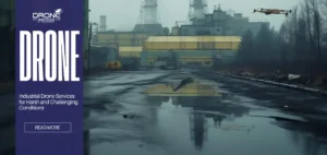
Industrial Drone Services for Harsh and Challenging Conditions
Industrial Drone Services for Harsh and Challenging Conditions Industrial drone services deliver a revolutionary solution which enables organizations to handle...
20 February 2026
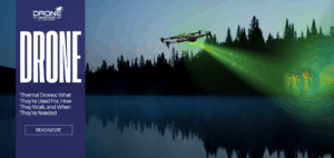
Thermal Drones: What They’re Used For, How They Work, and When They’re Needed
Thermal Drones: What They’re Used For, How They Work, and When They’re Needed TL;DR Thermal drones are uncrewed or unmanned...
19 February 2026
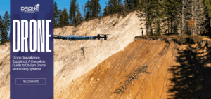
Drone Surveillance Explained: A Complete Guide to Civilian Drone Monitoring Systems
Drone Surveillance Explained: A Complete Guide to Civilian Drone Monitoring Systems TL;DR Drone surveillance is about using unmanned aerial vehicles....

18 February 2026
Commercial vs Industrial Drone Services in Ireland – Key Differences
Commercial vs Industrial Drone Services in Ireland – Key Differences Executive Summary / TL;DR “Commercial vs industrial drone services serve...