


Executive Summary / TL;DR
“Commercial vs industrial drone services serve different operational purposes and deliver different types of results for Irish businesses. Commercial drones primarily serve visual monitoring, whereas industrial drones conduct detailed inspections. In Ireland, knowing these differences helps ensure safety, compliance, and efficient operations. This article provides construction managers, engineers, and surveyors with practical guidance on equipment, regulations, costs, provider selection, and best practices to support informed drone decisions.”
Introduction
In Ireland, commercial vs industrial drone services serve different business needs, even though both use unmanned aerial vehicles. Commercial drone services focus on visual outputs such as photography, video, and general site overviews. Industrial drone services are used for inspections, surveying, and monitoring tasks that require precise measurements, organized data, and tighter operational controls.
Table of Contents
- Why Commercial vs Industrial Drone Services Matter
- Understanding Commercial Drone Services Use in Ireland
- Understanding Industrial Drone Services Use in Ireland
- What Are Their Differences in Equipment & Technology?
- Regulatory & Compliance Considerations in Ireland
- Cost Structures & Pricing Considerations
- How to Select a Reliable Drone Services Company in Ireland
- Real-World Applications & Case Studies
- Best Practices & Professional Checklist
- Limitations & Future Trends
- Conclusion
- FAQs
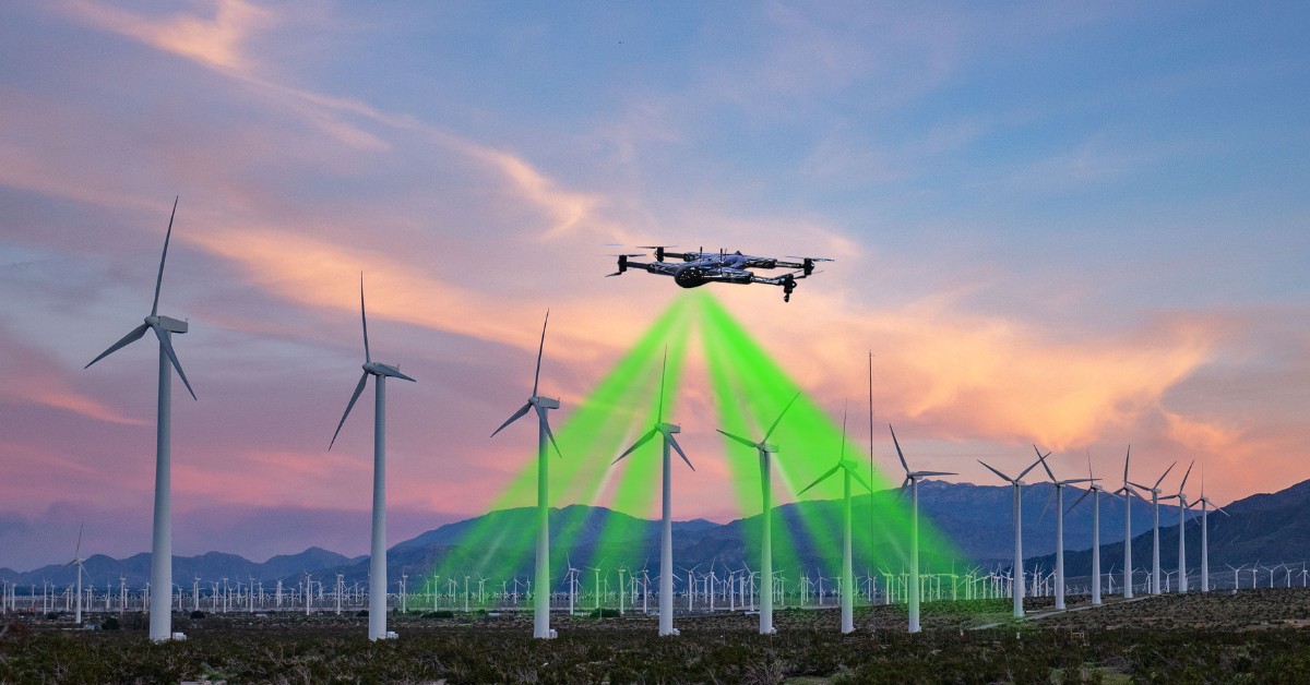
Across Ireland, construction, infrastructure, and energy projects are adopting UAVs at a steady pace. Teams now depend on aerial surveying Ireland solutions for safer monitoring, asset inspections, and faster site reporting.
Knowing the difference between these drone services helps teams work smarter, stay within regulations, and keep costs in check. Industrial projects usually need advanced sensors and approvals, while commercial work tends to follow simpler, lower-risk processes.
This article explores applications, equipment differences, Irish regulatory considerations, cost structures, provider selection, real-world case studies, and best practices to support informed decision-making.
Why Commercial vs Industrial Drone Services Matter
Drones are operationally and financially important for modern businesses in Ireland. They enable faster, safer, and more efficient data collection across construction, infrastructure, energy, healthcare, and property development. They also improve oversight through drone asset monitoring.
Manual Surveys vs Drone-Based Surveys
Manual surveys mean staff must access sites, sometimes at heights or in tricky, unstable areas, raising safety risks and potential errors. Drones gather high-resolution data from a distance, making inspections quicker, repeatable, and safer for aerial surveying in Ireland.
Helicopter Imaging vs UAV Workflows
Helicopter flights can give a broad aerial view, but they are expensive, complex to coordinate, and carry safety risks, making them impractical for regular checks. Drones provide the same coverage more easily, can be deployed quickly, flown as needed, and fit smoothly into routine inspection schedules.
Ground Inspections vs Drone Inspections
Ground inspections can halt equipment and limit access, which slows production, causes maintenance backlogs, and increases expenses. In contrast, drone inspections collect data remotely without stopping operations, allowing for more frequent checks and enabling safer, faster decisions.
Key Challenges in Industrial Drone Projects
Service selection is crucial for industrial inspections UAV projects demand due to environmental limitations:
- Accuracy needs: Industrial projects require precise, repeatable datasets to support engineering decisions, compliance checks, and long-term asset management.
- Safety risks: Active machinery and hazardous conditions demand inspection methods that minimise human exposure while maintaining operational awareness.
- Complex structures: Dense layouts, restricted zones, and sensitive infrastructure require careful planning and controlled flight operations.
Understanding Commercial Drone Services Use in Ireland
Commercial drone services provide visual inspections of structures, construction progress monitoring, aerial marketing content, and general site overviews. These commercial UAV operations allow teams to capture high-resolution imagery quickly, safely, and cost-effectively, reducing the need for manual surveys or helicopter flights.
Applications
Commercial drones support construction, property, and infrastructure projects using professional drone service models. They capture high-quality aerial photos for real estate and promotional content, document project milestones efficiently, and provide stakeholders with accurate visual records for informed decision-making.
Equipment
Commercial drones are designed to be easy and efficient to use. Lightweight UAVs can be deployed quickly; standard RGB cameras capture clear, detailed images, and simple flight plans keep data collection consistent across every site.
Benefits
Commercial drone operations offer practical benefits for Irish businesses. They allow fast deployment with minimal setup, lower costs by reducing labor or helicopter use, and improve stakeholder communication through clear visual updates and project oversight.
Limitations
Commercial drones are not suitable for engineering-grade measurements or compliance-critical inspections. Their accuracy and sensor limits may not meet strict legal or structural standards. Following drone surveying best practices helps maintain reliable visual data safely.
Understanding Industrial Drone Services Use in Ireland
Industrial drone services in Ireland use specialized UAVs for precision surveying, volumetric analysis, and structured asset monitoring, and industrial inspections for UAV tasks. These drones are designed to handle tough site conditions and reach areas that are difficult or unsafe for people to access. They reduce the need for risky on-site work while helping teams work faster and collect more reliable data.
Applications
Industrial drones are essential for construction, energy, and infrastructure projects, enabling teams to monitor site progress, measure earthworks, and inspect structures such as bridges and wind turbines safely, eliminating the need for scaffolding. They also make it easier to keep an eye on pipelines and remote assets for leaks, corrosion, or security issues, helping projects stay on schedule.
Equipment
Industrial UAVs are equipped with advanced sensors that let teams capture precise and reliable data. LiDAR creates detailed 3D models, RTK GPS ensures exact positioning, and thermal sensors reveal heat anomalies. High-resolution cameras make inspections easier and support UAV photogrammetry industrial projects.
Benefits
Industrial drones offer real, practical advantages for construction and infrastructure projects. They provide accurate, repeatable results, generate data that meets compliance standards, and keep teams out of hazardous areas. They also integrate with GIS, CAD, and BIM systems to make drone asset monitoring easier and more efficient.
Limitations
Preparing industrial drones is costlier and takes more time. They must adhere to flight regulations, and factors like weather and battery life can impact their functionality. Effective data collection requires careful planning in advance.
What Are Their Differences in Equipment & Technology?
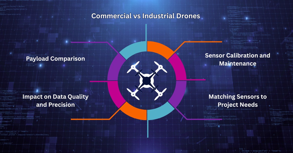
| Category | Commercial Drones | Industrial Drones |
|---|---|---|
| Primary Payloads | Equipped with user-friendly RGB cameras for high-resolution images. | Advanced sensors like LiDAR, thermal, or multispectral cameras and RTK modules. |
| Data Quality & Precision | Decent-quality pictures and moderate localization accuracy. | Centimeter-level data, 3D high-resolution models, and trustworthy measurements. |
| Sensor Calibration & Maintenance | Simple upkeep: camera alignment, basic GPS calibration, and firmware updates. | Rigorous sensor calibration, regular maintenance, and backup systems for safety. |
| Project Matching | Best suited for fast surveys, visual documentation, and promotional imagery. | Systematic UAV processes for complex mapping, measuring, and industrial projects. |
Regulatory & Compliance Considerations in Ireland
Irish drone operations are regulated by the Irish Aviation Authority (IAA) and follow EASA standards, ensuring all unmanned aircraft adhere to safety, altitude, and operational rules. Drones that weigh more than 250 grams or have cameras must be registered with the IAA.
Commercial drone flights usually fall under the ‘Open’ category for low-risk visual inspections. They need only minimal approvals and basic pre-flight checks, and by following altitude limits, teams can maintain drone compliance in Ireland easily for routine business operations.
Urban areas and challenging locations require larger drones for industrial operations. Ensuring UAV operational safety is crucial, so operators must obtain ‘Specific’ category permission, perform risk assessments, and adhere to strict safety protocols to protect people, property, and infrastructure.
Pre-flight planning and pilot certification are essential for both commercial and industrial operations. Having accurate documentation, clear operational manuals, and skilled personnel helps keep operations compliant and organized. This structured approach ensures safe, compliant, and well-documented drone operations across Ireland.
Cost Structures & Pricing Considerations
Commercial Drone Pricing
Commercial drone services usually require a smaller upfront investment and are often billed by flight, hour, or deliverable. Their simplicity makes them ideal for aerial photography and surveillance. Clear drone service pricing considerations help Irish businesses plan budgets accurately while evaluating return on investment.
Industrial Drone Pricing
Operating industrial drones requires specialized tools, careful planning, and extensive data processing, which can lead to increased overall costs. However, the benefits they provide—such as enhanced accuracy and safety, along with considerable improvements in efficiency—far outweigh these expenses. Many organizations report a significant industrial UAV ROI long term.
Factors Affecting Cost
Drone project costs depend on several aspects. Flight time, sensor type, project complexity, and data processing affect price. Careful evaluation helps businesses in choosing the right drone services provider for their operational needs.
How to Select a Reliable Drone Services Company in Ireland
#1: Experience & Certifications
In selecting the best drone services provider, the operators who have experience and related certification are reliable. The adherence to aviation authorities, specific training, and compliance with the operations standards would provide safe, correct, and professional delivery of services.
#2: Portfolio & Sector Knowledge
A provider’s portfolio reflects technical competencies and knowledge of the sector. Precise datasets are needed in industrial projects, whereas commercial projects are concerned about the high quality of visual output. The analysis of the past work is an indication of professionalism in the models of drone services in various operating situations.
#3: Hybrid Capabilities
Providers that offer both commercial and industrial services can combine imagery, mapping, and data analytics more effectively. These hybrid capabilities follow established drone survey best practices, helping ensure accuracy, stay compliant with regulations, and maintain consistency across complex projects.
Real-World Applications & Case Studies
Case Study 1: Commercial Drones for Construction Progress Monitoring
In 2022, a construction project used commercial drones to keep an eye on progress, record activities, and keep stakeholders up to date. A commercial quadcopter with an RGB camera captured frequent aerial images, giving the team a clear view of the site throughout the project.
The orthomosaics and 3D surface models created by the drone helped the teams track excavation progress, evaluate the site’s condition, and observe changes over time.
Although effective for reporting, the images were not fully measurement-ready, which shows that commercial drones are more effective for transparency and coordination but cannot be used for tasks that require precision.
Case Study 2: Industrial Drones Inspecting Bridges with LiDAR
In Ireland, industrial drones with LiDAR technology were used to inspect bridges, allowing engineers to gather detailed structural data safely and efficiently without the need for scaffolding or traffic disruptions.
Drones generated highly accurate 3D data files that helped engineers identify and address structural issues without posing any danger to people. This approach is part of a solution to a significant industrial problem. The practicality of using UAVs for regulatory inspections in the industrial sector is clearly demonstrated.
Orthomosaics, annotated maps, and comparison images helped stakeholders understand. Planning and risk assessment ensured operations remained safe and reliable, even in harsh weather conditions.
Choosing the best drone service is vital for project success. Industrial drones are better at specialized jobs than generic flying drones, which can only take broad photographs. Both technologies simplify drone asset monitoring and aerial assessments for Irish enterprises and sectors when utilized properly.
Best Practices & Professional Checklist
Planning
Clearly define missions with deliverables, specific objectives, and established protocols to ensure a robust safety program that complies with legal requirements. It is essential to have knowledge of the relevant regulations, understand the specific hazards involved, and identify the necessary data for every commercial and industrial aspect. This organized approach follows established professional drone service models, keeping operations efficient and reliable.
Execution
Picking the right drone and payload makes a big difference in any project. By sticking to set flight paths, calibrating sensors, and running redundancy checks, teams can avoid mistakes and work more efficiently. These steps also help improve drone inspection accuracy for both visual checks and precision measurements.
Data Processing
The team validates, processes, and integrates captured data into GIS or asset management systems. Engineers and project managers review the results to make sure the information is reliable and useful for decision-making. Following these steps consistently produces clear, high-quality outputs.
Hybrid Approach
To create a comprehensive dataset, combine commercial drone imagery with industrial measurements. Utilizing images, LiDAR, and multispectral data allows teams to analyze without hindering operations. This method follows proven drone survey best practices, ensuring professional and efficient results.
Limitations & Future Trends
Limitations
Both commercial and industrial drones have operational limits that can affect performance and data quality:
- Environmental factors like strong wind, rain, or low light can reduce sensor effectiveness.
- The coverage of larger projects is limited by factors such as battery life and flying time.
- Airspace restrictions and regulatory compliance can delay operations.
- Complex subsurface or interior structural examinations require complementary methods or powerful sensors.
Future Trends
Emerging technologies are shaping the next generation of drone operations:
- Integrating LiDAR and thermal sensors allows thorough examinations in various conditions.
- Automated inspection workflows improve efficiency and reduce human error, supporting industrial UAV innovations.
- Hybrid service models combine commercial visuals and industrial measurements for more comprehensive datasets.
- Advanced data analysis tools help teams interpret inspection results more effectively and support long-term asset planning, representing the drone inspection future.
- Expanded applications in 3D mapping and volumetric analysis illustrate the growth of UAV photogrammetry for industrial and complex projects.
Conclusion
Irish businesses need to clearly understand the difference between commercial and industrial drones (UAVs) to make informed decisions. While commercial drones excel at visual monitoring and progress reporting, industrial drones are designed for detailed inspections, surveying, and structured data collection.
Choosing the right type of service for each project helps improve safety, reduce costs, and ensures accurate results. Industrial drones reduce risks in challenging environments, while commercial drones provide quick, reliable insights to keep stakeholders updated on project developments.
Experienced drone service providers in Ireland support construction, infrastructure, and energy projects by ensuring regulatory compliance, efficient operations, and high-quality outcomes. Leveraging the right UAV technology and workflows allows teams to optimize site monitoring, asset inspections, and aerial surveying processes across diverse projects.
FAQs
Photogrammetry in Archaeology: Methods, Use Cases & Limitations
Photogrammetry in Archaeology: Methods, Use Cases & Limitation TL;DR Photogrammetry is a passive technique of remote sensing that uses redundancy...

The Role of Software in Smarter Drone Power Distribution
The Role of Software in Smarter Drone Power Distribution With the constant development of technology, drones are now classified as...
Industrial Drone Services for Harsh and Challenging Conditions
Industrial Drone Services for Harsh and Challenging Conditions Industrial drone services deliver a revolutionary solution which enables organizations to handle...
Thermal Drones: What They’re Used For, How They Work, and When They’re Needed
Thermal Drones: What They’re Used For, How They Work, and When They’re Needed TL;DR Thermal drones are uncrewed or unmanned...
Drone Surveillance Explained: A Complete Guide to Civilian Drone Monitoring Systems
Drone Surveillance Explained: A Complete Guide to Civilian Drone Monitoring Systems TL;DR Drone surveillance is about using unmanned aerial vehicles....

Commercial vs Industrial Drone Services in Ireland – Key Differences
Commercial vs Industrial Drone Services in Ireland – Key Differences Executive Summary / TL;DR “Commercial vs industrial drone services serve...