What Are Orthomosaic Maps? Orthophotos and Uses Explained
The current industries require precise, dependable, and scalable mapping systems. That is where the use of drone orthomosaic technology is necessary. Compared to traditional aerial photography, orthomosaic maps provide a georeferenced image that is distortion-free and can be measured and analyzed by professionals with a high degree of confidence.
An orthomosaic drone is a combination of accuracy and adaptability and turns out to be a valuable resource in agriculture, construction, and ecology. These maps can be used by both farmers who are inspecting crops and engineers who are surveying areas to give good information. However, what is an orthomosaic drone map and why is it being adopted by businesses so fast? Let’s explore in detail.
What Does Mean by Orthomosaic Maps?
Definition: An orthomosaic map is a high-resolution image created by combining numerous aerial photos. The photos are fixed with perspective and distortion, keeping the scale constant throughout the whole surface.
Th orthomosaic maps represent the features on the ground at the same scale as regular photos. This implies that professionals will be able to measure distances, areas, and coordinates based on the image. This accuracy is a game-changer in industries where accuracy is important.
Orthomosaic vs. Regular Photo
- Regular Photo: This was taken using a drone camera, but was distorted by the viewpoint and angle.
- Orthomosaic Map: This is an image of a smooth mosaic with fixed images and aligned to geographic position.
This disparity renders orthomosaic maps much more useful in surveying as well as decision-making.
Key Features of Orthomosaic Maps
In addition to the practical applications, orthomosaic maps have certain technical advantages that make them stand out. These are the main peculiarities that make them inalienable:
- Georeferenced Data: Each point is associated with real-world GPS coordinates.
- Distortion-Free Imagery: The straight lines are not distorted even over big spots.
- Measurable Surfaces: Lengths, areas, and perimeters are accurately calculated by the users.
With an orthomosaic drone, industries can see and achieve measured accuracy. For example, a construction team could determine the site’s progress without costly ground surveys.
Why Orthomosaic Maps Matter
Traditional surveys are time-consuming, expensive, and, in most cases, disruptive to normal operations. Conversely, orthomosaic mapping allows you to carry out rapid, comprehensive, and repeatable aerial surveys. Companies can continue their daily operations by regularly inspecting sites.
Orthomosaic mapping is easy to scale. It is applicable to projects of any magnitude, whether small farms or large cities. Experts can obtain the appropriate data needed in projects of any magnitude through drone flight paths and processing settings.
How Are Orthomosaic Maps Created?
It is not just taking pictures to make a drone orthomosaic. It involves proper planning, data recording and advanced software. Each of the steps is important in order to achieve reliable results without distortion.Step 1: Drone Flight Planning
Pilots trace out an intricate flight route before departure. The drone is required to fly over the entire area with a systematic overlap of the photos to ensure smooth stitching in the future. The altitude, camera angle, and speed of every project are adjusted. Elevated altitudes have greater ground cover with reduced resolution. Less altitude is more detailed but more time-consuming.Step 2: Aerial Image Capture
The orthomosaic drone takes hundreds or thousands of overlapping photos. The overlap between these images is typically 70-80 percent forward and 60-70 percent side overlap, the images must overlap to allow the stitching to be done correctly. The drone’s GPS captures the location of every photo. Other drones are RTK or PKK with centimeter-level accuracy.Step 3: Photogrammetry and Stitching Software
The photos are matched using common points in specialized photogrammetry software. The result is a single mosaic corrected for distortion. The software can also include the math required to keep the map real-world accurate and make the map a measurable georeferenced dataset.Step 4: Geo-Referencing and Accuracy Checks
Ground Control Points (GCPs) are identified marked features on the land with known GPS coordinates. By comparing aerial images to these locations, the orthomosaic survey grade can be made accurate. Scale and alignment accuracy checks ensure that the scale and alignment are within the project standards. Their absence can create major issues in measurement with minor mistakes.Step 5: Delivering the Final Orthomosaic
The completed product will be a high-resolution and smooth map. Clients can display it in GIS platforms, CAD software, or web-based mapping tools. This is achievable with an orthomosaic drone, and it may take hours rather than days, whereas conventional surveys may take weeks. Drones have been adopted in fast-moving industries because orthomosaics based on drones are the best option due to their speed and flexibility.Orthomosaics vs. Orthophotos: What’s the Difference?
Many confuse orthomosaics with orthophotos, but they’re not the same. Both are distortion-corrected images, yet they differ in scope and purpose. Here are some of their uses:
| Aspect | Orthophoto | Drone Orthomosaic |
|---|---|---|
| Definition | One aerial shot has been fixed on the planes. Any distortions are eliminated, so ground features are displayed in the correct size. | A massive georeferenced map is created by stitching the various orthophotos to create a single uninterrupted photograph. |
| Scope | This is capable of covering small spaces in a given frame that has been captured. | Alternatively, it may encompass large areas like farms, construction sites or even landscapes. |
| Accuracy | It gives specificity on localized areas but has a small coverage. | It is accurate in broad areas with uniform scaling. |
| Use Cases | It is most appropriate for small projects that require less complex, scaled images, such as property surveys or site inspections. | It is best suited for large-scale projects that demand meticulous measurements e.g., agriculture, mining, or infrastructure. |
Orthophotos and orthomosaics are necessary in mapping. Orthophotos are accurate at small scales, whereas orthomosaics are accurate at large scales. Knowing which to use at which point will guarantee projects the optimal balance of detail, coverage, and reliability.
Accuracy in Drone Orthomosaics: Key Factors
Every drone orthomosaic is based on accuracy. There are various considerations that determine whether the completed map is professional:
Ground Sampling Distance (GSD)
GSD represents the size of one pixel on the ground. The smaller the GSD value, the more precise. The GSD will depend on the drone’s altitude and the camera’s resolution.
Drone Altitude and Sensor Quality
Flight at high altitudes will cover a larger area but reduce the accuracy. This can be countered by using high-quality sensors to provide fine detail with no loss of coverage.
Flight Overlap and Patterns
The orthomosaic drone should keep the intended overlapping between images to create accuracy. Lack of enough overlap leads to stitching errors and inaccurate measurements.
GPS Precision: GCPs, RTK, and PPK
Ground Control Points (GCPs) are the points that relate the imagery to known points. The RTK and PPK technology offer centimeter-level accuracy and it does not have many ground markers.
Software Processing Methods
Different software packages have different algorithms, which influence the alignment, image clarity and precision of measurements.
Why Accuracy Matters
Even minor mapping mistakes will result in expensive errors. Building projects will displace buildings and farmers will be unable to estimate crop conditions.
Professionals avoid these risks with the help of a drone orthomosaic. The technology provides accuracy that cannot be attained by the traditional photos.
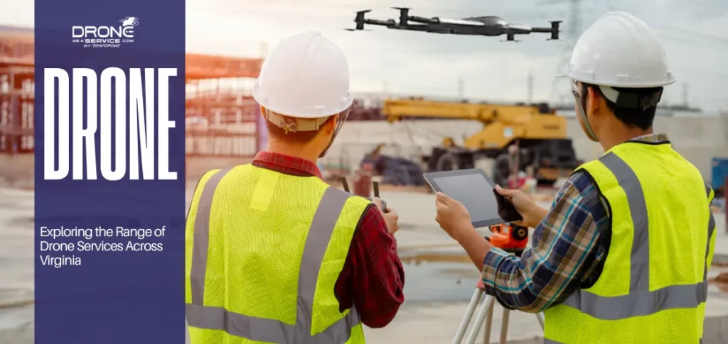
Applications of Orthomosaic Maps
Due to its versatility, a drone orthomosaic can be applied in most industries. Its use continues to increase annually in areas such as farming and urban planning.
Agriculture and Precision Farming
Orthomosaic drone maps are utilized by farmers in order to track the state of crops, irrigation, and soil. Patterns that cannot be seen by the naked eye can be seen in high-resolution images. They change the planting times, fertilizer application, and irrigation with accurate information. This saves on waste and increases the yield and profitability of crops.
Get to know more about agriculture drones and how they are used in contemporary agricultural methods.
Construction and Infrastructure
Construction teams use drone orthomosaic surveys to monitor and manage the project’s progress. They recognize site changes and compare conditions with design plans. Such maps also enhance communication.
Engineers, managers, and investors view the same reliable data to make informed decisions.
Mining and Quarrying
Orthomosaic drone maps are used in mining companies to measure stockpiles and calculate their volumes. These maps are safer and faster than manual surveys.
Proper orthomosaics save the workers the hassle of venturing out to risky territories, minimize operational hazards, and conserve precious time.
Energy and Utilities
Utility providers use drones to survey solar farms, pipelines, and power lines through orthomosaic surveys. These checks are quicker and less intrusive than surface checks.
Other than energy companies, check in on renewable projects with orthomosaics for maintenance, which is cost-effective and efficient.
Environmental Monitoring
Forestry teams, researchers, and conservationists utilize orthomosaic drone maps in wildlife tracking, deforestation research, and disaster management. The maps are quite clear and accurate in showing the changes in land. Flood mapping, wildfire assessment, and post-storm recovery planning are all examples of disaster mapping that involve the use of orthomosaics. This accelerates response activities and the distribution of resources.
Urban Planning and Land Management
City planners incorporate drone orthomosaic maps in GIS. The maps help in zoning, road development and infrastructure expansion. Property boundaries can also be analysed using survey-grade orthomosaics, which minimizes conflict over property ownership and real estate development.
A Growing Range of Uses
The orthomosaic drone is a flexible device that can be used in both urban and rural areas. It provides real data and is, therefore, a necessity in modern industries.
Farmers rely on it to monitor crops, irrigation, and soil health. Construction teams use it to monitor progress and enforce compliance.
The technology also supports urban planning and environmental monitoring, which has become more accurate and efficient and provides real-time information to support smarter choices in various fields.
Technologies and Tools Behind Orthomosaics
A drone orthomosaic relies on special equipment and programs. Image quality, accuracy and general project success is determined by the appropriate tools.
Drones and UAV Platforms
Mapping drones are intended for stable flights and high-precision imaging. An orthomosaic drone is typically characterized by high-tech GPS and a long flight.
Sensors and Cameras
There are regular RGB cameras, multispectral cameras, and LiDAR cameras. These broaden the use range of cameras for agricultural, forestry, and infrastructure applications.
Processing Software
Services like Pix4D, Agisoft Metashape, and DroneDeploy combine pictures and conduct photogrammetry to convert raw photos into precise orthomosaic maps.
GIS Integration Tools
The drone orthomosaic product is also open to GIS, CAD, and BIM software, which provides a smooth integration into the planning, engineering, and environmental systems.
Benefits of Orthomosaic Maps
Orthomosaic maps do not just provide images, but they also provide quality information that is relied upon by industries. These are the major advantages that ensure that they are essential in any field:
- High Accuracy: Survey-grade accuracy is a reliable measure.
- Cost-Effective: It is cheaper compared to the traditional surveys which require manpower and heavy equipment.
- Quick Data Gathering: Drones take days to cover several areas, and not hours.
- Scalable: Both small farms and large constructions can be fitted.
- Easy Integration: Easily connects with digital platforms for digital planning and analysis.
Given the orthomosaic drone, industries will have a calculable understanding at reduced time and resources.
Limitations of Orthomosaics
Orthomosaic maps have numerous advantages, and challenges are present. However, despite its advantages, the quality of the results may be influenced by factors like weather, lighting, terrain and regulations.
These are the limitations that should be understood when making realistic expectations and planning successful projects:
- Weather Dependency: This is affected by clouds, rain or wind speeds.
- Processing Large Data: Datasets require powerful computers to be stitched.
- Vegetation Problems: Thick vegetation and water surfaces that reflect high water levels may provide false readings.
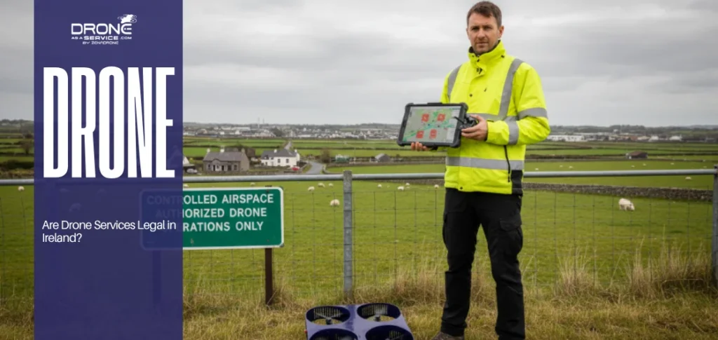
- Regulatory Limitations: Many countries enforce laws that regulate drone flight.
Although these limitations may hinder the best performance of the drone, they do not reduce the value of orthomosaics. By being planned and equipped, understanding drone weight capacity, and knowing the legal requirements, industries can fully exhibit their full potential. Learn more about drone flight regulation and how rules impact mapping projects.
Orthomosaic Maps vs. Traditional Maps
The selection of a mapping method begins by understanding the disparities between orthomosaic maps and traditional maps. They both present the world, but in greatly different specifics, accuracy, and purpose.
Orthomosaics have been proven to be precise in tasks like surveying and construction, whereas conventional maps are used in areas like access and general navigation.
It is good to know the strengths and weaknesses of each map to enable businesses and individuals to choose the appropriate tool:
| Aspect | Drone Orthomosaic Maps | Traditional Maps |
|---|---|---|
| Detail & Accuracy | These pictures are high-resolution, nondistorted, and exactly in the world coordinates and can be used in survey-grade accuracy. | These images are abstract and symbolic; thus, they cannot be measured accurately. |
| Cost | They have increased initial expenses due to the necessity of drone technology, special software, and processing. | They are cheaper and can be found in print and digital versions, and are common. |
| Usability | They are used in the operation of drones, stitching of the data and technical skills. | They do not require any form of training to read and interpret. |
| Applications | They are best suited to use in agriculture, construction, city planning, environmental surveillance and inspections. | They are also applicable in education, traveling, navigation and the general geographical orientation. |
| Update Frequency | The new flights can be updated regularly with the flight data of drones. | The updates are not common and might fail to reflect the real-time changes. |
Instead of treating orthomosaics and traditional maps as rivals, treat them as complementary products. The simplicity and general views of traditional maps and the precise and accurate data of orthomosaic drone maps, respectively.
The combination of the two will enable users, including ordinary travelers and industry professionals, to navigate spaces and make smarter, data-driven decisions.
Orthomosaic Drones: Top Models and How They Work
All drones are intended for mapping. An effective mapping drone must also be stable, possess a high-quality sensor with an accurate GPS to create an orthomosaic.
DJI, Parrot, and senseFly make the most popular drones used in mapping. Both models are designed for aerial surveys and data gathering.
A good example is ZenaDrone 1000. It has multispectral sensors, long flight time and real-time data analysis.
Together with sophisticated software, drones such as the ZenaDrone 1000 efficiently create precise orthomosaic maps and are utilized in professional work in most industries.
Factors to Consider When Selecting an Orthomosaic Drone
It is more than just picking and choosing the newest orthomosaic drone model; it is about selecting the features that your project needs.
The following are the main considerations to make when selecting the most suitable drone in mapping and survey:
- Camera Resolution: This is a higher resolution that provides a smaller ground sampling distance.
- Flight Time: Increased battery life will result in fewer breaks and increased range.
- Precision: GPS RTK and PKK provide precision in surveys to the extent of the survey.
- Software Compatibility: The drone should be compatible with the key photogrammetry systems.
- Budget and Scale: Select the features that would suit the project size as well as your budget.
When these are taken into account, investing in a drone that promises reliable performance and long-term benefits can be justified.
A proper drone will result in effective operations, quality data, and improved outcomes of the projects.
Technical and Cost Considerations
Drones, GPS, processing software, and storage are some of the equipment needed to create a drone orthomosaic. The price is dependent on the size of the project: a small project can only cost a few hundred dollars, whereas a large mapping project can cost thousands.
Outsourced companies that do not have in-house resources are flexible. The cost of professional drone surveys is often less expensive and less time-consuming than conventional ones, reducing the number of staff while providing the same accuracy.
The Future of Orthomosaic Mapping
Technology is changing rapidly. AI has simplified photogrammetry, and cloud processing does not require high-performance on-premise computers. The addition of LiDAR and hyperspectral sensors increases the possibilities of use.
The drone orthomosaic maps will form an important source of data for urban planners, smart-city initiatives, and autonomous cars. Live maps may be transmitted through 5G, and the information is immediately shared with field crews or office workers.
Conclusion
A drone orthomosaic gives accurate, fast, and efficient results. It transforms the manner in which the farms, construction sites and other industries collect and research spatial data.
An orthomosaic drone is no longer an option; it has become indispensable in contemporary mapping, planning, and monitoring. The future of technology offers quantifiable, scalable, and low-cost solutions.
At Drone as a Service (DaaS), we develop high-tech UAVs like the ZenaDrone 1000 so that we can map the area with high precision. AI, multispectral sensors, and long-range flight are combined with our drones to provide reliable information to businesses worldwide.