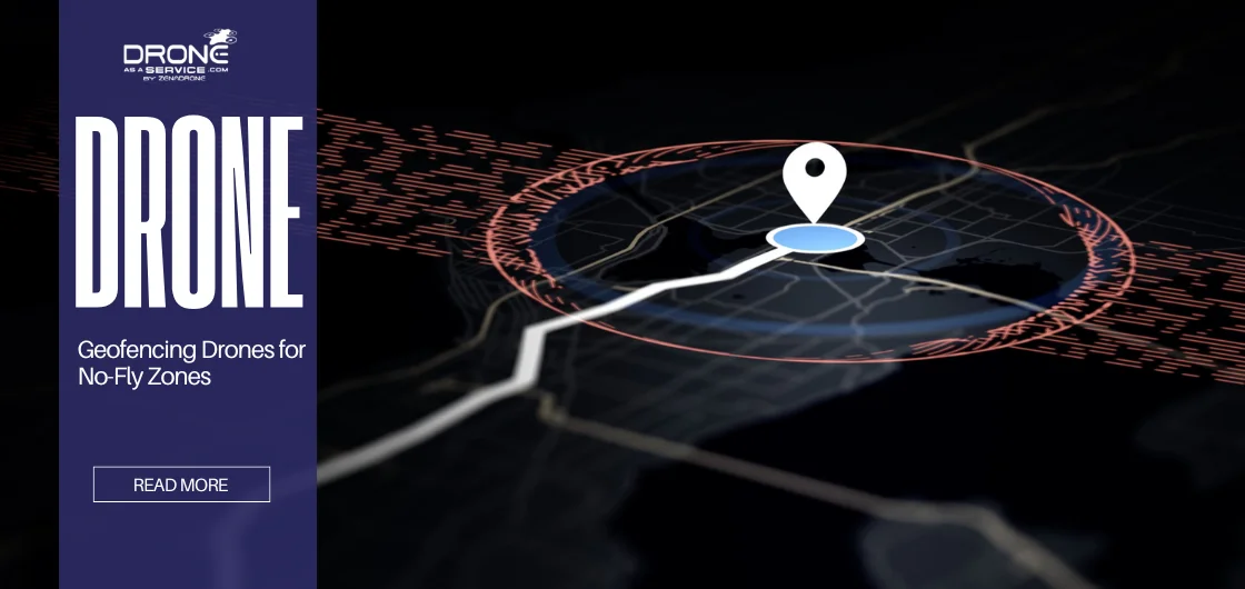
Geofencing Drones for No-Fly Zones
Drones are revolutionizing industries worldwide, from enhancing security surveillance to enabling faster deliveries and creating detailed aerial maps. However, accidental flights into restricted airspace raise serious safety, security, and legal concerns.
To address this, geofencing technology was introduced to help drones operate safely and within compliance. This article explores how drone geofencing works and its role in preventing unauthorized airspace access.
What Is Geofencing in Drones?
In the context of drones, a geofence is a safety net that uses GPS or radio frequency identification signals to create invisible barriers in the sky. These digital barriers block wayward drones from straying into prohibited areas or zones.
As a drone approaches a geofenced area, its software will recognize the boundary and stop moving or reverse direction.
This feature is critical for pilots when navigating no-fly zones. For hobbyists, it prevents airspace violations. For commercial operators, it ensures compliance, limits liability, and fosters trust when flying drones.
How Geofencing Technology Works
Geofencing works by combining drone firmware, mapping data, and GPS positioning. The drones are first populated with the pre-mapped no-fly zones from their system or cloud updates.
As the drone is in flight, a 3-meter GPS constantly monitors its position and cross-references it against prohibited zones.
In cases that the drone approaches a perimeter, the software intervenes, allowing it to halt its forward motion, hover, or initiate an automatic return to home.
Live cloud updates also help drones respond to new or temporary no-fly zones. This direct process of combining GPS and software allows geofencing to be a trusted method for keeping drones out of prohibited airspaces.
Understanding No-Fly Zones
No-fly zones are areas or domains where flying is illegal or prohibited due to safety concerns and security threats. They safeguard airspace over areas like government facilities, airports, and critical infrastructure like power plants or nuclear sites.
These no-fly zone areas are identified by national aviation authorities, like the Federal Aviation Administration (FAA) in the United States or the Civil Aviation Authority (CAA) in the UK.
These agencies assess risks, establish boundaries, and formulate regulations that drone operators must adhere to, especially when operating near illegal drone zones in the US.
Geofencing means drones can’t enter these zones. In cases where drones fly close to these zones, the technology detects restricted airspace and locks out the drone, encouraging safe, legal, and responsible flights without 24/7 operator attention.
Types of Drone Geofencing Systems
There are various types of geofencing for drones that provide different levels of control and flexibility.
Static Geofencing
Static geofencing relies on predetermined, hard-coded boundaries in the UAV/UAS software. It is dependable for basic security but may not receive updates from newly declared no-fly zones.
Dynamic Geofencing
Dynamic geofencing uses data from telematic systems or cloud-delivered updates. This iteration requires drones to be alerted to temporary restrictions on a map, such as emergency zones or key events, rather than static geofencing, which is less flexible and precise.
Custom Geofencing
Custom geofencing can be user-defined, allowing you to design your own space. It’s designed for job sites, farms, or small company premises where operators need to create custom safety zones.
Static geofencing is the simplest and most reliable when limited to fixed locations. On the other hand, dynamic geofencing provides better accuracy and flexibility. Finally, custom geofencing gives the ultimate freedom for special operations.
Benefits of Geofencing Drones for No-Fly Zones
Geofencing technology plays a vital role in ensuring drone safety and compliance. By creating virtual boundaries around restricted areas, it helps operators avoid risks and disruptions, supported by power sources supporting safe flights. Below are the key benefits of using geofencing drones for no-fly zones:
- Prevents Unauthorized Airspace Entry: Automatically restricts drones from flying into prohibited or sensitive zones.
- Enhances Safety: Keeps drones away from accident-prone or high-security areas, reducing the risk of crashes or incidents.
- Avoids Legal Penalties: Prevents unintentional violations that could result in fines, confiscation, or legal action.
- Builds Public Trust: Ensures drones used for delivery, photography, and mapping operate responsibly and safely.
- Supports Regulatory Compliance: Automatically aligns drone operations with aviation authority regulations without manual input.
- Minimizes Operational Risks: Reduces chances of accidents, uncontrolled inspections, or harm to people and property.
Challenges and Limitations of Drone Geofencing
Geofencing has a few challenges. The most common is dealing with GPS signal loss or interference, a scenario addressed by how drones navigate without GPS, which allows operations even when positioning signals fail..
Another issue is outdated or incorrect no-fly zone data, as drones may fail to recognize newly restricted areas or block regions if the information is not kept up to date.
An urgent need in emergencies is also a limitation, as operators may struggle to override geofencing when drones are required for emergencies, such as rescue missions.
Other risks include cybersecurity threats, where hackers can invade, access, and hijack software-driven systems, which can eventually affect the drone.
Drones require frequent firmware updates, a secure system design, and harmonized regulations across countries.
Drone GPS Calibration vs. Compass Calibration
GPS and compass calibrations serve different yet equally critical purposes in drone flight. GPS calibration aligns a drone’s position with satellite data for accurate navigation, while compass calibration syncs the drone’s orientation with Earth’s magnetic field to prevent drift and instability. Both systems work together to ensure reliable, safe, and stable flight.
| Feature | GPS Calibration | Compass Calibration |
|---|---|---|
| Purpose | Aligns position data with satellites for accurate location. | Aligns heading with Earth’s magnetic field for correct orientation. |
| When to Calibrate | When location reads incorrectly, after long travel, or in new areas with weak satellite signals. | When the drone drifts or spins due to magnetic interference or after changing locations. |
| Affected By | Satellite visibility, signal interference, or GPS antenna issues. | Local magnetic fields, nearby metals, or electronic interference. |
| Impact if Incorrect | Poor positioning, drifting, or GPS-based feature errors like Return-to-Home. | Incorrect heading, yaw drift, or unstable flight control. |
| Dependency | Relies on satellite signals, integrated with IMU and compass for navigation. | Works alongside GPS and IMU to maintain accurate direction and stability. |
Real-World Applications of Geofencing Drones
Smart geofence drones are beneficial in various sectors, as they enhance safety execution, ensure compliance, and optimize site operations.
Geofencing technology prevents commercial delivery drones from entering the limited airspace around urban areas and flying along restricted flight paths.
On farms, geofencing is used to establish areas where crops grow, allowing drones to spray or monitor fields within designated “safe zones.” It is equally effective for law enforcement and surveillance teams to help perform missions more safely and cost-effectively.
By creating virtual fences, such devices can help steer clear of sensitive or restricted areas, minimize privacy compromises, and prevent trespassing on restricted airspace, all while ensuring compliance with aviation laws.
Likewise, infrastructure inspectors use it to fly drones near utilities and power plants safely, such as communication towers, without getting too close to something that could put them in danger.
Even for hobbyist pilots, geofencing is a real game-changer regarding the flying experience and safety. It automatically ensures that their drones stay within legal parameters and out of no-fly zones, allowing them to enjoy the ride.
The Future of Drone Geofencing
The inevitable direction for drone geofencing is smarter, dynamic solutions powered by AI. As AI advances, drones will start using adaptive geofencing that can automatically adjust to real-time airspace changes, making every flight safer and more efficient.
Meanwhile, links to 5G networks and map data stored on the cloud will immediately allow drones to access information about no-fly zones and temporary restrictions.
As drones get smarter, they will eliminate their wind-up time by getting so nimble that they can change direction on a dime, dodge obstacles, and make judgments while flying just as a co-pilot would.
These developments will necessitate closer collaboration among technology companies, aviation regulators, and drone manufacturers to establish globally interoperable compliance standards that are applicable across all regions and platforms.
Beyond that, geofencing will also be crucial for emerging technologies such as urban air mobility and drone taxis.
Many new and novel technologies will require their airspace to be managed when performing tasks in increasingly crowded skies. Geofencing is a key technology in the future of aviation.
Conclusion
Geofencing has quickly proven to be one of the most effective mechanisms available to enhance drone safety and compliance with aviation laws.
Drone geofencing serves as an invisible barrier, preventing drones from approaching and entering prohibited zones.
It makes it easier to take risks, adhere to legislation, and promote public acceptance of drones. With these considerations in mind, the need for tight drone restrictions makes geofencing all the more critical for flying responsibly.
At Drone as a Service (DaaS), we’re committed to making the skies smarter and safer. We help you navigate airspaces confidently, comply with regulations, and enjoy smoother, worry-free flights.