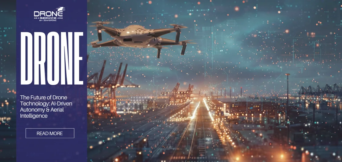
The Future of Drone Technology: AI-Driven Autonomy & Aerial Intelligence
Drone technology is entering a new era as part of digital infrastructures instead of being standalone tools. Drones have shifted from remotely piloted tools to fully autonomous decision-makers through the convergence of Agentic AI and edge computing. This technological advancement along with the implementation of new BVLOS (Beyond Visual Line of Sight) regulations enables self-managing fleets.
Autonomous drones can navigate through challenging landscapes because their existing technology enables them to adjust their flight routes in real time. Instead of working as an automatic machine, the system functions as an adaptive system changing based on environmental conditions.
AI-powered drones serve as the core systems that employ machine learning and computer vision to develop instant environmental assessments. It utilizes aerial images and converts it to usable intelligence, reducing the need for human analysis and advances decision-making.
The industrial sectors of energy, construction, logistics, and public safety are experiencing rapid implementation of aerial intelligence. Drones operate as essential elements within a digital ecosystem that generates predictive aerial data. Now, they have integrated an uninterrupted system that connects with business operations to deliver continuous access to real-time aerial monitoring information.
Evolution of Drone Technology: From Manual Control to Smart Systems
The development of drone technology has moved from human-operated systems toward autonomous operations. In the early days, drone operations required skilled pilots and continuous line of sight. These limitations, on top of manual data offloading, made it hard for various industries to conduct large-scale operations.
Advancements in computing power allowed for GNSS systems, collision sensors, and GPS navigation, resulting in ‘autonomous flight Systems can choose their actions based on real-time environmental conditions. AI-powered drone systems bridge the gap between intelligence systems and operational performance. It opened operational abilities that respond to environmental factors, which include moving obstacles and sudden weather changes.
Nowadays, intelligent drone operations can take place even in warehouses or dense forests without working GPS signals
Understanding Autonomous Drones
Autonomous drones can recognize and make logical decisions according to environmental situations without human control through its advanced features. This function is possible thanks to features like Artificial Intelligence (AI), onboard sensors, and other advanced software. Autonomous systems operate independently by determining their flight routes through real-time SLAM (Simultaneous Localization and Mapping) and superior computer vision technology. LiDAR, ultrasensors, and camera enables the drone to map out its environment, acting as the drone’s “eyes”.
Additionally, AI acts as the ‘brain’ that lets the drone make decisions mid-flight.
- Decision-Making: The drone can plan its route based on the objective, such as covering a specific area.
- Dynamic Adaptation: Drones use obstacle avoidance sensors and an onboard logic system to detect obstructions and sudden winds and reroute to safer paths.
- Edge Computing: The system achieves millisecond reaction capabilities through processing data directly on the drone, which enables safe navigation at high speeds.
- Fail-Safe Logic: it activates the recovery procedure when it encounters low battery levels, hardware problems, or signal loss instead of remaining in flight.
These systems enable organizations to make large-scale, repeatable deployments possible across global industries, eliminating hazards and the need for human pilots.
Artificial Intelligence: The Brain of Future Drones
If rotors function as muscles and sensors work as eyes, then artificial intelligence serves as the drone’s brain. AI-Powered Drones possess the ability to fly, but they also have the capacity to understand their surroundings. Human operators previously needed to search through thousands of images over several days to find possible defects in key infrastructure. AI cuts this time to hours.
AI models today execute data processing through edge computing and cloud systems to generate Predictive Aerial Data.
- Object Detection: The process involves locating specific objects, which consist of power line insulators and agricultural plant species, and building thermal leaks.
Change Detection: The AI system tracks site modifications by comparing current flight data to previous data, tracking both building development and activities. - Predictive Analysis: The system enables organizations to shift their approach from conducting repairs after equipment failure to implementing scheduled maintenance. This results in significant operational time savings for essential systems.
- Semantic Segmentation: enables users to differentiate between roads and trees, and power lines, which helps them categorize data into specific groups.
Aerial Intelligence: When Drone Data Becomes Decision-Ready
Aerial intelligence provides information for quick decision-making. Given its ability to convert raw data to accurate insights ready for decision-making.
Accurate map modelling
AI technology creates accurate three-dimensional models together with digital twins through aerial photography, which serves as its primary reference point. The digital replicas enable stakeholders to conduct simulations while developing operational plans and controlling resources from a distance.
Systems are connected
Companies use Predictive Aerial Data to create future project visualizations, which require aerial intelligence to connect with its Enterprise Resource Planning system and Geographic Information System.
The connection between these systems changes a drone from being just another device into an essential element of digital communication infrastructure.
This highlights the readiness of these drone data through aerial intelligence when models are accurate and are interconnected between systems. This allows stakeholders, inspectors, and companies to come up with quick decisions upon insight extraction.
How AI, Autonomy, and Aerial Intelligence Work Together
The system operates as a closed-loop process that achieves continuous improvement through time. As drones gather more data, AI models become more accurate, resulting in improved reliability on autonomous operations. With aerial intelligence growing, organizations can integrate drone insights into broader decision-making processes.
The actual strength of drone technology emerges through its combination of three elements: autonomous control, aerial intelligence, and artificial intelligence capabilities.
- Autonomy: Autonomous Drones ensure that data is collected consistently every time. They fly the same path with the same camera angles, removing the human variability that often ruins data comparisons.
- Aerial Intelligence: AI scans the incoming data stream, extracting relevant insights, tagging defects, and filtering out the gigabytes of “noise.”
- Artificial Intelligence: Aerial intelligence structures these insights so a project manager, field engineer, or executive can make a high-stakes decision in seconds.
Intelligent Drone Operations depend on this fundamental principle. Drones transform into continuous intelligence sources that enable organizations to achieve their operational excellence and strategic objectives
Renewable Energy: Predictive Maintenance from the Sky
The renewable energy sector is one of the fastest adopters of autonomous drone technology. Wind turbines and solar farms cover extensive areas, which include complicated systems that operate in distant locations. However, traditional inspection is not only time-consuming. It’s also expensive, as well as dangerous for ground crews.
Autonomous drones solve these challenges by providing:
- Faster inspection cycles
- Consistent data capture
- Reduced safety risk for workers
- Better asset lifecycle management
AI can detect issues like panel degradation, thermal anomalies, and blade damage. The process of inspecting equipment establishes time-series datasets that show operational patterns that help forecast upcoming failures. The concept of Predictive Aerial Data represents its fundamental nature. Energy operators can schedule maintenance proactively, avoiding unplanned outages and improving overall asset performance.
Construction and Infrastructure: Real-Time Project Intelligence
Real-time project intelligence supports the construction industry by providing critical information through:
Autonomous Drones
Autonomous Drones deliver project owners a complete aerial perspective. Drone concrete inspection and volumetric analysis of stockpiles finish faster than traditional site evaluation methods.
AI-powered software
AI-powered software enables site teams to compare present construction progress with the original BIM (Building Information Modeling) and CAD blueprint design. The system detects building errors at an early stage, including footer misplacement and pipe installation errors, which require expensive corrective work.
The integration of drone autonomy systems enables site inspections to occur daily without requiring pilots on site; at the same time, it delivers continuous automated site monitoring capabilities that did not exist before.
Furthermore, this highlights its ability to provide significant insights through continuous inspections which reduces delay and expensive reworks.
Mining, Surveying, and Geospatial Intelligence
Autonomous drones have the ability to map hazardous and inaccessible areas that are present in mining environments. Drones can reach deep open pits and unstable underground shafts that humans are unable to access.
They finish their work in a shorter time frame while collecting accurate land survey information.
- Volumetric Calculations: The AI system calculates material volume from stockpile measurements to conduct instant inventory management of existing stockpiles.
- Terrain Modeling: The process creates high-resolution digital elevation models (DEMs), which enhance drainage planning and haul road optimization activities.
- Regulatory Compliance: The high-precision data permits mining boundary verification and environmental restoration activity monitoring.
- Safety Monitoring: AI algorithms create a system that tracks high-wall stability through the detection of millimeter-scale movements that could lead to landslides, thereby ensuring worker safety.
The data acquisition process now takes only hours to complete in these sectors. It enables companies to manage their operations with greater agility while improving safety outcomes.
Public Safety and Smart Cities
Every second holds vital importance for public safety operations. (DFR—Drones as First Responders) Autonomous Drones now serve as emergency first responders as they launch from their docking stations whenever a 911 call arrives.
The aerial units reach the location before ground teams do, while they supply dispatchers with real-time Aerial Intelligence. The AI system can track moving vehicles while it detects fire origins through heat signature identification in areas with thick smoke. It also locates missing people who are hidden in dense forest areas through thermal imaging technology.
The advanced obstacle avoidance system enables drones to operate in narrow spaces, between buildings, and indoor locations without safety risk. The firefighters and police officers achieve better situational awareness, allowing them to approach unknown situations without entering the area “blind.”
Logistics, Airspace Management, and Regulatory Trust
The integration of drones expands to logistics, airspace management and regulatory trust. Its enhanced and advanced technology contributes to these departments through:
- The logistics and internal operations: drone autonomy systems for delivering the last mile while handling internal logistics through bypassing ground traffic and accessing remote locations.
- Intelligent traffic organization: Future drone technology uses artificial intelligence to control real-time aircraft routing and collision avoidance while managing air traffic flows. It will empower the safe and efficient operation of multiple aircraft in shared airspace.
- Advanced Unmanned Traffic Management (UTM): Airspace management systems function as digital air traffic control systems enable multi-drone operations through their flight planning and conflict resolution capabilities.
- Automated Compliance: Remote ID and geo-fencing systems enable automated regulatory compliance by transmitting drone identification information while blocking entry into no-fly zones.
- Building Public Trust: Public acceptance and new systems are more rapid when regulations develop further. It pushes organizations to achieve both safety benchmarks and accountability standards before they can launch their systems nationwide.
The Next Decade of Drone Technology (Conclusion)
The current state of drone technology has progressed beyond basic development to create new ways of operating digital systems. Drones have developed into essential digital systems that link physical spaces with business intelligence. This becomes possible through the combination of artificial intelligence, IoT, and Geographic Information System, and corporate software platforms.
Autonomous drones now function as real-time data engines that continuously generate predictive insights through their ongoing data processing. Organizations now obtain decision-ready intelligence from aerial data through AI-driven analysis and enterprise integration. With this, it enables them to identify risks and enhance their operational efficiency and create their future strategies.
In the next decade, drone applications will evolve from simple business tools into fundamental business structures. Organizations that implement Intelligent drone operations will achieve a competitive advantage through predictive aerial data, enhancing business operation efficiency, guided by the expertise of a skilled drone pilot who ensures data quality and mission success.
This concludes the evolution of drones as an essential system creating technological framework for future digital business operations.