How Drone Services Are Transforming the Energy Industry?
Drone inspections utilize UAVs to gather high-resolution visual, thermal, or LiDAR data for energy assets more efficiently, safely, and at a lower cost than manual or helicopter inspections. It’s not just a minor upgrade—it’s a significant change in how we maintain the systems that power our world.
How did we reach this point? For years, the energy industry has relied on labor-intensive, high-risk, and costly methods. Inspectors had to climb to dangerous heights, walk across huge areas, or organize expensive helicopter teams. The work was slow, the data was often based on personal judgment, and the safety risks were very real.
Drones are shifting the operations in today’s generation. They provide every energy company, big or small, with access to detailed and valuable data about their assets.
The benefits are impressive:
- Safety: People stay safely on the ground, away from live equipment, high places, and dangerous areas.
- Cost Reduction: This is the aspect that excites me the most. Thermal cameras on drones can find problems that you can’t see, like parts that are getting too hot in a substation or panels that are broken in a solar farm, before they become bigger problems.
- Thermal Insights: This is the aspect that excites me the most. Thermal cameras on drones can find problems that you can’t see, like parts that are getting too hot in a substation or panels that are broken in a solar farm, before they become bigger problems.
- Digital Twins: The information we gather allows us to create very precise digital models of assets. These models are more than just for show—they help with planning, simulations, and figuring out when maintenance is needed.
Utilizing drones as a service (Daas) isn’t just a cost—it’s one of the best things an energy company can do right now. The company will benefit more by making the energy grid safer, more reliable, and more efficient.
A Brief History of Energy Infrastructure Inspection and the Rise of Drones
Inspecting energy infrastructure used to involve a lot of manual labor and was often dangerous. Linemen from those days say the job took real physical strength and a readiness to face big risks.
- Throughout the 20th century and into the 1990s, inspections were conducted manually. Crews climbed transmission towers and wind turbines, which was a slow and risky process. For larger areas, they used helicopters. They were quicker than walking, but costly, weather-dependent, and still dangerous for everyone involved.
- The risks and inefficiencies were significant. Sometimes, a single inspection requires shutting down a power line, which costs thousands of dollars per minute. It often ended up with only handwritten notes or unclear photos. Rather than stopping problems before they started, we usually waited until something failed.
At first, energy inspections relied on climbers and human-crewed aircraft. Around 2016, things changed. Technology has advanced, and drones have become practical business tools, rather than just hobbies.
Here’s what led to the worldwide use of UAVs:
- The U.S. Part 107 set clear rules, making it both legal and practical to use drones for business purposes.
- High-resolution zoom and thermal cameras became cheaper and smaller.
- Flight planning software enabled us to establish automated flight paths and collect accurate data every time.
In the past, inspections were associated with hazardous climbing, expensive helicopter flights, inaccurate data, downtime, and repairs, which occurred once something went wrong. Nowadays, drones enable us to survey in a safe way, save money, obtain superior data, minimize disturbances, and prevent issues prior to their occurrence.
What Is an Energy Infrastructure Inspection?
An energy infrastructure inspection monitors the performance, safety and condition of power plants, renewable or oil and gas plants through visual data, thermal data, or LiDAR. This process serves as a comprehensive evaluation of the critical systems that support electricity supply and industrial operations. Inspections don’t just find cracks and rust.
They have three main uses:
- Keep Worksafe: Inspections keep the workers and the people safe by uncovering issues beforehand and preventing accidents.
- Ensure Reliability: Consistent checks ensure a negative impact on the business by avoiding the breakdown of operations and unexpected failures at high costs.
- Extend Asset Lifespan: Accurate data from inspections enables energy companies to plan maintenance effectively and maximize the value of their infrastructure.
The modern inspections apply a number of technologies to provide a full picture:
- RGB: RGB High-resolution 4K-8K photos and videos assist in detecting physical damage, corrosion, and growing vegetation that is too close to machinery.
- Thermal Imaging: This technology detects heat anomalies, which are crucial for identifying electrical issues, broken parts, and solar panel defects.
- LiDAR: This method makes accurate 3D models of buildings, which makes it easier to measure clearances and model complex shapes.
- Multispectral Imaging: Multispectral imaging can also be applied to the environmental effects of pipelines and energy plants, although it is commonly applied to the agricultural sector.
How Drone Technology Enhances Energy Infrastructure Inspection
Drones make it easier to inspect energy infrastructure by giving you stable, high-resolution images, thermal images, accurate LiDAR maps, and regular automated flight paths. The current enterprise drones are technologically advanced with a considerable edge over other alternatives in the energy sector.
These systems use special tools that combine precision engineering with cutting-edge sensing technology. Here’s why today’s drones work so well:
1. Advanced Imaging Technology
Drones act as flying sensor platforms. What really matters is the equipment they carry:
Visual Cameras (4K-8K): These aren’t just for video. With strong optical and digital zoom, pilots can safely spot a cracked insulator from more than 100 feet away.
These thermal cameras are a game-changer. Radiometric thermal sensors can do more than just show pictures of heat; they can also tell you how hot it is. This helps find hot spots in electrical parts, leaks in pipes, and broken solar cells with high accuracy.
LiDAR Sensors: LiDAR sends out millions of laser pulses to create a detailed ‘point cloud’ model of an asset. This is extremely useful for measuring the sag in a power line or mapping the structure of a dam wall, even through light vegetation.
2. Intelligent Flight Systems
The way you fly the drone matters as much as the camera itself.
- GPS RTK/PPK: These systems offer sub-centimeter accuracy. Every photo and data point gets a precise geographic tag. For mapping a pipeline corridor, this level of accuracy is essential.
- Obstacle Avoidance: Drone sensors enable it to automatically navigate through complex areas, such as dense forests or refinery structures. This prevents crashes and makes sure data is collected.
- Automated Flight Routes: With mission planning software, we can set a drone to follow the same path each time. This makes it much easier to compare data over time and track the development of a problem.
All sensors are checked and recalibrated before every mission to ensure that the data is valid. In the case of thermal cameras, a known reference source is used. This process assists us in ensuring that the data is of professional quality since we cannot make crucial decisions based on inaccurate data.
Comparison of Drone-Based and Traditional Inspection Methods:
| Category | Drone | Helicopter | Climber / Rope Access |
|---|---|---|---|
| Cost | Low (Up to 50% savings) | Very High | Moderate to High |
| Safety | Excellent (Operators on ground) | Moderate (Pilot & crew at risk) | Poor (Climber at high risk) |
| Data Detail | High-Resolution, Multi-Spectral | Moderate, Limited by a stable platform | High, but limited to hand-reach |
| Downtime | Minimal or None | Often Requires Shutdown | Almost Always Requires Shutdown |
| Inspection Speed | Very Fast | Fast | Very Slow |
Benefits & Applications of Drone Services in the Energy Sector
Drone inspections help energy companies save money, keep workers safer, expedite maintenance, and collect vital data on key assets. In other words, they help turn a hectic, unpredictable maintenance schedule into a more organized and strategic process. Our clients often feel relieved when they see how clear and useful the data is.
Here are the main benefits that make a real difference:
- Enhanced Safety: Safety is essential. Drones stop the need for personnel to work at heights or near live equipment, thereby reducing the primary risks associated with energy inspections.
- Dramatic Cost Reduction: For example, there is no need for helicopter fuel, special climbing teams, or long periods of downtime. These savings directly impact your bottom line.
- Unmatched Speed and Efficiency: A drone can inspect a 10MW solar farm in just a few hours. The same job would take a ground crew days or even weeks to complete.
- Minimal Operational Downtime: Many drone inspections can be conducted while the equipment is still operational. There is no need to shut down a power line or stop a wind turbine, so you avoid losing revenue.
Drones are useful in a lot of ways. They turn possible problems into actions based on data. The breakdown indicates the key applications as follows:
- Power Lines and Utility Grids: There should be an inspection of towers, lines, and insulators to determine the presence of damage.
- Wind Turbines: Inspecting the blades: cracks, erosion in the front area, and lightning damage.
- Solar Farms: Identification of faulty modules, hotspots, and combiner box issues across extensive arrays of panels.
- Substations: Thermal scanning to detect overheating breakers, transformers, and connectors.
- Oil and Gas Pipelines: Checking for leaks, corrosion, and people getting in the way of the right-of-way.
Mini-Section
The return on investment is readily apparent. For example, one of our clients, a mid-sized utility, started using drones and saw a 300% ROI in the first year. They discovered a major fault during a routine inspection that, if left unaddressed, would have resulted in a $2 million outage. The numbers speak for themselves.
Power Line & Utility Grid Inspections
The truth is that our transmission and distribution grids are aging, and maintaining their reliability is always a challenge. Drones have become a key tool in this effort.
When you see a drone’s camera catch a tiny crack in an insulator from 50 feet away, it’s clear why you’d prefer this over sending someone up to inspect it.
You should know about two kinds of grid inspections:
- Transmission Inspections: These include the long power lines, which are of high voltage. LiDAR and sharp camera experiences on drones are ideal for inspecting large steel towers, identifying rust spots, and ensuring the lines do not collide with trees.
- Distribution Inspections: They are concentrated on the local lines, which supply power to homes and businesses. Drones are used to quickly find problems like broken wires, cross-arms, and insulators that aren’t working right, especially after storms.
So what do we seek when we are on Inspections? The following are some of the most critical matters:
Damage to Conductors: This consists of damaged wire, damage due to vibration, and damage by objects that contact the lines.
- Insulator Cracks: Insulators, whether ceramic or composite, can crack, which can cause flashovers and power outages.
- Vegetation Encroachment: LiDAR data assists in mapping the growth of trees and plants along power lines, thereby enabling the crews to cut them prior to causing outages.
- Inspect the towers for signs of rust, loose bolts, and structural fatigue to determine if they are experiencing corrosion or other issues.
Response to Storms and Restoration of Outage
With a big storm, it is time to waste no moment. It is possible to dispatch drones immediately to investigate the long power lines and locate the precise location of the fallen poles and damaged equipment. It assists the crews to work quickly and can reduce restoration days down to mere hours.
UV Corona Detection Note
For advanced diagnostics, some drones use UV sensors. These sensors detect faint ultraviolet light from corona discharge, which serves as an early warning sign of electrical stress on high-voltage components. This technology works like an X-ray for power lines.
Drone Services for Renewable Energy (Wind, Solar & Hydro)
The renewable energy sector has adopted drone technology more rapidly than most other industries, primarily due to the remote locations, large scale, and high value of assets that are challenging and costly to inspect manually.
Here are the three renewable energy sectors that benefit from the drone services:
Wind Turbine Inspections
In the past, inspecting a 300-foot turbine meant sending a climber up with a rope and a camera. It was slow, weather-dependent, and risky. Now, things have changed:
- Drones capture extremely detailed images of the blades to identify micro-cracks, leading-edge erosion, and damage from lightning strikes.
- They can safely check the tower and nacelle for any structural problems.
- This data helps engineers make targeted repairs, which extend the turbine’s life and boost energy output.
Solar Farm Inspections
Even one shaded or faulty panel can lower the performance of a whole string. Checking thousands of panels by hand with a thermal gun is extremely difficult. Here are the drone operations that could give:
- Drones equipped with thermal cameras fly over a solar farm, quickly identifying hotspots that indicate faulty cells or electrical issues, as well as microcracks.
- They create a detailed report that shows exactly where each defect is located and its severity. This helps teams prioritize the most critical repairs first.
- This can help recover a lot of lost revenue. Solar farms can recover up to 5% of their output simply by addressing the issues identified by the drones.
Hydroelectric Dam Inspections
Dams are huge structures, and keeping them safe is critical. Drones offer a secure and thorough way to keep an eye on them.
- Drones conduct detailed visual and LiDAR scans of dam walls to detect cracks, spalling, or erosion.
- They can inspect spillways, penstocks, and other critical components that are difficult and hazardous to access.
- The 3D models created by drones are used to monitor the structure over time and to plan major repairs.
Oil & Gas, Pipelines & Critical Energy Infrastructure
The oil and gas industry relies on some of the most complex and hazardous infrastructure worldwide. Ensuring environmental safety is essential. Using drones enables companies to transition from merely reacting to problems to proactively predicting and preventing them.
Here are the three sectors that are challenging to inspect:
Pipeline Corridor Mapping and ROW Monitoring
There are numerous countries through which the pipelines pass, and maintaining the Right-of-Way is a full-time, critical task.
ROW Encroachment
Drones are used to fly along designated routes, capturing clear shots and special images of individuals working on the construction site, vehicles operating in unauthorized areas, or trees that might grow on pipeline premises, causing damage. This watch helps prevent accidental break-ins to the pipeline.
Corrosion and Ground Movement
LiDAR scans create a 3D image of the ground, which helps engineers identify areas where the land is eroding, sliding, or shifting, potentially exposing or damaging the buried pipeline.
Methane & Gas Leak Detection
- Methane is a powerful greenhouse gas with significant safety and environmental implications, making the detection of leaks crucial. Drones can detect leaks more accurately and efficiently than ground inspections.
- From a safe distance, these sensors can detect and measure leaks of methane and other VOCs from equipment, flanges, and tanks.
- This enables immediate repairs, which in turn reduces greenhouse gas emissions and lowers the risk of accidents. It is also much more effective than ground-based leak detection.
Offshore and Refinery Inspection Challenges
In the energy industry, one of the most hazardous professions is working in the offshore oil and gas sector. Drones help keep workers out of these dangerous areas:
Structural Integrity
UAVs (including small, cage-like drones for inspecting confined spaces) inspect flare stacks, underdecks, and the interiors of boilers for corrosion, weld damage, and coating failure.
Atmospheric Monitoring
Drones can carry sensors to monitor air quality around a refinery and detect hazardous levels of H₂S or other toxic gases before they become a problem.
Safety, Regulations & Compliance (Global, U.S. & EU)
There are strict rules for flying drones, but they are in place to ensure the safety of the airspace. Regulatory bodies are rapidly adapting to help businesses thrive. Drone inspections are permitted, but they must comply with the specific rules governing flight operations in each country.
Here are the things that you need to consider before flying a drone:
Dealing with the Regulatory Environment
- United States (FAA Part 107): This guide covers commercial drone flights. Pilots need a Remote Pilot Certificate to fly. Part 107 explains where, when, and how you can fly, including airspace limits and the need to keep the drone in sight.
- European Union (EASA Regulations): The EU has established uniform rules for drones across all its member states. You need to pick the right category to fly: Open, Specific, or Certified. Most energy inspections fall under the Specific category and require permission from the national aviation authority following a thorough risk assessment.
Safety and Pre-flight Procedures
A professional DaaS provider prioritizes safety over merely complying with the law. A thorough pre-flight workflow is necessary for a successful inspection:
- Site Assessment and Risk Analysis: We identify all potential hazards on the ground and in the air.
- Airspace Authorization: We utilize systems like LAANC to verify for temporary flight restrictions and obtain permission.
- Briefing: We review the mission, safety rules, and emergency plans with the entire team.
- Before each flight, thoroughly inspect the drone, sensors, and communication systems.
Encrypted Data and Data Privacy
Critical infrastructure inspections produce sensitive data. One of the primary components of the DaaS service is to ensure the security of such data and its proper management.
- End-to-End Encryption: Data is encrypted immediately when it is removed from the field and when it is stored. This keeps it safe from people who shouldn’t be able to see it.
- Compliance: We have to follow the rules that govern the data of important infrastructure. This usually means keeping location data safe and using secure methods to access it so that it can be checked again later.
Costs and Return on Investment of Drone Services in the Energy Sector
Depending on the asset, drone energy inspections usually cost between $300 and $5,000 per day. The price is based on a number of things, such as the type of asset, the site’s complexity, the types of sensor payloads needed, the distance traveled, and the level of detail in the final report and analysis.
The following table shows typical drone service costs for different parts of the energy sector:
| Asset Type | Typical Pricing Range (USD) | Primary Pricing Basis |
|---|---|---|
| Wind Turbines | $300 – $800 | Per turbine |
| Solar Farms | $400 – $1,200 | Per Megawatt (MW) |
| Power Lines/Towers | $1,000 – $5,000+ | Per day or per mile |
| Oil & Gas Infrastructure | $1,500 – $5,000+ | Per mission or daily rate |
Here are the three main things that affect how much drone services
cost:
- Travel and getting to the site, which costs more for places that are hard to get to or are far away.
- The type of sensor payload, with specialized sensors like thermal cameras and LiDAR, is driving up prices because they need more equipment and training.
- Using high-level AI services to analyze and comply increases the cost of processing and reporting.
The Return on Investment Model
DaaS is business-friendly since it reduces risk and makes things easier:
- Reduction in Labor and access cost: Disposing of helicopter rentals, scaffoldings, or bucket truck time will save money in the short term and is simple to determine.
- Faster Maintenance: The utility can make repairs weeks or months earlier thanks to speedier reporting. You can save a significant amount of money and prevent damage in the long run by identifying a microcrack today, rather than after it causes a failure.
- Less expensive insurance: When workers spend less time in dangerous situations, liability insurance costs go down by a measurable amount.
- Less downtime: Identifying a faulty part early, such as a bad insulator or a hot solar cell, means fewer outages. We know that using drone data to power AI-driven predictive maintenance reduces unplanned downtime by 35%. That really helps the bottom line.
Future of Energy Inspections: AI, Automation & Autonomous UAVs
We are now at the start of this transformation. The drones you see today will be common in decades. In the future, we will not rely on manually gathered and analyzed data, and then take concrete action based on it.
AI defect detection and classification
The current situation is that individuals examine most of the information nowadays. AI will soon handle most of it. Machine learning software is being trained to identify and categorize problems, such as a broken insulator or a hot spot on a solar panel, more quickly and accurately than a person can. This will convert massive data into easy, prioritized tasks for repair teams.
Autonomous drone-in-a-box systems
This is the objective of large and remote locations. They are weatherproof stations that have a drone. The drone can take off, perform a pre-planned inspection, fly back to the station, land, charge, and transfer its data all without having a pilot on the ground. This enables regular and routine inspection of valuable properties such as remote power plants or offshore platforms.
Digital twins and predictive modeling
Drones provide the information on which living digital twins of energy equipment are made. The high-detail models are maintained with each new inspection. Engineers can run tests and simulations in the virtual model. Lastly, this information will be used by AI to make predictions regarding future issues, not only to identify present-day ones, but also to predict maintenance needs.
The Next Decade of Drone Energy Inspections (2025–2035)
With the advancement of technology, energy sectors will become smarter and safer, essentially operating autonomously.
Further autonomous maintenance: Drones will stop being sensors and become repairers. They will fix problems and perform small repairs, such as tightening bolts or applying a protective layer, but these tasks will be controlled remotely.
Constant surveillance and smart grids: In the future, grids will be properly smart, with nearly all major components monitored by ground sensors and tiny drones. In the event of a fault occurrence, it will be detected, isolated, and reported immediately.
Predictive modeling and AI knowledge: AI will not only identify defects but also prioritize their threat to the business. It will identify the most hazardous issues that may compromise financial or regulatory interests, and create the most optimal work-order list for human review.
AR asset visualization: AR glasses will be used to provide field technicians with an overlay of drone data on top of the visuals, such as a heat map of a transformer, which will provide them with useful and instant information before they have touched the equipment.
Bottomline
Drone as a Service (DaaS) is no longer a new technology; it is now the most effective way to maintain the world’s energy infrastructure. The facts are clear—drone services make workers significantly safer, provide data quality that can’t be questioned, reduce operational costs by more than 50%, and accelerate the entire maintenance cycle.
Are you ready to see how UAV inspections for utilities can give you an immediate return on investment for your most important assets?
FAQs
What are drone inspections for the energy industry?
Drones that are capable of capturing pictures, heat images, or LiDAR-based inspections, such as those of power lines, wind turbines, and pipelines. They provide detailed information to assist in maintenance and planning.
How much do drone inspections cost?
The price of a drone inspection will be determined by the project’s size and its specific requirements. Typically, a small local substation costs approximately $2,000, and a large wind farm costs over $30,000. Since the travel distance, sensors employed, and the complexity of data analysis and reporting are the main factors that increase the price, the latter has a minimal impact.
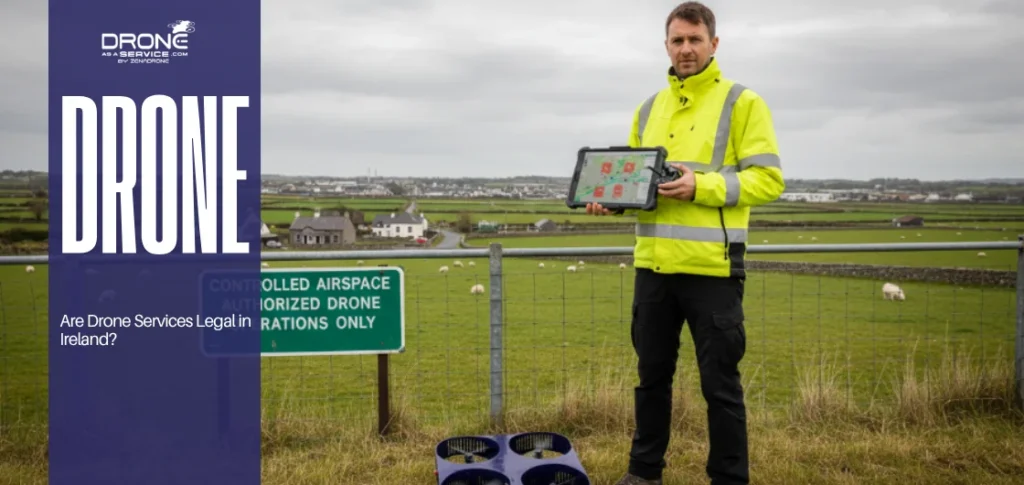
Are drone inspections legal in the U.S. and Europe?
Yes, drone inspections are not illegal, provided the operators are properly licensed to conduct them. Pilots in the U.S. must adhere to the FAA Part 107 rules. Operators in the EU are obligated to adhere to EASA guidelines, which require commercial work to be conducted with special permits.
What type of drones are used for energy inspections?
Enterprise-level multi-rotor and fixed-wing UAVs are employed. These are commercial systems that can contain RTK GPS, which has centimeter accuracy, and high-end payloads, such as radiometric thermal cameras, high-zoom lenses, and hardened LiDAR systems.
What industries benefit most from UAV inspections?
Drone inspections have the most significant impact on the energy sector, particularly for companies operating utilities, solar and wind farms, and oil and gas. Substantial benefits are also realized in other areas, including infrastructure, mining, and agriculture.