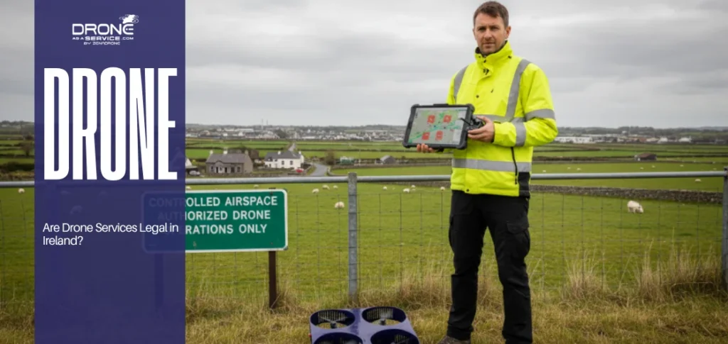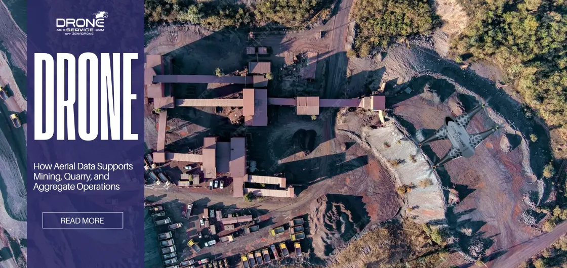
How Aerial Data Supports Mining, Quarry, and Aggregate Operations
TL;DR
- Aerial drone data provides fast, high-accuracy, full-site visibility compared to slow manual surveys.
- It creates 3D models and maps that improve planning, design, and daily operational decisions.
- Enables precise stockpile volume and production tracking for better inventory and revenue control.
- Improves safety by allowing remote inspection of hazardous areas and unstable slopes.
- Supports compliance and environmental monitoring across the full mining lifecycle.
Mining operations need improved site visibility given the large dimensions and physical condition changes, to ensure safety and efficiency. Meanwhile, aerial data provides high-frequency updates to keep pace with daily excavation. Mining site intelligence systems provide a method to view the whole site operations, allowing work to continue without stopping heavy machinery.
Traditional data collection methods have major drawbacks because they depend on manual land measurement, which requires weeks of processing time. During the gap of this time, the site undergoes transformation before ground survey results become available.
Aerial data provides operational intelligence, which helps quarry and aggregate sector leaders to identify operational blocks that occur in their processes. This integration of the digital monitoring system has given new resource collection methods for both quarry and aggregate operations and large open-pit mining operations.
What Aerial Data Means in Mining and Quarry Environments
Aerial data in mining and quarry environments utilize drones to obtain high-resolution images and LiDAR data for 3D models and orthomosaics. These produced models and orthomosaics provide mining experts a visual representation of the site for proper monitoring and decision-making.
These drone-based monitoring systems create a complete digital twin of the site, enabling management to operate the location in real time. It achieves precise acquisition by combining more than 1000 points, creating earth surface models that reach centimeter accuracy.
These drones systems provide inspectors a complete view of operations that ground teams cannot obtain.
Additionally, image data analysis converts basic photos into insights for site monitoring and measurement. This process involves automated systems performing stockpile volume estimation, thus enhancing material movement tracking and remote site visibility. Drones’ capabilities make them reliable tools for ensuring safety during mining operations. Overall, regular process monitoring lets organizations adapt their operations in real-time thanks to aerial and ground data support.
The Role of Aerial Data Across the Mining Lifecycle
Early Planning and Site Assessment
Aerial data supports mining operations by providing precise topographic baselines acting as an initial site evaluation prior to excavation. Engineers use this preliminary mining site intelligence to create haul roads and drainage systems that follow the natural terrain. Exact land measurement prevents expensive design mistakes that would affect the quarry and aggregate operation for many years. Establishing a baseline understanding of the exact land measurements are essential for projects in quarry and aggregate sites.
This is because this acquired information reduces the risk of permit delays, by providing reliable measurements. Integrating aerial data in this stage supports organizations in resource and infrastructure planning, establishing actual requirements according to site allocations. Aerial data enables an understanding of the site’s terrain, access points, and its overall configuration, including environmental limitations and potential hazards.
By gaining an overall aerial information, it supports the early planning of the site for its designs and operations.
Active Operations and Production Monitoring
Aerial data controls operational activities and production tracking through both active operations and production monitoring. This verifies that the mine’s daily “burn rate” stays in line with its projected long-term rates. Ongoing data collection allows for the comparison of actual excavation versus the design plan, highlighting deviations immediately. The site monitoring and measurement enable operators to track equipment performance and site productivity in real time to achieve output goals.
The weekly stockpile volume estimation process allows managers to verify that sales targets are fulfilled while coordinating their logistics activities. With aerial data, it improves material movement tracking while giving remote site visibility to stakeholders without the need for site presence.
The drone’s intelligence functions primarily as a mining safety monitoring tool which detects wall failures and equipment congestion.
Post-Extraction and Site Closure
Monitoring ongoing reclamation and restoration efforts guarantees compliance with environmental regulations. Aerial records (e.g. drone data and images, etc.) of post-extraction and site closure phrases serves as documentation, which is critical for meeting environmental regulations.
Aside from serving as proof of compliance, this documentation also supports planning for future land use and redevelopment.
The final closure audit requires complete waste pile measurements, which need accurate identification of all remaining waste material. Closing processes, which restores the site, uses data to ensure proper placement of restoration materials according to the existing reclamation plan.
The continuous monitoring process enables regulators to track progress, which reduces the need for direct site assessments.
Supporting Core Mining and Quarry Activities
Surveying and Mapping for Operational Awareness
Aerial platforms support operational awareness development through surveying and mapping, delivering comprehensive coverage that ground-level surveys fail to provide. The system supports better coordination and site planning because it delivers precise mapping data for all operational processes that need to be executed.
The maps, which display hidden hazards and access points, enhance safety, enabling users to identify dangerous areas. Implementing this process keeps maps updated on a daily basis, supporting safety operations in vulnerable ground environments. Mining operation sites require this detailed information to achieve maximum operational efficiency.
Measuring Stockpiles and Material Movement
The process of measuring stockpiles and material movement brings immediate financial benefits to the industry. This process decreases estimation errors that occur during manual walking inspections. Integrating this system delivers precise volume data for organizations to manage their inventory and allocate resources effectively.
Production managers need to monitor material movement because it enables them to boost operational efficiency, directly impacting their financial results. This application serves as the ultimate method for stockpile volume estimation, enhancing safety by avoiding hazardous slope areas.
Meanwhile, automated inventory checks enable better onsite asset management, giving organizations higher accuracy in production output and sales figures.
Tracking Site Changes Over Time
Temporal analysis of stacked datasets enables researchers to track site changes throughout different time periods allowing comparison of site conditions. Furthermore, it enables the detection of patterns and outliers while discovering nonconforming elements, saving future rework expenses through early detection.
The system tracks environmental impacts while ensuring compliance with site regulations throughout each stage of the site’s existence. Engineers can improve their long-term planning by studying the pit or quarry development through time. This consistent data generation creates a complete audit trail that both internal teams and external regulators can use it for their reviews and inspections.
Improving Safety Through Remote Site Visibility
These technologies improve human safety through remote site visibility and establish safer working conditions, protecting workers from dangerous areas. With real-time visibility, safety teams can choose appropriate actions which protect workers from potential risks found in dangerous areas.
Detection of structural movements can be identified through a digital environment, from inspection of high-walls and crests to tailings dams. The industry now introduces a proactive safety system that uses data to determine safety procedures while steering away from dangerous areas.
Environmental Monitoring and Compliance Oversight
To maintain an operating license, organizations must document site boundaries and environmental effects at specific times and locations. This process is a key part of environmental monitoring and compliance management.
Additionally, it supports the identification of environmental hazards while developing strategies for reducing their impact through water runoff management and boundary control. Environmental teams can keep an eye on dust levels and revegetation success efforts by regularly checking on the site. This makes sure that the site stays within its allowed limits.
Quarry and Aggregate Operations: Different Scale, Similar Needs
Quarry and aggregate operations need these digital tools to keep track of their high-turnover inventory and tight margins. For large or small scale mining operations, regular and repeatable monitoring is still important for making sure operations run smoothly.
- Scale: Identifies fundamental operational procedures used by large-scale mining activities, yet it establishes distinct operational requirements.
- Consistency: Establishes base performance standards that need to be monitored through regular testing procedures.
- Optimization: Creates operational efficiency, which maintains safety standards at both low and high operational capacities. The system enables better control of logistical operations while delivering necessary supervision to help business owners operate their various sites. improves decision-making power through its ability to create precise reports, which enable better planning processes for decision-making.
How Different Teams Use Aerial Insights
Operations and Production Teams
Operational and production teams utilize aerial insights (orthomosaic, 3D models, drone images, etc.) for their daily planning and site monitoring progress. These 3D models and orthomosaic maps assist daily monitoring and site crew allocations by providing a real-time view of the site.
Aerial data additionally allows identification of site bottlenecks and solving these problems through the detection of haul road congestion and loading zone inefficiencies. The data is used for the purpose of material transport and operating performance in order to optimize the use of their fleet resources.
Real-time activity also helps check floor levels and the accuracy of the bench height, allowing productivity and area progress monitoring. This also allows supervisors to direct their teams with actual site visuals, reducing work errors by using complete site visibility.
Engineering and Planning Teams
Digital terrain models serve as essential tools for engineering and planning teams for design and site assessment confirmations. The infrastructure and resource planning process benefits from this capability, which enables them to create and test future expansion scenarios.
Additionally, data collection supports scenario modeling and optimization decisions, which extend mine operational life while reducing mining waste.
3D models can also be built using the collected data, allowing users to implement engineered designs within the existing terrain. Teams can even use this data to determine strip ratios while making accurate estimates about future production outcomes.
Safety and Environmental Teams
Aerial data acts as tools for safety and environmental teams to track down risks and unsafe areas for their workforce. Drone-collected data is capable of detecting hazards within the operation site, preventing workers from operating on those specific areas.
The drone’s ability to provide high-quality images supports compliance through documentation for environmental monitoring. The documentation proves berm safety and high-wall conditions to meet compliance requirements.
Continuous monitoring of environmental impact, together with mitigation efforts, protect site operations from exceeding authorized limits.
Drones also allow safety inspections on inaccessible areas such as steep slopes and wet tailing areas. This capability serves as a crucial system that supports the efficiency of risk assessments.
Common Challenges When Using Aerial Data
The main challenges in using aerial data in mining operations are storage requirements and sophisticated processing software.
Additionally, data and planning operations depend on how often data is collected, especially when there are drastic changes in terrain. Difficulties in internet access, particularly in remote sites, can also affect upload speeds and processing time for extensive datasets.
On top of that, untrained teams may incorrectly interpret high volumes of data. Data collection procedures face restrictions from weather and visibility conditions including the complex integration of aerial data.
Managed Aerial Data Collection vs In-House Approaches
The choice between a managed service and an in-house team depends on two factors: available resources and required expertise.
A managed approach provides consistent performance along with reliable hardware and accurate data results, making equipment maintenance unnecessary. This way, it becomes possible for teams to meet their objectives when they focus on results rather than equipment.
Professional services ensure that the data is survey-grade and legally defensible for all reporting needs. Outsourcing enables their aerial programs to operate at multiple locations without incurring high costs for equipment and staff development.
Whereas, the in-house need organizations to invest on costly drone equipment, pilot training, and equipment maintenance. It also requires technical expertise in data collection, processing, and interpretation for data accuracy and regulatory standards. An in-house provides flexibility over data collection and scheduling of drone operations. However, this approach requires upfront investment. increasing operational costs.
The Future of Aerial Intelligence in Resource Extraction
The future of aerial intelligence lies in the ability to enable continuous site monitoring for proactive management. Automation, together with predictive analytics and artificial intelligence, produces improved decision-making capabilities.
By consistently gaining real-time data, these technologies detect emerging risks in advance, allowing organizations to react proactively to avoid deterioration.
Future systems will integrate with digital twins and advanced analytics for total operational efficiency. The industry will experience a change, enabling organizations to perform real-time updates about their strategic planning and resource management activities.
This will bring the industry to a fully digital workflow with sites being planned, tracked, and optimized by intelligent systems.
Conclusion: Aerial Data as a Standard Operational Tool
Aerial data has become a standard tool for operations that show how valuable it is for mining, quarrying, and aggregate operations. Organizations can use the data as a current operational base for planning and decision-making in operations, meeting standards. The application of aerial data collection serves as a standard for supporting efficiency and compliance in mining operations.
Mastering land survey techniques and using Drone as a Service (DaaS) can help daily site operations and provide a strategic edge. Accurate land measurement and strong site monitoring allows accurate estimation of stockpiles and movement tracking of materials.
Companies make mining safety monitoring their most important value by using remote site monitoring. The approach of remote site monitoring allows consistent site visibility, hazard detection, and monitoring of changes, enabling proactive responses to hazards.
It also improves safety by limiting the need for on-site exposure and environmental compliance through acquired data.
FAQS
What is aerial data in mining, quarry, and aggregate operations?
– Aerial data is the spatial information that drones collect to run a mining operation. It gives a detailed digital picture of the whole mining site.
How is aerial data different from traditional ground-based site data?
– Aerial data provides higher site information density because it captures the entire area within minutes. It eliminates the safety hazards associated with manual measurement used in traditional land surveys.
How does aerial data support daily mining and quarry operations?
– The system delivers visual documentation, which enables quarry and aggregate operations management to monitor production output and safety compliance.
At which stages of the mining lifecycle is aerial data most useful?
– The entire mining operation needs continuous monitoring because every critical phase of the project demands active monitoring until the end.
Can aerial data be used for both surface mines and quarry sites?
– Yes, both large mines and smaller quarry operations and aggregate operations benefit from the efficiency and accuracy of aerial data.