TL;DR
- Multispectral imaging uses advanced sensors on drones to capture terrain data beyond visible light, improving mapping accuracy.
- It helps detect elevation changes, soil conditions, and vegetation health for better planning and decision-making.
- Drone-based mapping is faster, safer, and more cost-effective than traditional surveying methods.
- Key outputs like NDVI and digital elevation models turn raw data into actionable insights across industries.
- Widely used in agriculture, construction, and environmental monitoring to reduce risks and optimize resources.
Multispectral imaging captures data across specific light wavelengths, revealing terrain details invisible to the naked eye compared with aerial imaging. This capability makes it suitable for projects where precision directly influences cost, safety, and long-term outcomes overall and future success.
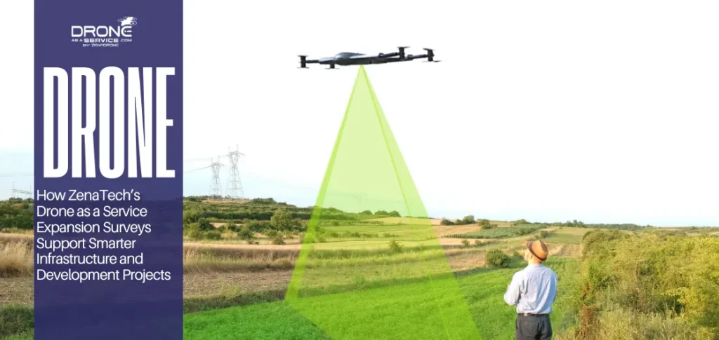
Terrain mapping is mandatory in most industries. Any minor mistake in the height or omission of land formations may cause drainage problems, ineffective planning, or expensive infrastructural redesigns.
With the constant increase in the demands of accuracy and accountability, solid terrain mapping has ceased to be a luxury. It is now a necessary condition that allows us to keep the projects on track and avoid costly issues in the future.
Enhanced Productivity and Information Integrity
Drones’ terrain mapping services are capable of addressing reliable terrain mapping by providing high-resolution aerial coverage of a large or challenging area regularly. Multispectral sensors on the drones facilitate the terrain analysis dimension in terms of repeatability and efficiency.
This approach will save time in the field compared to the traditional techniques and will also preserve good data quality. Compared to conventional methods, this approach reduces field time while maintaining strong data quality.
The main advantages of the multispectral mapping on drones are:
- Better data collection at a faster rate with less disruption to operations.
- Better visualization of changes in elevation using digital elevation models.
- Better inputs to land use planning and site design.
- Economic support: improved financing of agriculture, infrastructure, and environmental projects.
Turning Data into Practical Insights
The actual value of multispectral imaging is the application of the data. Raw imagery is converted into useful information that is utilized in planning and risk assessment through processed outputs.
Engineers have the opportunity to test the slope stability, planners are able to test the suitability of the site, and the farm owners are able to decide on the land management.
As demand grows for accurate and scalable land analysis, drone mapping services continue to play a vital role in delivering precise insights across industries. By combining efficiency with dependable data, multispectral imaging supports smarter decisions and more confident project execution across sectors.
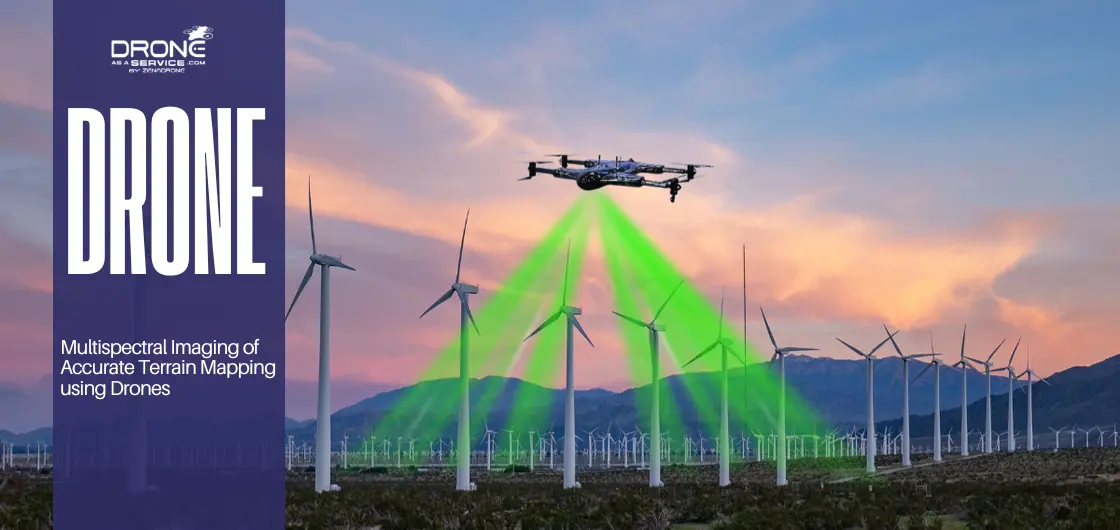
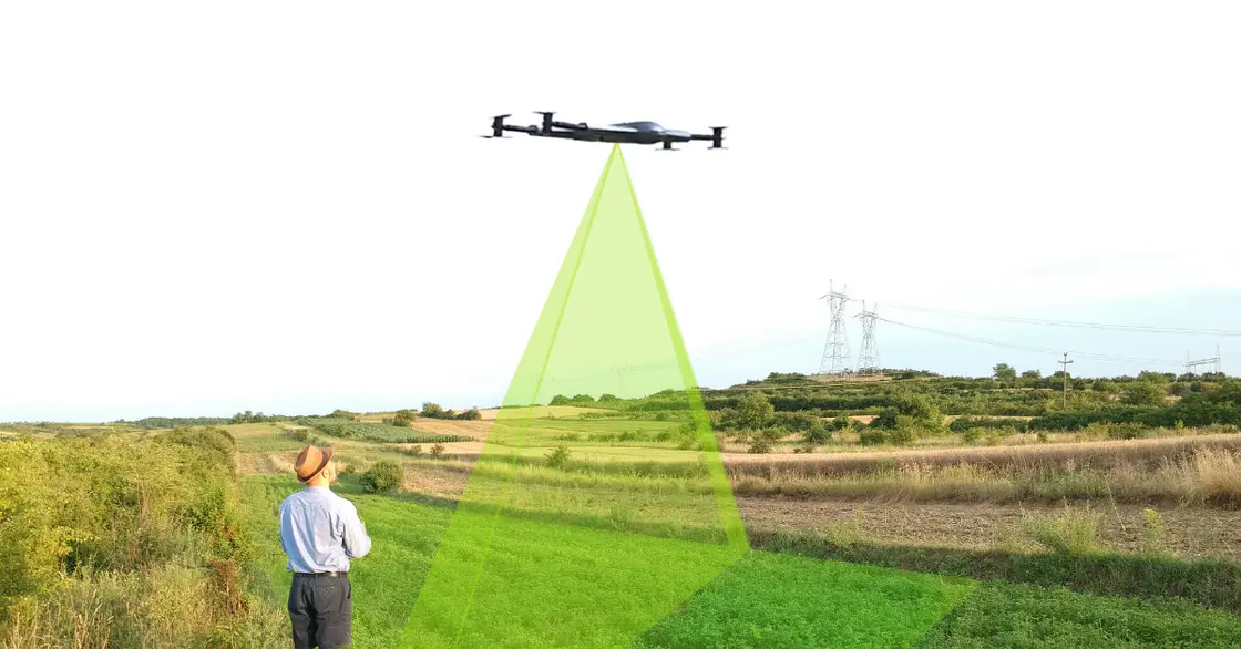
What Is Multispectral Imaging?
Multispectral imaging is another specialized type of remote sensing, which records the data at specific wavelengths within the electromagnetic spectrum. A standard camera only records what the human eye observes, whereas the multispectral sensors extend their detectability to the invisible light.
This technology is very specific since it separates light into different spectral bands, which enables professionals to examine the physical and chemical characteristics of a landscape accurately.
The significant distinction between the normal RGB image and the multispectral image is the depth of data they can gather. RGB images have three bands only: Red, Green, and Blue. Multispectral imaging, on the other hand, incorporates the visible colors together with other bands such as near-infrared imaging (NIR).
Although an RGB photograph gives the visual representation of a site, multispectral information provides the mathematical map of the ground conditions.
Multispectral Bands and Their Insights
For those new to data interpretation, these bands act as indicators for specific problems. For example, healthy plants reflect high amounts of NIR light but absorb most red light.
When a multispectral map depicts a sharp decrease in NIR reflection in a given region, it will provide a warning signal about the stress experienced by the plants or a lack of water, well before the damage is apparent to the naked eye.
Such a detailed level enables specific intervention so that resources such as water or fertilizer are not utilized in areas where they are not actually required.
How Multispectral Terrain Mapping Works
Multispectral terrain mapping is based on a coordinated workflow comprising highly specialized multispectral sensors, accurate flight performance, and advanced software.
Having both aerial imagery and specialized light sensors will allow professionals to convert crude reflections of light into topographical information ready to be acted on.
Drone-Based Multispectral Sensors
The ability to conduct multispectral drone mapping with small, high-performance multispectral sensors attached directly to uncrewed aerial vehicles (UAVs) makes modern multispectral drone mapping possible.
Such cameras not only take a single image, but they also take multiple images at various wavelengths, such as the NIR, Red Edge, and the regular visible bands. This technique enables the drone to capture an enormous volume of aerial data, which has layers of data that cannot be seen by an ordinary camera.
Flight Planning and Data Collection
High-quality geospatial data has to be achieved through proper flight planning. The operators have to define specific parameters on altitude and image overlap so that all the inches of the ground can be covered with various angles.
GPS accuracy would be necessary in this case since it enables the drone to take georeferenced multispectral information. Each pixel is associated with a specific location on the earth, which is where the basis of any successful drone terrain mapping project lies.
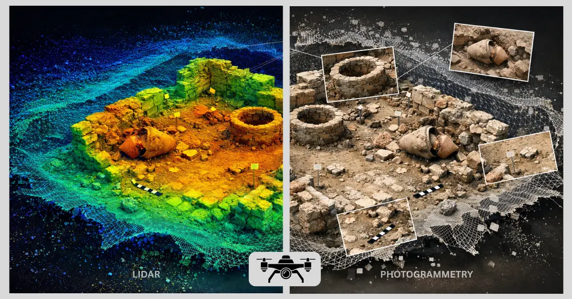
Data Processing and Terrain Modeling
In terrain mapping, after the flight has been made, the raw images are then subjected to a procedure known as image stitching.
The software matches thousands of individual photographs into a single giant and unified map. Digital elevation models (DEMs) and detailed topographic mapping may be created using this workflow.
These models provide a three-dimensional picture of the ground, giving engineers and project managers clear insight into terrain conditions overall. They help predict water flow patterns and determine accurate locations for infrastructure placement based on the real ground shape data.
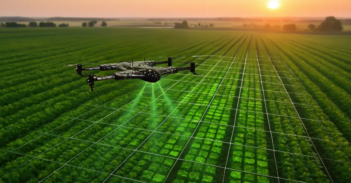
Vegetation Indices Explained
Vegetation indices are also one of the strongest outputs of multispectral mapping, including NDVI (Normalized Difference Vegetation Index), NDRE ( Normalized Difference Red Edge), and OSAVI Optimized Soil-Adjusted Vegetation Index. These indices are mathematical formulas that are used to compare the reflectance of various light bands to measure certain conditions.
NDVI: A standard of crop health monitoring, which has been applied to differentiate typical vegetation and thin or unhealthy plants.
NDRE: It is used in dense canopies where NDVI may become inaccurate.
OSAVI: This is applied in spaces where plants are spaced in between soil because it is used to filter the brightness of the soil to get a better reading.
These indices enable data-driven decision-making. For example, a land manager can refer to an NDVI map and see which areas have irrigation issues. They can address these areas even before the grass turns yellow. This accuracy saves time, money, and resources since it is possible to perform targeted maintenance.
Applications of Multispectral imaging in Terrain Mapping
Here are the main applications of multispectral imaging in mapping terrain:
Precision Agriculture
In the world of precision agriculture, multispectral imaging is a game-changer for maximizing yield while minimizing waste. By regularly scanning fields, farmers can move away from uniform application treatments and focus solely on areas requiring immediate attention.
This technology allows growers to perform a detailed crop health assessment that reveals the hidden biological status of every plant.
By utilizing vegetation indices (NDVI), teams can conduct deep irrigation and nutrient analysis to see exactly where the land is lacking irrigation. Instead of guessing, they get a data-driven look at soil moisture and nitrogen levels across the entire plot.
This precision is the ultimate tool for early stress and disease detection. Because multispectral sensors pick up on changes in leaf structure before they are visible to the human eye, they catch pest infestations or fungal outbreaks weeks in advance, ensuring a more profitable, sustainable farm.
Environmental Monitoring
In environmental monitoring, drones use remote sensing to provide a clear look at ecosystem health. By performing land cover analysis, agencies can classify terrain features and track how vegetation changes over time. This data is vital for vegetation and ecosystem analysis, helping experts protect biodiversity.
Furthermore, these maps assist in soil erosion and water management to prevent land degradation and enhance the management of natural resources in a sustainable manner that will soon be developed further in the future.
Land Surveying and Urban Planning
Multispectral drones capture vital information that is not captured by regular cameras, and this drastically increases the accuracy of the land surveying. Engineers use these insights during the terrain assessment. It is more helpful in construction projects because it determines the stability of the soil and the drainage pattern prior to construction.
This technology is one of the foundations of urban planning today, as it provides backup infrastructure and high-resolution data support. With the combination of infrastructure planning and multispectral insight, cities are capable of creating more innovative green spaces and more resilient utilities, ensuring that new developments are both sustainable and ideally suited to the existing landscape.
Benefits of Drone-Based Multispectral Terrain Mapping
The potential to use drone technology for accurate terrain analysis provides a significant advantage across multiple industries.
Drone technology is much faster than more traditional ground-based techniques, which are both time-consuming and labor-intensive, as the drone can cover hundreds of acres in a single flight.
This efficiency leads to cost-effective mapping by reducing the need for large field crews and expensive manual equipment while providing a much higher resolution of data. The main advantages of this strategy are:
Greater Precision
A high-resolution sensor can record centimeter-scale detail, and all land features are taken into consideration.
Quick Turnaround
It takes hours to complete projects that previously took weeks to be surveyed.
Increased Safety
Drones do not require people to fly in dangerous or inaccessible areas.
Scalability
Whether it is a small construction site or a massive agricultural plot, drones can adapt to projects of any size with ease. However, the real value lies in the quality of the output. In fact, these sensors provide evidence-based insights that go beyond traditional aerial photography. Additionally, they help detect hidden risks, such as underground drainage issues, before they become serious problems.
Therefore, decision-making improves significantly, as project managers can allocate resources more accurately.
Key Features to Consider in Multispectral Drones and Sensors
To achieve successful multispectral drone mapping, it is essential to select the right equipment. Currently, the market offers a wide range of options, including all-in-one drones (turnkey solutions) and modular sensors that can be swapped between different aircraft. As a result, these features ensure that data remains accurate, consistent, and repeatable.
Best Multispectral Drones and Sensors
When considering integrated solutions, small multispectral drones are highly effective for terrain mapping. This is because they offer high portability, long flight times, and a combination of RGB and multispectral sensors. In addition, they enable efficient data capture, seamless software integration, and stable performance during routine surveying and mapping operations.
Critical Selection Factors
Sensor Quality: A high resolution and a mechanical shutter are essential to avoid motion blur and to provide good data.
Flight Efficiency: Flight Time and Coverage: Efficiency is measured in acres per flight. An integrated drone like the Mavic 3M offers up to 43 minutes of flight time in one operation.
Accuracy of Positioning The accuracy of positioning requires centimeter-level accuracy through RTK or PKK modules to align the data without having to manually use ground control points.
Sunlight Calibration: Inbuilt sensors that are used to measure the solar irradiance are used to normalize data under varying light conditions to produce a set of consistent indices.
The choice of a drone is determined by the size of the project. Integrated units provide the most convenient collaboration of affordability and efficiency to use when it comes to regular monitoring. In contrast, modular systems offer a greater degree of specificity required to conduct high-end scientific analysis.
Why Drone as a Service is the Right Choice for Multispectral Mapping
Partnering with Drone as a Service allows organizations to access multispectral terrain mapping without costly training or significant in-house equipment investments. The direct access to professional drone services through outsourcing ensures an immediate opportunity to use drones in a variety of landscapes.
The specialized service provider will guarantee that projects enjoy:
Multispectral Technology
The fleet will be provided with enterprise drones with sensors of 2026 standards, which will be able to capture the invisible light bands and analyze them to obtain accurate vegetation and soil data.
Industry-Specific Solutions
Missions are designed to fulfill the requirements of agriculture, construction, or environmental science to meet specific compliance and reporting standards.
Consistent, Quality Data Delivery
Certified pilots and GIS analysts manage the entire process, from mission planning to image stitching, producing survey-grade maps ready for use. With the help of these drone mapping services, organizations change ordinary aerial photos to high-resolution images.
This professional approach guides land management decisions using high-quality data that reduces the risks involved and maximizes the utilization of the resources with the highest degree of confidence.
Case Examples & Real-World Results
The real-world application of multispectral technology has moved beyond research labs into large-scale industrial use. By examining a specific case study, organizations can see how these sensors translate into tangible project results.
Precision Agriculture Success
A 500-acre row-crop operation utilized multispectral sensors to identify a specific pest infestation. Instead of a uniform chemical application, the farmer treated only the 5-acre affected zone. As a result, this targeted approach led to an 80 percent decrease in the amount of chemicals used. Moreover, it prevented the crop from losing 25 percent of the harvest.
Vineyard Water Management
Multispectral terrain mapping was used in a vineyard in California to detect uneven irrigation that cannot be seen by the human eye. As a result, the vineyard maximized water efficiency by identifying thirsty vines in time. Consequently, this improved grape quality by 15 percent and significantly reduced utility costs.
Environmental Restoration
In a mining restoration project, drones provided high-resolution digital elevation models to monitor soil erosion. With this data, engineers were able to balance slopes more effectively. As a result, they prevented landslides, protected the local ecosystem, and minimized safety risks.

Conclusion
Multispectral imaging has transformed land management, moving beyond visual estimation to accurate terrain mapping for informed industry decisions. The cameras record invisible light bands, exposing sub-surface water pooling that traditional aerial photography cannot capture.
This potential must be harnessed with specialized expertise and high-end sensors. Drone as a Service (DaaS) provides professional flight operations to convert raw data into valuable intelligence for your project.
Contact Drone as a Service (DaaS) today to ensure your next mission is backed by survey-grade precision.