TL;DR
- Multispectral drone mapping uses advanced sensors (including infrared) to capture data beyond visible light, revealing hidden insights about land and vegetation.
- Unlike regular drone imaging, it uses indices like NDVI and NDRE to accurately measure plant health, stress, and nutrient levels.
- It delivers faster, safer, and more accurate data collection, helping detect problems early and reduce costs.
- Widely used in agriculture, construction, environmental monitoring, and inspections for data-driven decision-making.
- AI and cloud processing enhance analysis, turning complex drone data into actionable insights and predictive solutions.
Introduction
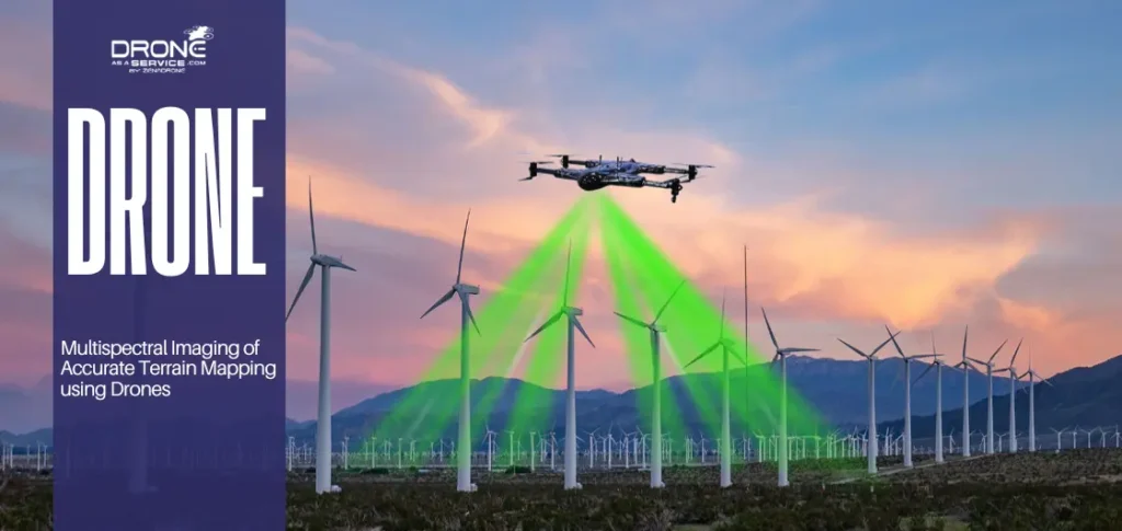
Multispectral drone mapping is a way to get detailed information from the sky by using drones with special cameras. These sensors, unlike regular cameras, pick up more than one type of light.
These drones use special cameras that see more than just regular colors; they pick up “invisible” details like infrared. They let people spot changes in plants or land that you’d never notice just by looking at them.
Businesses prefer this because it’s fast, safe, and accurate. You can scan huge fields in minutes and check out dangerous spots without putting anyone at risk. Plus, it helps you find minor problems early, before they turn into expensive disasters.
This article will go into detail about multispectral drone mapping and exactly why it is having such a significant impact in so many industries.
For professional-grade results, explore our multispectral drone services designed for agriculture, construction, and environmental projects.
We will also dive a little more in-depth about how these camera drones seem to “see” the world in a way the human eye can‘t. Finally, we’ll look at how data is already being used to solve problems both in nature and industry.
What Is Multispectral Drone Mapping?
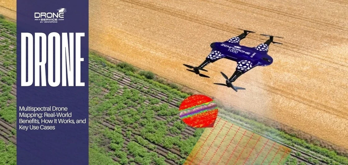
When you fly a UAV with multispectral cameras over an area, you can get information from different wavelengths of light. This process is called multispectral drone mapping.
Each wavelength provides unique information about surface conditions, plant health, moisture, and materials. Once you put all this data together, you get a map that reveals hidden patterns you’d never see in a normal photo.
It turns a simple drone flight into a powerful way to actually solve problems, rather than just taking pictures.
Difference from Regular Drone Imaging
1. Standard RGB Imaging
Standard drone cameras work just like our eyes, capturing only red, green, and blue light. While these images look good, they don’t tell the whole story. They are useful for basic visual inspections but lack the depth needed for technical analysis.
2. Multispectral Imaging Explained
Multispectral drones go beyond visible light by capturing wavelengths such as near-infrared. This allows them to detect details that are invisible to the human eye, making them far more powerful for analysis.
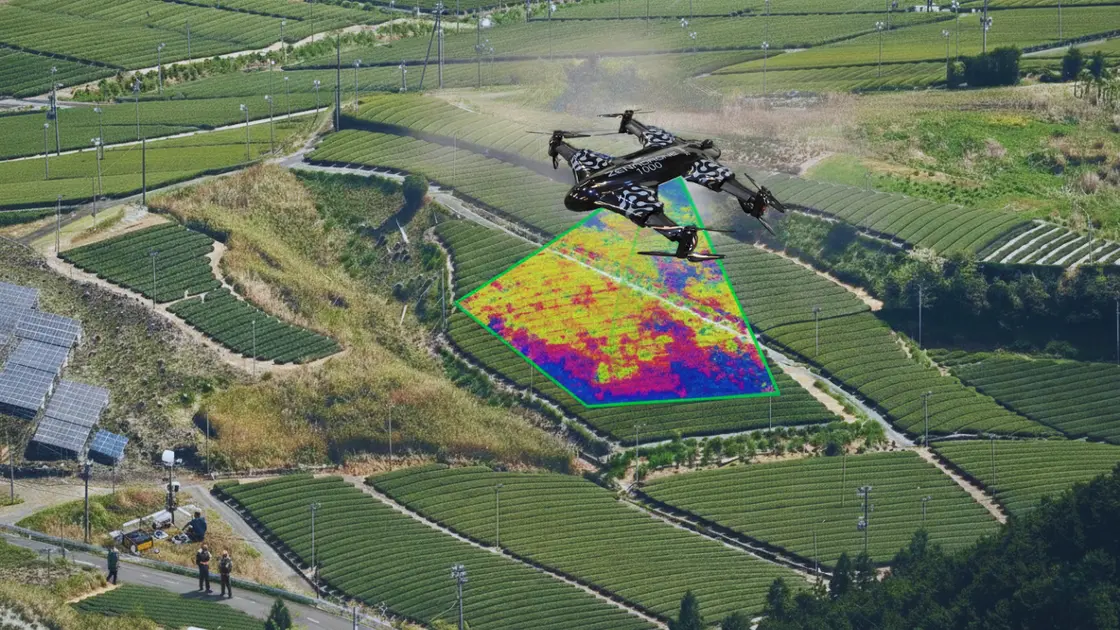
3. NDVI for Early Plant Health Detection
One of the most widely used metrics is NDVI (Normalized Difference Vegetation Index). It measures the difference between near-infrared light (reflected by healthy plants) and red light (absorbed during photosynthesis).
The result is a value between -1 and +1:
- Higher values = healthy, dense vegetation
- Lower values = stress, poor growth, or bare soil
Farmers and land managers use NDVI to:
- Measure plant health
- Detect water stress early
- Identify nutrient deficiencies
- Target specific problem areas
4. NDRE for Advanced Crop Analysis
When crops are fully mature, NDVI can lose accuracy due to saturation. This is where NDRE (Normalized Difference Red Edge Index) becomes useful.
NDRE focuses on the red-edge band, which is highly sensitive to chlorophyll content. This makes it ideal for:
- Measuring chlorophyll concentration
- Monitoring nitrogen levels
- Analyzing mid- to late-season crop health
- Detecting stress in dense vegetation
5. NDVI vs NDRE: Key Difference
NDVI provides a broad overview of plant health and density. In contrast, NDRE offers deeper insight into plant physiology, especially chlorophyll and nutrient levels.
Together, these indices turn drone imaging from simple photography into a powerful diagnostic tool, helping detect problems long before they become visible.
How UAVs Capture Data
To get accurate results, drone flights must be carefully planned. The drone needs to fly at a steady height and take photos that overlap, ensuring no spots are missed.
Before taking off, special “calibration panels” are used to adjust the camera for the current sunlight, so the data stays consistent even if the weather changes. Once the flight is over, the hundreds (or even thousands) of individual photos are stitched together to create a single, massive map called an “orthomosaic.”
It’s not just a big picture; it is a precise digital record that allows you to measure distances and compare changes in the land over weeks, months, or years.
To understand how these elevation models are created from raw drone data, read our detailed guide on drone terrain mapping basics.
Key Benefits
The most significant advantages of using multispectral drones are that they save time, keep people safe, and show you what’s happening below the surface. You can collect a massive amount of data much faster than a person on the ground could. It means you don’t have to send workers into dangerous or difficult areas as often.
More importantly, it takes the guesswork out of land management. It gives you a clear look at plant health and soil quality, spotting issues that you wouldn’t see just by walking the fields.
1. Speed
Using drones allows you to survey massive areas in just a few hours rather than several days. This speed is a lifesaver because it lets teams react immediately if crop health drops or if a site becomes risky. Because the data comes in so fast, it also prevents the long delays and downtime that usually slow businesses down.
2. Safety
Drones take the danger out of the job by doing the climbing and scouting on behalf of workers. Instead of sending people up shaky structures or onto unstable ground, they can send a drone.
It’s a much safer way to get the job done without losing any of the detail or accuracy you need for a professional inspection.
3. Accuracy
High-quality multispectral photos help you catch problems early. It’s like an early-warning system.
Using “health maps” (like NDVI) can help find things like plant stress or hidden moisture while there’s still time to fix them easily. Finding these issues early enables you to avoid expensive repairs and keeps minor problems from turning into total failures.
Primary Applications
The applications of multispectral UAVs (Unmanned Aerial Vehicles) are constantly growing as businesses understand the importance of data-driven decisions. Their uses in agriculture, construction, environmental monitoring, and assessments make decisions easier and more cost-effective.
1. Agriculture & Crop Health
Farmers use these drones to keep an eye on their crops all season long.
With plant health scores, they are able to precisely map out where their plants are experiencing problems (pests, disease, or nutritional deficiencies). They then only treat those areas instead of the entire field, saving their time and money.
For a complete guide on how vegetation indices help detect crop stress early, check out our article on crop health monitoring with NDVI.
2. Industrial & Site Analysis
By using multispectral drone surveys of their Industrial sites, managers can monitor the condition of their sites in relation to problems such as vegetation overrunning, erosion of soil, issues with drainage, and the site’s building status.
This information then aids them in adhering to health & safety regulations, planning repairs, and maintaining the land better.
3. Environmental Monitoring
Environmentalists use these drones to keep a close eye on everything from deep forests and hidden wetlands to winding rivers. By using sensors that see near-infrared light, they can track how the landscape changes with the weather.
4. Structural & Roof Inspection Enhancements
Using multispectral sensors drastically improves roof inspections through the identification of trapped moisture and small patches of weeds or moss. These are often early warning signs of leaks or insulation problems, showing up long before any visible damage appears inside the building.
Step-by-Step Workflow
Seeing exactly how a multispectral scan works helps you understand why the data is so reliable.
Doing so demonstrates the immense amount of thought and effort put into the planning stage, data acquisition, and data processing to produce reliable results on every occasion.
1. Pre-Flight
Mission planning defines the survey area, flight altitude, overlap, and timing. Weather conditions are checked to avoid inconsistent lighting or wind interference.
2. Calibration
Calibration ensures that the sensor readings reflect real surface conditions rather than lighting changes. Reflectance panels provide a reference point for accurate data.
3. Data Capture
As it flies over, the drone is flying in a grid pattern, y shoots backwards and forward at the same height, with each photo overlapping with the previous one. The overlapping of the images enables the stitching of the images to be made by the computer very simply.
4. Post-Processing
Once the flight is done, the software takes all those photos and stitches them into a massive, detailed map. It also calculates “health scores” like NDVI and NDRE.
This stage is when raw snapshots are turned into actual answers that you can use to make decisions.
5. Actionable Insights
This outcome enables you to determine what actions you will take in the real world (i.e., which areas require more water, planning repairs, identifying changes in nature, etc.). This part is when the real raw data finally comes together as an understandable action plan.
Equipment and Software
Getting results you can actually trust comes down to the gear you choose. When you find the right drone, the right camera, and the right software, everything clicks.
It turns what would be just a bunch of random photos into clear, high-quality maps that give you the real-world answers you need to grow your business.
1. Selecting the Right Multispectral Drone Sensors
Multispectral drone sensors vary by band configuration, resolution, and accuracy. Projects determine which bands are needed based on goals such as vegetation health or material inspection.
2. Choosing Enterprise UAV Platforms for Professional Surveys
Enterprise multispectral drones are strong workhorse drones built for enterprise applications.
Unlike consumer hobby drones, these professional-grade drones are actually made to do some work. They are capable of longer flights, have stabilized flight in harsh winds, and precision GPS systems that can identify locations to within an inch.
They’re not just for looks; they provide consistency and accuracy every time you fly.
3. Software Tools for Processing and Analyzing Multispectral Data
Pix4D and Agisoft are commonly used for photogrammetry and orthomosaic creation. QGIS supports GIS analysis and visualization, completing the UAV mapping workflow.

AI and Future Trends
Thanks to AI, today it can analyze hundreds of images super quickly and detect problems straight away. For example, it can spot plants that need watering or tiny cracks on a wall unnoticed by the naked eye.
Not only can it identify current problems, but it can also predict future problems; thus, prevention can be effected.
1. AI-Based Multispectral Analysis for Faster Insights
AI multispectral analysis is like having an expert assistant that never gets tired.
The AI automatically scans the data to spot patterns or things that look “off.” It takes the heavy lifting out of the work and turns mountains of data into a simple report in a fraction of the time.
2. Cloud-Based Processing for Better Collaboration
Cloud platforms allow teams to upload, process, and share data quickly. Stakeholders can access results without specialized software.
3. Predictive Analytics Using Historical Drone Data
Drone data predictive analytics uses past multispectral surveys to forecast future conditions. It lets you plan, so you can fix problems before they even exist.
Conclusion
Multispectral drone mapping is a real game-changer. Multispectral drone mapping provides a bird’s-eye view and a level of insight that is unachievable with conventional methods. These insights reveal hidden problems that are impossible to detect with the naked eye, improving efficiency, safety, and decision-making. This approach also helps businesses eliminate guesswork and reduce costs.
From NDVI drone mapping in agriculture to industrial multispectral UAV inspections and environmental monitoring, the value of this technology continues to grow.
If you’re ready to start using these drones but don’t want to deal with the technical headache, you can hire experts to do the heavy lifting for you. It means you get the detailed reports and clear answers you need without having to buy your own fleet or train your own pilots.
Companies like Drone as a Service (DaaS) handle everything from the actual flight to the data crunching. It’s the fastest way to turn high-tech data into better results for your business.
(FAQs)