


Summary
Irish construction, infrastructure, and surveying firms increasingly rely on specialist drone providers to enhance safety, improve data accuracy, and ensure regulatory compliance. Outsourcing operations reduces on-site risks, accelerates project timelines, and delivers consistent, decision-ready data for managers and engineers.
Introduction
Drone services Ireland providers are no longer offering niche tools; they now deliver structured, professional solutions that support complex, high-value projects.
Surveying, construction, infrastructure, and energy companies use the experienced operators to provide the precise aerial data in the real-life project.
The benefits of drone services become clear when flights are professionally planned, safely executed, and documented by certified operators who understand regulatory and industry standards.
Rather than relying on ad-hoc internal operations, outsourcing ensures predictable outputs, managed risk exposure, and reliable decision support.
Drones in professional services allow conducting safer inspections, collecting data much faster, and ensuring reliable documentation that facilitates planning, compliance, and project management.
This article explains why drones matter in Ireland, how they improve safety, accuracy, and cost control, and what decision-makers should consider when selecting a provider.
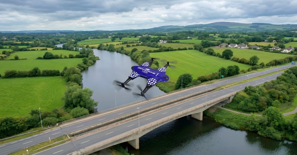
Why Drone Services Matter for Irish Projects
Ireland’s project environment presents unique challenges that make professional drone services particularly valuable:
- Urban density often requires inspections to be completed without disrupting traffic, pedestrians, or operational workflows.
- The coastal and offshore property is exposed to wind, salt, and weather, restricting safe access manually.
- Traditional surveying methods can be slow, costly, and logistically complex when dealing with remote or rural locations.
- Traditional inspection processes often need scaffolding, hoists, or closures that add to time and expenses.
- Through aerial surveying Ireland workflows, certified teams can safely capture data in areas that are otherwise difficult or hazardous to access.
- Because inspections must align with aviation and workplace safety laws, drone compliance Ireland standards are a non-negotiable requirement.
- Drones allow capturing data at a faster rate, cover an area again and again, and provide uniform visual data.
- There is clear aerial documentation to aid in planning, tracking progress, and assessing conditions.
Improved Site Safety and Risk Reduction
Best Practices Checklist for Maximizing Drone Service Value
Planning and Preparation
- Establish inspection goals, precision goals, and reporting deliverables upfront.
- Check location, access control, and surrounding airspace issues.
- Detects health and safety hazards and the necessary control measures.
- Deliver drone deliverables in line with project timelines and decision milestones.
Execution and Site Coordination
- Confirm operator licenses, insurance, and licensing.
- Plan the flight operations with site managers and safety officers.
- Verify weather conditions and contingency.
- Make sure that there are agreed flight paths and data capture standards.
Data Delivery and Use
- Check deliverable formats are appropriate to design, reporting, or asset management.
- Check the data reviews quickly in order to be complete and useful.
- Store outputs in a safe place where they can be referred to in the future and audited.
- Provide homogeneous data sets amongst project stakeholders.
Higher Accuracy and Reliable Data Outputs
Accuracy is not determined by equipment alone; it depends on structured flight planning, calibrated sensors, and controlled data capture techniques.
Drone teams of professionals draft guided flight plans and apply calibrated sensors to yield consistent and stable results.
Such control is required to make data appropriate in planning approvals, progress validation, and reporting of the status of assets at different phases of project execution.
UAV site monitoring allows teams to repeat surveys at defined intervals, making it easier to track progress, verify quantities, and document change over time.
Infrastructure drone mapping supports accurate measurements, volume calculations, and clear visual documentation across asset lifecycles.
Also, quality datasets will minimize controversies as they will give verifiable documentation that can be consulted by various stakeholders.
Properly gathered and processed, the drone data will serve as a reliable project resource and not a single visual representation that is utilized as a presentation tool.
Cost Efficiency and Time Savings
While there is an upfront service fee, engaging a professional drone services company often reduces overall project costs.
Traditional surveys may take several days and multiple personnel, whereas drone inspections are often completed within hours. Quick data gathering reduces the decision-making process and downtime on active sites.
The long-term savings come in terms of less rework, fewer access requirements, and improved information on planning.
In construction, infrastructure, and asset monitoring ventures, drones provide an easy ROI by reducing the labour requirement, enhancing the precision of the schedule, and ensuring a high standard of safety and quality of the data, which makes them a more affordable option compared to traditional solutions.
Regulatory Compliance in Ireland
The drone operations in Ireland are subject to the regulations of the Irish Aviation Authority (IAA) and EASA.
Certified operators handle all the permissions, risk assessment, and airspace requirements, and this brings about a safe and legal blend in the flight operations.
Compliant drone services require appropriate insurance, documented operating procedures, and certified pilots authorised under Irish regulations.
Following proper regulatory processes protects both the client and provider from legal risk, delays, and preventable safety incidents.
It is also guaranteed by the use of trained specialists to make sure that the inspections are done to the standards of workplace safety and environmental requirements.
Drone compliance in Ireland, therefore, is one of the primary aspects that should be considered when organizing aerial surveys or site inspections to ensure that all the flights are performed in accordance with regulatory frameworks and that the obtained data are legally admissible and can be used to report and make a decision.

Industry-Specific Use Cases
Drone services provide tailored advantages depending on the sector and operational requirements.
Drones are used in infrastructure teams to survey bridges, roads, railways, and utilities, which do not disrupt traffic and community services, and ensure the safety of assets.
Proper site documentation and visual reporting enable commercial property managers to efficiently plan maintenance, conduct lease audits, and accurately value properties.
The operations in the energy and utilities industry are also dependent on drones in the industrial drone inspection of wind farms, substations, and pipeline work in remote or dangerous areas, minimizing the exposure of workers to hazards.
In all industries, drones provide quicker access to locations, more secure methods of inspection, and regular and verifiable documentation.
These services enable beating the weather conditions, coastal environments, and complicated city centers or rural areas in the Irish context, wherein projects stay efficient, compliant, and data-driven.
Choosing a Professional Drone Services Company
Selecting the right provider requires more than comparing equipment lists. Find experience, certification, and sector knowledge teams.
Professional service providers that provide drone services must have a well-defined workflow, adhere to regulatory requirements, and have pertinent experience working on the project.
Expert operators know construction schedules, infrastructure coordination and are able to provide usable and decision-ready data.
When evaluating providers, reviewing examples of professional drone services can help organisations understand what compliant, industry-focused delivery should look like in practice.
In order to make sure that the checklist can be reliable and valuable, take into account the following:
- Check certifications of operators and coverage of insurance.
- Assess prior experience in your field of conducting projects.
- Compliance with the health and safety regulations and the Irish Aviation Authority on checks.
- Assess the quality of reporting and form of data.
- Determine the reliability of products and response times.
- Make sure that there is proper communication and coordination of projects.
Common Mistakes Businesses Make
Many organisations encounter setbacks due to common mistakes when hiring drone services, particularly when due diligence is rushed or incomplete. Key pitfalls include:
- Selecting providers only on the basis of price can endanger quality and safety.
- The choice of operators that are not certified, insured, or authorised by regulations.
- Taking ambiguous deliverables that restrict the usefulness of the data collected.
- Neglect of the requirements of drone compliance in Ireland endangers time loss or unauthorized inspections.
- Lack of validation of the pilot experience or industry experience.
- Ignoring turnaround times and reporting criteria leads to coordination problems in the project.
Essential Questions to Ask Before Hiring a Drone Services Provider
Decision-makers should have a clear set of questions to ask before hiring to ensure providers are reliable, safe, and fully compliant with Irish regulations.
Addressing these questions early helps organisations minimise operational risks and select a partner capable of delivering accurate, decision-ready data.
Key considerations should include certifications, prior sector experience, reporting standards, turnaround times, and site safety coordination.
- Are the pilots accredited and insured to carry out business in Ireland?
- Is the provider in possession of all Irish Aviation Authority and EASA authorisations?
- What is their construction, infrastructure, or surveying project experience that is specific to the sector?
- Are they able to offer sample deliverables or precedent projects?
- Which data formats, data reporting standards, and software are compatible?
- How long will it take to deliver and report the data?
- What are their site safety coordination and compliance requirements management?
Best Practices for Maximizing Drone Service Value
The use of drone services must be properly planned and communicated to realize the greatest value. Best practices can be applied in teams, which makes them efficient, safe, and reliable in their results.
Organisations may consider structured Drone as a Service models to access verified operators, technical guidance, and scalable support.
The best practices to be observed in teams should include:
Planning and Preparation
- Specify the objective of the drone survey or inspection, which outputs, and which accuracy levels are required.
- Predefine reporting formats, file type, and standards of deliverables.
- Finalize project dates, milestones, and the revision procedure.
Site Coordination and Execution
- Check access, safety measures, and necessary permits or airspace clearances.
- Take weather conditions into account and make flights during appropriate times.
- Align the actions of the site managers, contractors, and safety officers.
Data Management and Post-Processing
- Make data captured to seamlessly integrate into the existing project systems.
- Check deliverables and make them ready to use.
- Actually distribute shared datasets to the stakeholders to facilitate planning, reporting, and compliance.
Limitations and Practical Considerations
Although advanced drone solutions offer clear advantages, they are not suitable for every environment or operational scenario.
The weather may limit flight operations, such as high wind, heavy rain, or poor visibility, which may compromise data quality.
Restrictions on the airspace of the airports or surrounding sensitive facilities must be permitted and thoroughly planned. Urban density and access to the site: The changes in site access may require extra approvals, coordination, or mitigation measures.
Drones do not eliminate but supplement the old inspection and surveying techniques with faster and safer data collection, where available.
These limitations should be known because they contribute to the creation of realistic expectations and the adequate utilization of drones.
Senior practitioners share the operational limits, propose alternative solutions when necessary, and combine the outputs of drones with other inspection tools to provide safe, precise, and legally acceptable outcomes in the construction, infrastructure, and surveying projects in Ireland.
FAQs
Bottom Line: Driving Safer, Smarter Irish Projects Through Professional Drone Services
Hiring an experienced drone services company provides measurable safety, accuracy, and compliance benefits for Irish projects.
The benefits of drone services across construction, infrastructure, and surveying include reduced risk exposure, more accurate data, and stronger operational efficiency.
The engagement of qualified providers helps to make sure that inspections are conducted under the regulations, provide practical insights, and make well-informed decisions.
Organisations that need steady and quality outcomes must enlist the services of experts who are familiar with the Irish project environment, problems with the site, and industry-related needs so that all aerial surveys or inspections can contribute a measurable value to the functioning of the organisations.
To understand how professional drone services can strengthen your projects, engage with certified operators who align with Irish regulatory and sector-specific requirements.
Transform Your Irish Projects with Certified Drone Experts
Get compliant, high-accuracy aerial data to reduce risk, speed up inspections, and make confident decisions.
Schedule Your Consultation Today
Benefits of Hiring a Drone Services Company in Ireland
Benefits of Hiring a Drone Services Company in Ireland Benefits of Hiring a Drone Services – Ireland Summary Irish construction,...

How to Check Weather Forecast Before Flying a Drone
How to Check Weather Forecast Before Flying a Drone Weather is not just a background condition for drone flying; it...

Drone Surface Emissions Monitoring (DSEM): Ultimate Guide
Drone Surface Emissions Monitoring (DSEM): Ultimate Guide Drone Surface Emissions Monitoring (DSEM) is changing how we protect the environment. It...

Geocaching Drones: How They Work and Revolutionize Modern Treasure Hunting
Geocaching Drones: How They Work and Revolutionize Modern Treasure Hunting What is Geocaching? Geocaching is considered a modern treasure hunt....

How Drone Services Increased ROI For Irish Companies
How Drone Services Increased ROI For Irish Companies Drone Services ROI – Ireland TL;DR This guide shows how Irish businesses...
Photogrammetry in Archaeology: Methods, Use Cases & Limitations
Photogrammetry in Archaeology: Methods, Use Cases & Limitation TL;DR Photogrammetry is a passive technique of remote sensing that uses redundancy...