Drone Surveillance Explained: A Complete Guide to Civilian Drone Monitoring Systems
TL;DR
- Drone surveillance is about using unmanned aerial vehicles. While drones may have various applications, this particular type of drone usage focuses on observation and monitoring. It moves us away from the traditional or manual walkthroughs or static cameras to a more cost-effective and efficient way of getting information.
What is Drone Surveillance?
Drone surveillance refers to using drones for a number of civilian applications, like infrastructure monitoring, public safety, and environmental observation. They are equipped with cameras and sensors, helping people watch over certain areas, activities, and/or conditions in real-time or over a period of time.
These drones are usually used to improve safety and provide timely information. When they go looking around their surroundings, these drones help identify issues before they become bigger problems. They help in getting faster responses, efficient management, and better planning for communities and organizations.
Drone Surveillance vs Regular Drones
There’s this belief that any drone with a camera is a surveillance drone, but actually, there’s a difference. It is important to understand that the distinction lies not just in its hardware but in the intent behind its use.
Regular drones, often called consumer or camera drones, are, in general, designed for creative expression and recreational enjoyment. You can use these drones to capture a beautiful sunset, film a family vacation, or simply enjoy the thrill of flying a drone. The end result for this is usually either a photo or a video that’s often shared socially or artistically. So basically, their primary job is to create art or provide entertainment.
In contrast, surveillance drones are purpose-driven tools designed for data collection. When a drone is used for surveillance, it stops being a toy and becomes a tool for operational oversight. It can be used to scan a perimeter, inspect a hazardous site, environment, or ensure safety. The end result: actionable data, offering live feeds, heat maps, or structural analysis, which are used to make a decision.
Basically, the contrast between the two isn’t about the camera; it’s the purpose. A drone becomes a surveillance tool not because of what it can record, but because of how and why the data it captures is used.
How does Drone Surveillance Work?
Many view surveillance drones as just flying a camera overhead, but it is much more than that. It is an organized, systematic step-by-step process designed to turn aerial views into data.
Planning the Monitoring Task
This is the first step in which the operator defines the mission goals and selects the specific sensor that’s going to be used in the drones.
Defining the Area and Flight Path
Next, the pilot or operator points out the correct boundaries, the altitude, and the route to make sure that the drone can cover the target zone efficiently.
Flying the Drone
The third step is where the drone launches and follows a pre-set route autonomously. It will have to adjust its speed and position and maintain stability throughout its flight.
Observing and Recording Data
Fourth is where the drones’ onboard cameras capture high-resolution images or videos, detecting any issues and/or problems around the area.
Transmitting or Storing Data
In here, the live video feeds are transmitted instantly to command centers and is stored for later processing
Reviewing and Analysing Information
Lastly, there is specialized software that processes the footage. Creating a detailed map or identifying threats that may have been missed by manual observation.
This shows that drone surveillance is a structured workflow of data collection and analysis, not just the act of flying a drone.
Autonomous vs Manual Drone Surveillance
Automation in drones is not magic; it is simply the result of an advanced drone surveillance system. It’s important to note that “autonomous” simply means pre-planned, while “manned” refers to human-controlled. Both are valid methods of using drones, but they do have distinct mechanics and uses. Take a look at the table below.
Type | Definition | Key Difference | Best Use |
|
|
| |
|
|
|
Neither autonomous nor manned surveillance is better than the other. They obviously serve different functions in very different situations.
Core Components of a Drone Surveillance System
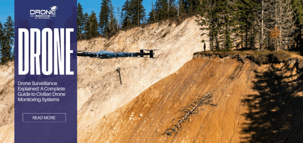
To trust a drone surveillance system, one must know that this is not just a flying camera, but a compound of multiple technologies working together to achieve a seamless transition from raw data to actionable insights.
Surveillance Drone Platform
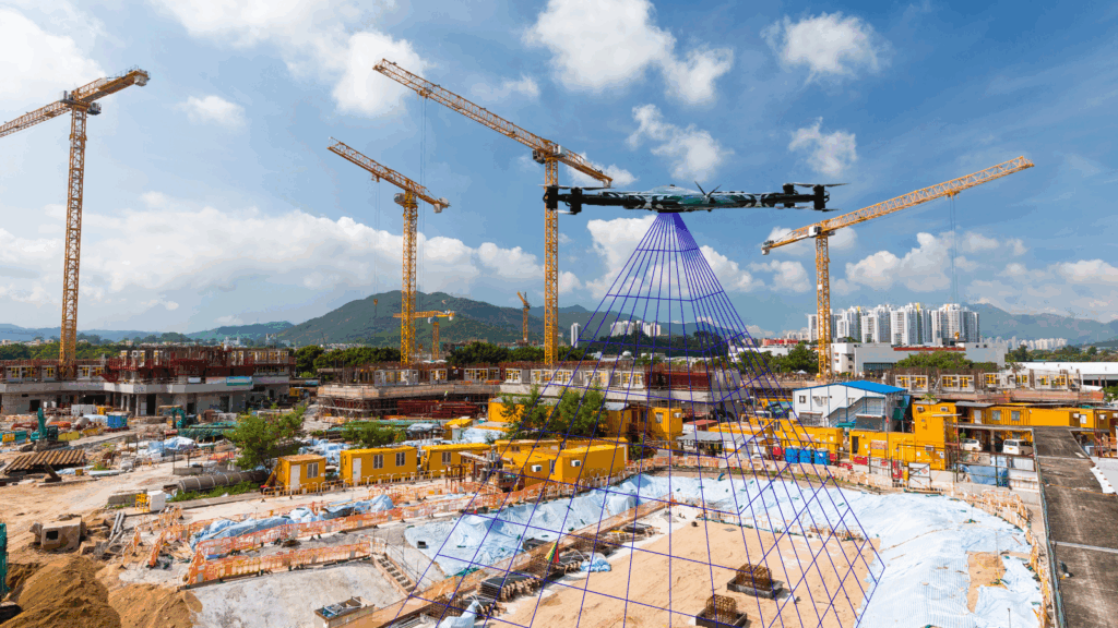
A surveillance drone platform provides advanced, autonomous, and real-time monitoring using high-resolution cameras, thermal imaging, and AI analytics. For effective monitoring, a drone must have:
Endurance
Your drone must have the capacity to fly for extended periods. Allowing it to cover a lot of ground and maintain a consistent view of the area without interruptions
Stability
Drones must be able to hold out against environmental factors. Stability is essential as it allows the drone to automatically maintain a vertical position to ensure stable and usable footage.
Coverage
The drone surveillance system must be capable of reaching the different vantage points in an area. This includes the ability to go over terrain or access hard-to-reach areas.
Endurance, stability, and coverage form the foundation of a drone surveillance platform. Without them, even advanced drones cannot deliver.
Camera and Sensors Used in Drone Surveillance
It’s important to note that different missions require different eyes to capture the right data. Here are some of the different cameras and sensors used in drone surveillance:
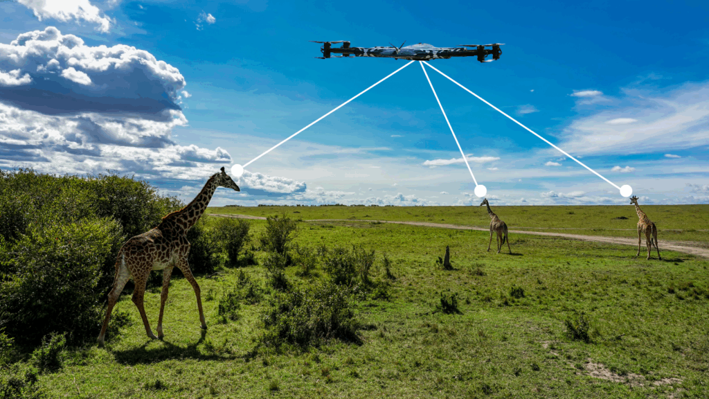
Optical Cameras (Visual Monitoring):Optical cameras capture high-resolution images. So basically, what we see is what it captures, providing immediate situational awareness and detailed inspection data.
Thermal Sensors (Heat-based Observation):These sensors detect heat signatures instead of light. They are used to investigate temperature changes that are invisible to an ordinary camera.
Multispectral Sensors (Environmental Data):These types of sensors capture footage that spans specific light bands. They see beyond the visible spectrum to analyze, providing data on environmental conditions.
LiDAR (Mapping and Inspection – Civilian Only):LiDAR uses laser pulses to measure distance. It creates 3D structures and landscapes. Providing information and details of the terrain for planning purposes.
By knowing which cameras and/or sensors to use, a single drone can be anywhere from visual security patrols to complex structural analysis.
Navigation, Control, and Safety Systems
Safety and precision are the pillars of any civilian surveillance operation, making flights controlled and predictable.
GPS Navigation: GPS can allow the drone to know where it is in real-time. Advanced workflow, such as PKK (Post-Processing Kinematic), refines this data to a micro-level accuracy, ensuring that the drone knows its path and tags data correctly.
Obstacle Avoidance: Drones use a combination of eyes and ears in the form of ultrasonic sensors, stereo cameras, and LiDAR, detecting physical obstructions. After, the drone then uses either Reactive Avoidance or SLAM, allowing itself to navigate in tight spaces.
Return-to-Home (RTH) Features
This feature is like an automated safety net. It is designed to trigger automatically in three specific scenarios:
- Low Battery RTH: this is when power levels drop
- Failsafe RTH: This situation occurs when the connection between the controller and the drone is lost
- Smart RTH: This is where the pilot manually activates the feature
Upon activation, the drone flies up to a safe altitude above trees or buildings, then flies directly back to the launch point
These features make sure that using drones for surveillance is never a guessing game. By having these features, operators can conduct missions with confidence.
Communication and Data Transmission
Drone surveillance also depends on communication and data transmission. But we need to differentiate between live feeds and recorded data to help us manage expectations about them.
- Communication
Drones use high-bandwidth transmission to stream videos directly to a command center. This live link enables operators to react almost instantly to unpredictable events and situations. - Data Transmission
Not all drone surveillance is live; the real work starts after the drone lands. The drone stores all data on board, which is later processed by specialized software to create detailed models and reports.
The method of transmission defines the mission’s speed and depth. Understanding the difference ensures users know when to expect a live video feed and when to wait for a processed, high-precision report.
Civilian Applications of Drone Surveillance
Drones are not limited to passive observation. They measure, inspect, and analyze environments to improve operational efficiency and safety. Below are key civilian applications of drone surveillance technology.
Infrastructure and Asset Monitoring
Drones are widely deployed to inspect transportation networks and industrial infrastructure that would otherwise pose safety risks to human inspectors. In the railway industry, for example, drones equipped with specialized inspection software monitor tracks to detect structural damage or wear. By identifying issues remotely, engineers can plan targeted maintenance without prolonged service disruptions.
Agriculture and Land Monitoring
In agriculture, drones provide farmers with a comprehensive aerial view of their fields, enabling data-driven decision-making that reduces waste and improves crop yield. Equipped with multispectral sensors, drones collect detailed crop health data. This allows farmers to apply fertilizers or pesticides precisely where needed, rather than treating entire fields uniformly.
Traffic Monitoring and Smart Cities
As urban environments expand, drones are becoming integral to modern city operations. In smart cities, autonomous drones support logistics and traffic supervision, helping manage congestion and improve transportation efficiency. Beyond traffic management, drones assist with infrastructure inspections and generate data that supports long-term urban planning initiatives.
Environmental and Wildlife Monitoring
Environmental researchers use drone technology to access remote or hazardous areas without disrupting ecosystems. Drones patrol vast regions to monitor wildlife populations, track habitat changes, and detect illegal activities such as logging or poaching. This approach enables safer data collection while providing researchers with real-time insights to support conservation efforts.
Benefits of Drone Surveillance
The adoption of drone surveillance is driven by distinct operational advantages that traditional methods cannot match. Below are some of the benefits:
Covers Large Areas
Surveillance drones are able to close the gap between satellite-scale and ground-level details, allowing operators to survey hundreds of areas and terrains.
Faster Observation
Drones can be deployed on demand, capturing high-resolution data quickly. Providing actionable insights within hours compared to traditional surveys.
Reduce Human Risks
By performing inspections and surveys remotely, drones help in reducing the need for humans to go into dangerous and hazardous environments.
Cost efficiency
Because drones require fewer logistics and less fuel, it makes repeating data collection financially possible.
Better Situational Awareness
Since drones are used in aerial data collection, they eliminate the blind spots that ground-based surveys may encounter.
Practically, with these benefits, drones are no longer just an alternative. Their ability to deliver faster, safer, and more cost-effective data has made them a great solution for modern issues.
Limitations and Challenges of Drone Surveillance
Drones are not all perfect and 100% accurate. We must understand the limits of this technology. Knowing the limits and challenges, it manages our expectations of what these drones can actually do.
Battery Limitations
Since drones have a heavy processing load, they can drain batteries really quickly. This then turns into limited flight times and frequent replacement of batteries.
Weather Dependency
Despite measures, drones, when faced with harsh environmental occurrences, can destabilize flight and blind sensors. This forces operators to stop operations and delay results.
Data Interpretation Limits
Drones collect the data but cannot interpret it. This requires special software or an expert to analyse to interpret this data.
Airspace Restrictions
Not all airspace is legal for drone flight. There are strict regulations in place that often require complex waivers and safety demonstrations for legal operation.
Drones are powerful tools, but they are not magic. Success requires navigating through these challenges and limitations to ensure safe, legal, and effective operations.
Privacy, Ethics, and Responsible Drone Surveillance
Clearly, there is a distinction between surveillance and invasion, but how do we avoid the latter? By adhering to the ethical guidelines and federal regulations.
Difference between Public and Private Spaces
Ethical operators should be able to distinguish between the right to fly and the right to pry. This makes the collected data focused on the target infrastructure rather than flying over private property.
Data Minimization
Following the principle of “need-to-know”, operators should set sensors to capture only what they need. This prevents inadvertent recording and data liability
Transparency
Trust is built through communication. By planning flight paths with stakeholders and defining the purpose, this reassures that public operations are professional.
Drone Surveillance is not Spying
Commercial surveillance is a transparent activity. It gathers safety metrics, not secrets; fundamentally, it’s different from spying.
Responsible drone use is not just about following laws; it’s also about earning the public’s trust by proving that safety and privacy can coexist.
Legal and Regulatory Considerations for Drone Surveillance
To operate professionally, one must navigate the rulebook of the skies, or basically the rules and regulations we must follow, so that operations are safe, legal, and insurable.
High-level aviation rules across the globe share similar requirements, such as maintaining visual line-of-sight (VLOS), staying below altitudes of 400 feet, and strictly avoiding restricted zones, like airports or government facilities. These regulations are essential frameworks designed to protect airspace safety, national security, and individual privacy from the risks of unregulated flights.
Ultimately, compliance is the hallmark of a professional program since it validates insurance, minimizes liability, and builds public trust necessary for the industry to grow rather than facing fines or confiscation.
Future of Drone Surveillance Technology
The future of drone surveillance technology is moving fast. It’s the time for automated, intelligent systems that function as permanent fixtures of the industrial landscape.
This evolution is defined by two distinct advancements:
Smarter Monitoring
Future drones will operate via automation 24/7, utilizing AI to execute flights and process data with no human intervention.
Integration with Infrastructure
Drones are evolving into permanent on-site fixtures for continuous, uninterrupted monitoring.
As these developments are becoming one of our everyday lives, we must have a stronghold on responsible development. We must prioritise end-to-end encryption and secure configuration, creating a self-sustaining ecosystem that protects the data it collects.
Drone Surveillance vs Traditional Monitoring System
Drone technology does not replace existing systems it’s as if it acts as another layer added onto that system. Drones just fill in the gaps where traditional monitoring systems can’t. Take a look at the table below.
CCTV Cameras | Ground Patrols | Satellites | |
|---|---|---|---|
Limitations |
|
|
|
Drone Surveillance Advantage |
|
|
|
FAQS
What is the difference between a hobby drone and a surveillance drone?
It’s all about the intent. One is for fun and art, while the other is a specialised tool designed for collecting data and ensuring safety.
Do drones replace security guards or CCTV Cameras?
No, they actually work together. Drones act as “layers” that CCTV cameras and security guards may not be able to do or have.
What happens if the drone loses signal mid-flight?
It has a return-to-home feature. This safety net automatically activates when situations for drones are going badly.
Can surveillance drones fly in bad weather?
Unfortunately, no. Strong winds and heavy rain may affect the drone’s system, which may cause damage to the drone if forced.
Do I need a human pilot for every mission?
Not always. There are now autonomous drones with AI to fly pre-planned routes on their own
Conclusion
Drone surveillance has moved well beyond its “sci-fi” reputation to become a quiet workhorse for modern safety. We aren’t just putting cameras in the sky anymore; we are gathering the kind of hard data that actually helps us make better decisions. Whether it’s inspecting a rusting bridge or tracking wildlife, we can finally tackle these dangerous jobs without putting a single person at risk. That is what we call advanced technology. It isn’t here to replace the tools we already use, but to give them a serious upgrade, offering a perspective that we simply can’t get from the ground.
Read Our Other Blogs
23 February 2026
The Role of Software in Smarter Drone Power Distribution
The Role of Software in Smarter Drone Power Distribution With the constant development of technology, drones are now classified as...
23 February 2026
Industrial Drone Services for Harsh and Challenging Conditions
Industrial Drone Services for Harsh and Challenging Conditions Industrial drone services deliver a revolutionary solution which enables organizations to handle...
20 February 2026
Thermal Drones: What They’re Used For, How They Work, and When They’re Needed
Thermal Drones: What They’re Used For, How They Work, and When They’re Needed TL;DR Thermal drones are uncrewed or unmanned...
19 February 2026
Drone Surveillance Explained: A Complete Guide to Civilian Drone Monitoring Systems
Drone Surveillance Explained: A Complete Guide to Civilian Drone Monitoring Systems TL;DR Drone surveillance is about using unmanned aerial vehicles....
18 February 2026
Commercial vs Industrial Drone Services in Ireland – Key Differences
Commercial vs Industrial Drone Services in Ireland – Key Differences Executive Summary / TL;DR “Commercial vs industrial drone services serve...
18 February 2026
How Aerial Data Supports Mining, Quarry, and Aggregate Operations
How Aerial Data Supports Mining, Quarry, and Aggregate Operations TL;DR Aerial drone data provides fast, high-accuracy, full-site visibility compared to...


