TL;DR
- Multispectral drones capture data beyond visible light, revealing insights invisible to standard cameras.
- Construction teams use them for progress tracking, cut/fill calculations, and site safety monitoring.
- Mining operations rely on multispectral surveys for volumetric analysis, stockpile management, and environmental compliance.
- Environmental consultants apply multispectral imaging for wetland mapping, erosion monitoring, and vegetation health assessment.
- Infrastructure managers deploy drones with multispectral cameras for corridor monitoring, drainage analysis, and asset management.
Introduction
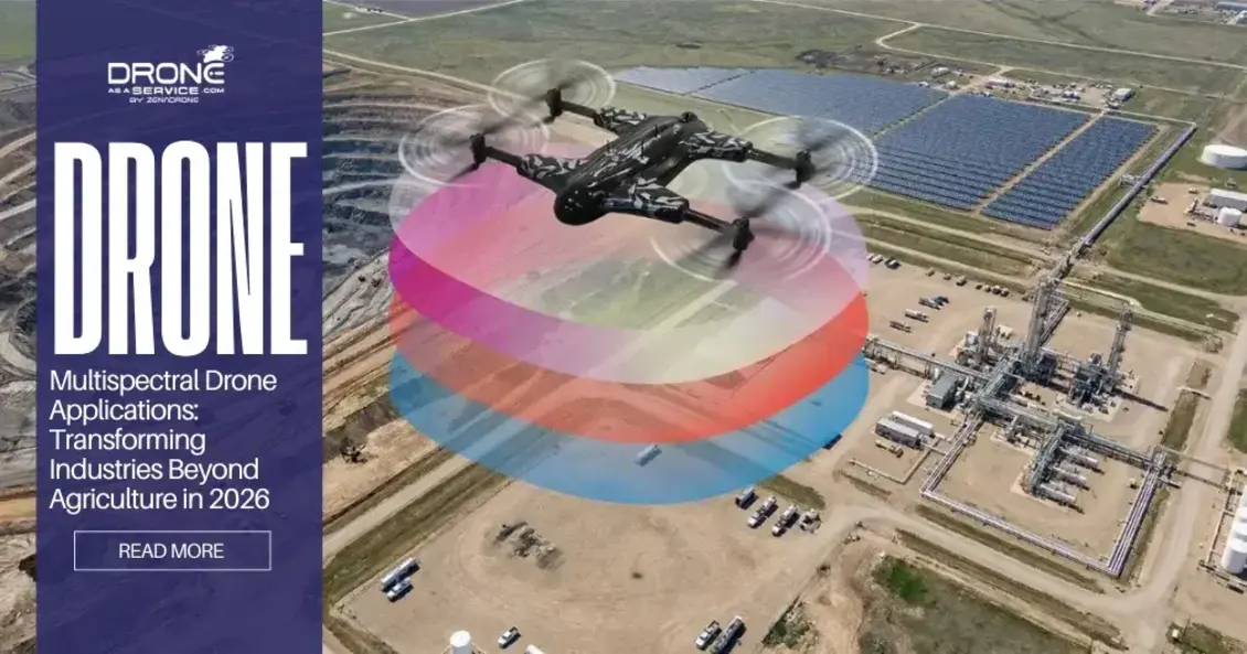
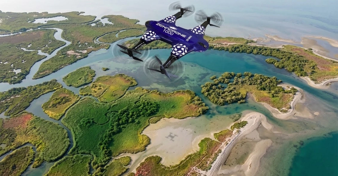
When most people hear “multispectral drone,” they immediately think of farming and crop health monitoring. However, this technology is transforming far more than just the agricultural sector in our modern industrial landscape.
The utilization of specialized aerial sensors is completely changing the construction progress monitoring and mining volumetric analysis. These tools help in environmental impact assessment and infrastructure inspection to record high-resolution data in different spectral bands.
Traditional methods like ground surveys, visual inspections, or manned aircraft are often slow and miss critical data points. These legacy processes can be expensive and frequently fail to identify subsurface issues before they become costly problems.
Multispectral drone services deliver rapid, accurate, and comprehensive data across multiple industrial sectors with high-resolution sensors. These advanced tools capture unique spectral signatures to reveal hidden site conditions that standard cameras simply cannot detect.
A drone with multispectral camera payloads allows for a deep dive into site-specific data for informed decision-making. This article covers five key industries using multispectral imaging drone technology to achieve superior project outcomes today.
We will explore how drone mapping services enhance construction, mining, and environmental assessments through precise drone multispectral services.
Why Multispectral Matters Beyond the Farm
Multispectral drone services are now essential for identifying structural or environmental risks before they escalate into major project failures. Drone mapping services can be used to engage in time-series analysis to monitor the variation in moisture or material stability over time.
Standard RGB cameras can only capture what the human eyes can see, specifically red, green, and blue light waves. A multispectral imaging drone captures additional bands like Near-Infrared (NIR) and Red Edge to reveal hidden data layers.
This technology reveals the health of vegetation, soil moisture, and mineral composition, which is invisible in standard high-resolution cameras. These sensors detect minor stress tendencies in material and environment, giving a higher degree of intelligence to the site managers.
These special data layers generate massive 3D models that have profound spatial intelligence when used together with drone terrain mapping. Applying a drone with multispectral camera technology enables the development of an orthomosaic with multi-layered spectral data.
Combining these different layers into one digital twin creates a comprehensive view of the complex industrial project sites. To understand how these 3D models are created, read our guide on understanding drone terrain mapping basics.
This guide reflects current industry applications of multispectral drone technology across construction, mining, environmental, infrastructure, and urban planning sectors based on 2026 best practices.
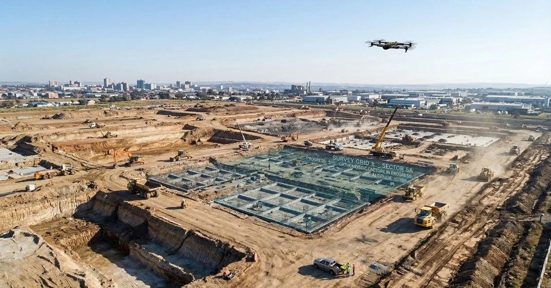
Application #1: Construction and Civil Engineering
Site Preparation and Cut/Fill Analysis
Managers use a site survey drone to create a precise DSM (Digital Surface Model) that assists during preliminary phases of site planning. This data can be used to perform an accurate cut/fill analysis and also makes georeferencing consistent throughout the entire project lifecycle.
Multispectral data shows hidden soil moisture patterns that greatly impact the excavation timetable and stability of the heavy machinery onsite. With a multispectral imaging drone, teams can estimate cut/fill volumes with an impressive level of accuracy of 2-5cm.
Progress Monitoring and Compliance
Weekly or monthly flights monitor the construction against the initial plans to keep the project on schedule and within the budget. High-resolution orthomosaic maps generate detailed visual progress reports that assist the stakeholders in visualizing the present state of development.
The multispectral bands capture the initial signs of vegetation encroachment or erosion monitoring challenges that cannot be captured by standard cameras during surveys. When these thermal anomalies are detected, they may also show stress on the equipment or drainage systems below the ground before they cause a structural failure.
Post-Construction Vegetation Management
Vegetation management near active sites is improved by using an RGB overlay to visualize potential environmental encroachment issues early. Consistent time-series analysis helps teams track structural changes and maintain regulatory compliance with local building and safety codes.
Time-series analysis as a method of comparing seasonal data will guarantee long-term adherence to all the landscaping requirements and the municipal green space regulations. Professional drone multispectral mapping furnish the recorded evidence to seal the environmental bonds and construction permits.
This guide reflects current industry applications of multispectral drone technology across construction, mining, environmental, infrastructure, and urban planning sectors based on 2026 best practices.
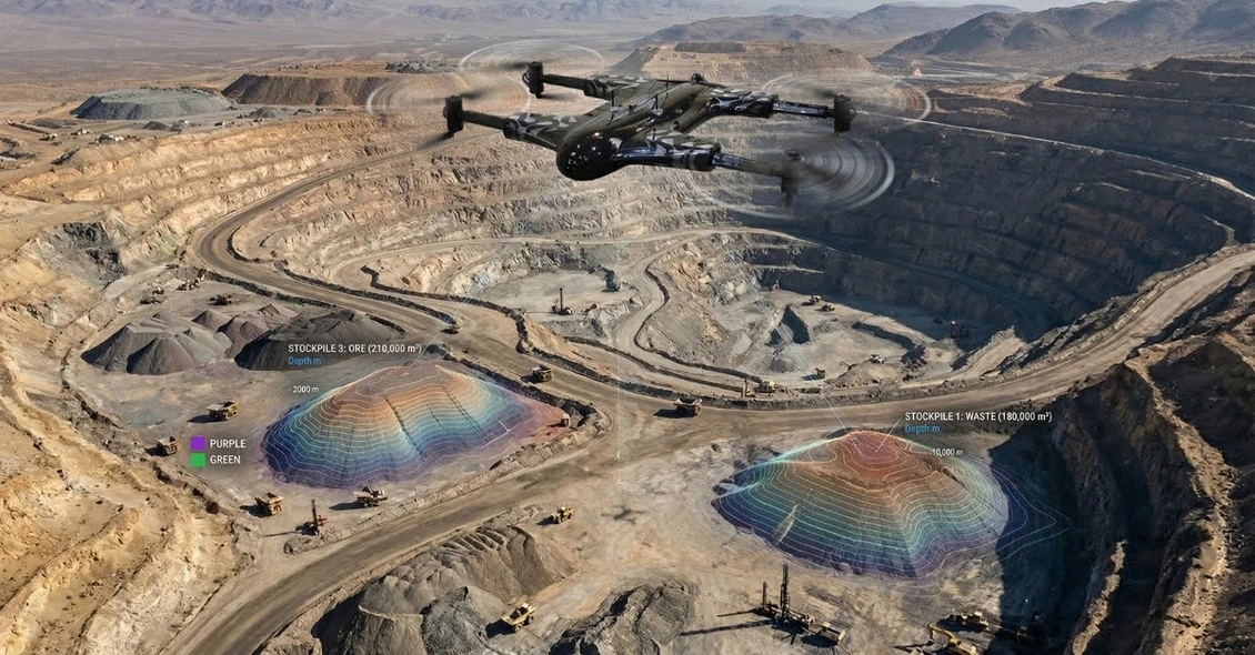
Application #2: Mining and Aggregates
Volumetric Analysis and Stockpile Management
Thousands of tons of material are moved each month in mining operations, and counting inventories manually is extremely slow and inaccurate. Multispectral sensor drone mapping services determine the stockpile measurement volumes with an established error margin of less than 2%.
Stockpile measurement becomes significantly faster when using volumetric calculations derived from high-density point cloud data collected during flights. Engineers monitor slope stability and identify thermal anomalies in coal piles to prevent hazardous conditions for all ground personnel.
With regular flights that monitor inventory and do not disrupt the ground crew, production does not pause to conduct a normal site survey. Multispectral data is used to differentiate different material types by their unique spectral signature to better manage their resources.
“A gold mine in Nevada reported that drone aerial surveys shortened their end-of-month stockpile inventory process from 3 days to 4 hours, freeing up their survey team for other critical tasks.” – (2026 Mining Efficiency Report)
Mine Planning and Pit Optimization
A detailed DTM (Digital Terrain Model) is used to optimize pit design, and RTK/PPK technology removes the use of manual GCPs. Having a different spectral signature of various minerals enables automated land classification and a more efficient planning of resource extraction.
Engineers monitor slope stability and wall conditions remotely to identify potential failure points before they become life-threatening hazards. This technology reduces safety risks by keeping survey personnel far away from active faces and heavy machinery movement zones.
Environmental Compliance and Reclamation
Modern mines must monitor their environmental impact constantly and plan for land closure long before the resources are exhausted. Multispectral drone services track vegetation recovery on reclaimed land using NDVI time-series analysis to ensure healthy growth.
These sensors are used to check the sediment pond and drainage patterns to avoid the entry of contaminated runoff into the nearby protected water systems. Georeferenced data enables mines to record regulatory compliance to government agencies with timed and high-resolution evidence of their work.
This guide reflects current industry applications of multispectral drone technology across construction, mining, environmental, infrastructure, and urban planning sectors based on 2026 best practices.
Application #3: Environmental Monitoring and Conservation
Wetland Mapping and Assessment
Wetlands are highly regulated ecosystems in which constant and extensive monitoring is necessary to guarantee their continuous well-being. A multispectral imaging drone records water bodies, types of vegetation, and data on hydrology, to formulate a comprehensive site map.
Wetland mapping projects benefit from vegetation indices that highlight plant health and moisture levels in sensitive, protected ecological zones. Erosion monitoring along shorelines is enhanced by comparing 3D models to quantify soil loss over specific seasonal time periods.
Analysts classify wetland boundaries accurately using NIR bands, as water absorbs near-infrared light more strongly than dry land. These flights monitor seasonal changes and drought impacts to support permitting and mitigation projects with scientifically defensible spatial data.
Erosion and Coastal Monitoring
Shorelines, riverbanks, and steep slopes change constantly due to natural weathering and human activity in these sensitive coastal areas. Time-series drone terrain mapping quantifies erosion rates by comparing point cloud data from different months or years.
Multispectral data reveals subtle vegetation loss that often precedes major slope failure, allowing for much earlier intervention and planning. This proactive approach helps engineers plan remediation before expensive damage occurs to nearby infrastructure or protected natural habitats.
Habitat Assessment and Species Management
Conservationists map invasive species using their unique spectral signature, which allows for targeted removal efforts without harming native plants. Using a drone with multispectral camera technology enables the monitoring of endangered species habitats without causing any ground disturbance.
These tools assess wildfire damage and track vegetation recovery through NDVI time-series analysis to ensure ecosystem restoration goals. Objective and repeatable data support long-term conservation planning by providing a clear record of environmental changes and management success.
Application #4: Infrastructure and Utilities
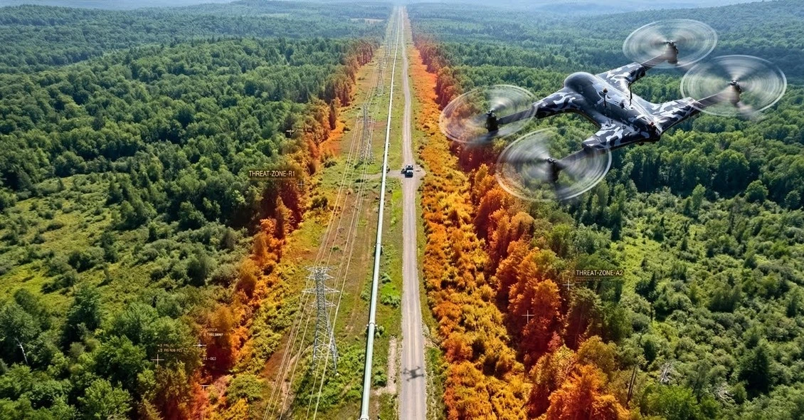
Corridor Monitoring (Pipelines, Power Lines, Rail)
Linear infrastructure covers hundreds of miles of different terrain types, making walk-throughs dangerous and time-intensive among utility workers. A drone with multispectral camera payloads captures vegetation encroachment that could potentially threaten power lines or railway safety.
These sensors detect leaks or seeps in underground pipelines by identifying subtle thermal and multispectral anomalies in the soil. Utilising multispectral drone services prevents costly outages, reduces manual patrol costs, and significantly improves overall worker safety in the field.
Drainage and Stormwater Management
Modern infrastructure projects must manage complex water flow to prevent structural damage and localized flooding during heavy rain events. Drone terrain mapping creates precise drainage models that allow engineers to visualise how water moves across a specific site.
Multispectral data identifies saturated soils and poor drainage areas that might otherwise remain hidden from standard visual inspection tools. Designing effective stormwater systems becomes much easier when you can monitor performance and slope stability with high-resolution spectral data.
Asset Inventory and Condition Assessment
Maintaining accurate inventories of infrastructure assets is essential for long-term municipal planning and urgent repair prioritisation across large networks. High-resolution orthomosaic maps capture exact asset locations and their current physical conditions with centimetre-level georeferencing for GIS integration.
Thermal and multispectral bands detect material deterioration and structural weaknesses that are completely invisible to standard high-resolution RGB cameras. Using a site survey drone allows teams to prioritize maintenance schedules based on objective, data-driven condition assessments and reports.
This guide reflects current industry applications of multispectral drone technology across construction, mining, environmental, infrastructure, and urban planning sectors based on 2026 best practices.
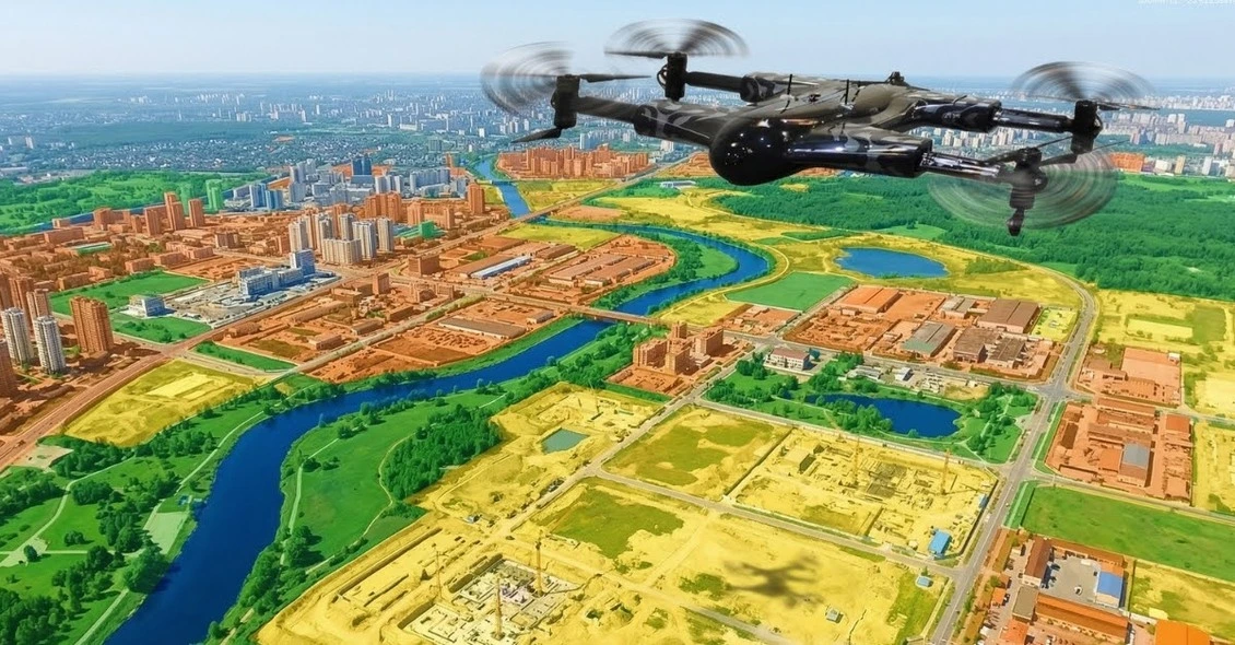
Application #5: Urban Planning and Development
Site Suitability Analysis
Before developing any new urban area, planners need comprehensive site data to ensure the land is truly suitable for construction. Multispectral drone flights capture topography, vegetation, water bodies, and existing structures with high-precision drone mapping services.
These sensors classify land cover types automatically using specific spectral data to identify potential development constraints very early in planning. Recognising wetland mapping boundaries or flood-prone zones supports informed decisions and leads to much faster regulatory approvals for projects.
Green Space Management
Cities must maintain parks, golf courses, and various public spaces to ensure a high quality of life for all urban residents. NDVI maps reveal irrigation issues, disease, and environmental stress in urban vegetation long before plants begin to physically wither.
Using a drone with a multispectral camera helps optimize maintenance resources and significantly improves the health of valuable public amenities. This technology also allows city officials to document tree canopy coverage for the mandatory 2026 sustainability and environmental reporting goals.
Smart City Integration
3D models made of high-resolution drone data provide direct inputs into advanced digital twins to manage modern cities. These models integrated with GIS offer continuous urban management and track construction effects on all the surrounding areas.
The sustainability of urban growth and responsiveness to the alteration of environmental conditions are guaranteed by supporting long-term planning with correct baseline data. Using a Multispectral Imaging Drone for Urban Planning creates smarter and more resilient modern cities.
Comparison Table: Industry Applications at a Glance
Choosing the right drone mapping services depends on your specific industrial needs and the required frequency of data collection. This comparison table shows how a multispectral imaging drone can provide value in a wide variety of industries with unique data products.
Utilizing these multispectral drone services guarantees that project managers acquire the most precise, science-based data on each decision.
The Technology Behind These Applications
Sensor Capabilities Summary
Multispectral drone services use specialized sensors to record narrow light bands that the human eye cannot see. RGB bands give visual context to an orthomosaic, and NIR(Near-infrared spectroscopy) bands are used to map healthy vegetation.
Red Edge band is specifically essential in early stress detection of plants and distinguishing among the similar-looking invasive species. Certain platforms also have thermal sensors to detect moisture leaks, overheating equipment, or heat loss in essential utility infrastructure.
Platform Considerations
Choosing a drone with a multispectral camera involves weighing the tradeoffs between multi-rotor agility and fixed-wing long-distance flight endurance. Multi-rotors are ideal for high-detail site survey drone missions, whereas fixed-wing units cover hundreds of hectares in a single flight.
Modern RTK/PPK technology provides survey-grade precision for drone terrain mapping without requiring the use of manual GCPs. Large-scale operations require sufficient flight planning and battery management to maintain full and continuous data collection of sites.
Data Processing Pipeline
The transition from raw imagery to a finished DTM involves complex photogrammetry and advanced spectral analysis in the cloud. Automated classification algorithms use spectral signatures to map land cover types, which significantly speeds up the urban planning process.
Time-series analysis enables managers to detect minute changes in site conditions or erosion patterns over multiple survey dates. Final deliverables are provided in industry-standard formats for seamless integration with existing GIS, CAD, and BIM professional workflows.
Research confirms that integrating drone-based digital twins into BIM software can reduce project documentation time by over 50%. (Source: MDPI 2026 Construction BIM Integration Study)
This guide reflects current industry applications of multispectral drone technology across construction, mining, environmental, infrastructure, and urban planning sectors based on 2026 best practices.
How to Choose the Right Approach for Your Project
Selecting the correct multispectral drone services depends entirely on the specific goals and technical requirements of your industrial project. This decision framework helps managers determine if they need a multispectral imaging drone or a more traditional survey tool.
Decision Framework
Question 1: What problem are you solving?
If you require basic topography, drone terrain mapping is the most efficient method for generating a high-quality DTM. For monitoring vegetation health or moisture, a drone with multispectral camera payloads utilizing NDVI indices is the best choice.
Question 2: What accuracy do you need?
Construction-grade projects that need a 2-5cm precision should use RTK-enabled drones with strategic GCP (Ground Control Points). General urban planning or exploration missions usually require standard processing to manage the needs of larger land classification and site analysis.
Question 3:What’s your timeline and budget?
You should consider having a one-time site survey, drone mission, or time-series analysis monthly to monitor your site. Hiring professional drone mapping services often provides better ROI than managing complex hardware, software, and pilot training in-house.
For expert guidance, you can book a Drone as a Service (DaaS) Consultation to discuss your specific needs. It helps you select the right drone multispectral survey frequency to maximize your project’s overall data value.
This guide reflects current industry applications of multispectral drone technology across construction, mining, environmental, infrastructure, and urban planning sectors based on 2026 best practices.
Future Outlook: 2026 and Beyond
By 2026, the AI-powered classification will be the industry standard in regard to processing complex drone mapping services data sets. Real-time edge computing has enabled operators to process critical issues without having to wait for long cloud uploads.
The adoption of spectral data into advanced digital twin and BIM systems continues to generate massive operational efficiencies in the world. Furthermore, regulatory expansion for BVLOS (Beyond Visual Line of Sight) flights is enabling much larger infrastructure and environmental monitoring projects.
Modern sensor fusion now combines multispectral, LiDAR, and thermal capabilities into single, highly efficient drone camera payloads. These combined technologies provide a comprehensive understanding of both the surface geometry and the chemical composition of any project site.
Decreasing hardware and processing costs are finally making advanced multispectral drone services accessible to even smaller-scale local construction projects. This democratization of high-resolution data ensures that every industry can benefit from the precision of a drone multispectral survey.
Conclusion
Multispectral drone services are no longer limited to agriculture they have become essential tools across construction, mining, environmental monitoring, infrastructure, and urban planning. From precise volumetric analysis in mining to time-series vegetation monitoring in environmental projects, these drones deliver high-resolution, actionable data that traditional methods cannot match.
Implementing multispectral imaging drones ensures safer operations, faster project timelines, and more informed decision-making. Whether you are planning a large-scale construction site or monitoring urban green spaces, integrating drone multispectral services can provide measurable ROI and long-term operational efficiency.
(FAQs)