Inspect telecommunications infrastructure inspection using drones, monitor telecom tower construction sites, repairs, and improve network safety and security with drone technology.
ELEVATED TELECOM INSPECTION DATA
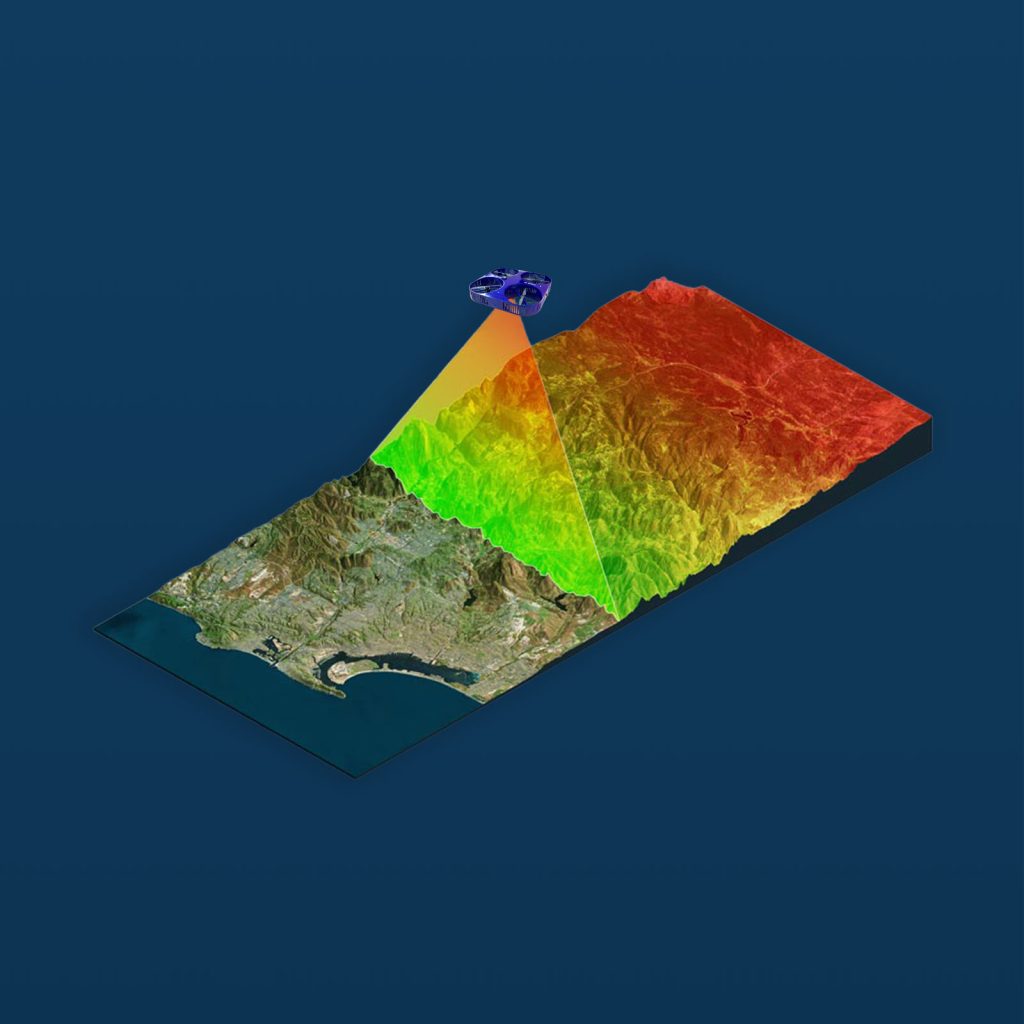
With Drone as a Service for telecommunications, operations can inspect and monitor vast networks of cell towers, antennas, fiber optic cables, and telecom substations efficiently and safely. Our AI-powered drone inspections—featuring 4K drone cameras, LiDAR mapping, multispectral sensors, thermal imaging, and radar scanning—capture comprehensive data regarding the condition and performance of your operational assets, enabling you to optimize telecom network performance, plan predictive maintenance, expansion, and repairs.
VERSATILE TECHNOLOGY TELECOM INSPECTIONS
Our telecom drone inspection services can identify issues—both visible and beyond the range of visible light—in even the most difficult-to-reach or hazardous places. Our data enables you to create a comprehensive analysis of operational performance via high-resolution aerial video and drone photography, multispectral mapping, terrain modeling, and 3D digital twin models for telecom assets.
OPTIMIZE TELECOM NETWORK PERFORMANCE AND SECURITY
Our next-generation telecom drone data solutions enable telecommunications operations to:
Gather data insights on network coverage and signal strength performance
Detect defects, corrosion, damage, and vegetation encroachment
Conduct real-time monitoring of field operations, repairs, construction progress, safety compliance, and security
Monitor environmental compliance
Respond rapidly to emergencies
SAFER, MORE EFFICIENT, AND COST-EFFECTIVE TELECOMMUNICATION DRONE INSPECTIONS
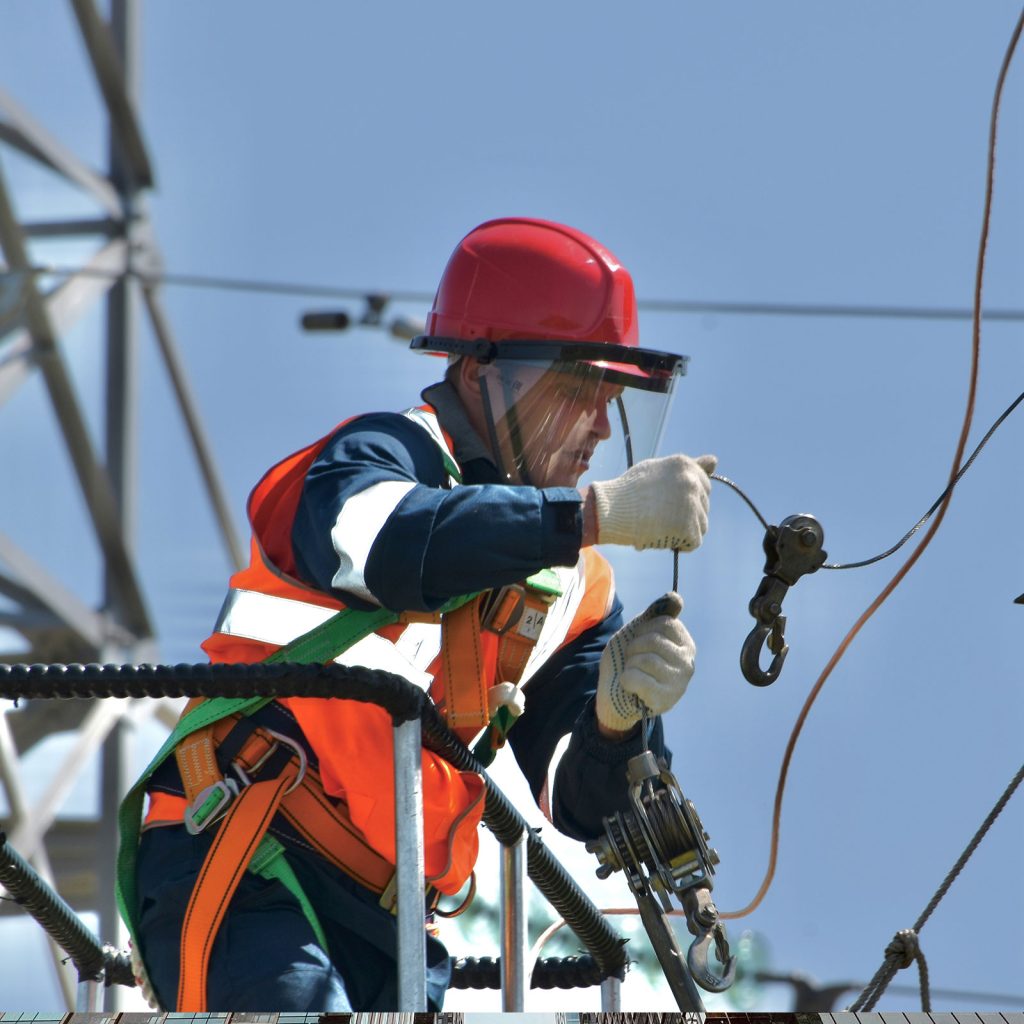
Drones eliminate the traditional job hazards faced by telecommunications workers, including accessing remote telecom infrastructure, scaling tall structures, and entering hazardous areas. Drone-based telecom inspections can cover vast networks much faster than ground-based teams, reducing project timelines and lowering telecom maintenance costs with drones.
TELECOMMUNICATION DRONE SERVICES MADE EASY
Avoid the costs of drone ownership and the inconvenience of hiring pilots and maintaining regulatory approvals. Our managed drone services for telecom companies ensure that all projects have the required approvals, and every mission is flown by a licensed FAA-certified drone pilot, using an FAA-registered commercial drone. Our pay-per-use drone services and subscription-based drone solutions provide flexibility to clients, and we offer end-to-end drone data management and analytics services.