PPK Workflow for Drones: Complete Process & Accuracy
Drone operators aren’t the only ones concerned with accuracy for any project. Clients and stakeholders need reliable data, and this data can come from both 2D and 3D mapping.
That said, conventional mapping that relies on GPS isn’t always accurate. They can drift or be off by a few meters. To ensure precise measurements for CAD, architecture, or construction work, engineers and architects need other methods.
In this article, we’ll delve into what PPK is. We’ll also break down the process of a PPK workflow and how it makes your operations more efficient.
What is a PPK (Post-Processing Kinematic) Workflow?
Short for “post-processing kinematic”, PPK is a way to correct GPS image locations post-flight.
A drone PPK workflow goes as follows: the initial observation data comes from the drone, which is geotagged. Afterwards, the pilot or user uploads it to their software that enables data correction.
PPK takes the drone’s data and compares it with the base station’s information. Any algorithms are then applied after the image data has been taken. The less accurate geotagged data is corrected, giving the user a more precise final output.
PPK vs. RTK and GNSS vs. GPS: What are the Differences?
PPK is an alternative to Real-Time Kinematic (RTK), where positioning and algorithms are applied in real-time. However, they have their differences.
Similarly, both GNSS (Global Navigation Satellite Systems) and GPS (Global Positioning Systems) also have specific applications when flying drones. Here’s a quick breakdown between them:
PPK vs. RTK
One difference between PPK and RTK is that the latter needs a constant connection mid-flight.
RTK provides corrections in real-time, which is crucial when you need drone precision accuracy. However, because it corrects in real-time, RTK needs a strong connection between the drone and the base.
Unlike RTK, PPK records positioning data and only applies any corrections afterward. In a nutshell, here are the main factors and differences between the two:
- Time-to-Data Criticality – Does your current mapping or surveying operation need high accuracy now?
- Immediate Positional Accuracy Validation – Does your project need immediate accuracy validation during data gathering or surveying? I
- Network or Radio Coverage – Does your site support a strong connection or radio coverage? If not, PPK data processing might be more suitable.
GNSS vs. GPS
A GPS (Global Positioning System) is widely used for daily activities, from driving to recreational flying. However, what most users know as GPS is only one part of a larger whole.
The larger network of satellites is what is referred to as “Global Navigation Satellite Systems” (GNSS). It comprises different systems, or “constellations”, that other countries maintain.
To ensure a high-accuracy drone workflow, RTK and PPK processing rely on GNSS to calculate centimeter-level accuracy. However, GNSS can be prone to signal interruptions, especially from atmospheric conditions.
What is the Full Process Behind PPK Workflows?
PPK is mainly used for precision drone operations, but it can also be used as a backup when surveying using RTK.
One reason for this is that PPK is more flexible since users can process it multiple times with different settings. On top of that, it relies less on ground control points (GCPs). It also does not require a strong connection between the base and the drone.
While it takes more time than RTK, PPK focuses on reliability. Despite relying on GNSS constellations, PPK stores the raw data locally. Errors are only corrected after collecting the data.
Here is the whole process behind a post-processing kinematic workflow:
Preparing and Configuring Your Drone
Not all drones are made equal. When users need high precision and accuracy, some drones are better equipped for the task than others.
To ensure data quality and accuracy, your drone must have the appropriate hardware that can record raw GPS data. Ideally, your drone should be a GPS drone that can handle this task.
Next, for drone PPK flights, you must configure it to yield the data you want. Adjust the settings on your drone’s manual beforehand.
Finally, here’s a checklist for software and hardware you need for your flight:
- Drone and Payload Hardware – Aside from your drone, you must also have the appropriate modules. These can range from full-frame cameras to LiDAR modules.
- Photogrammetry Software – Depending on your drone’s model, it may already have photogrammetry software included.
- Flight Mission Software – Your drone should also come with onboard flight mission software. These can be accessed via your drone’s remote control or via mobile apps.
- PPK Process Software – Your drone may come with PPK software that uses freely available GNSS orbit and clock information. Alternatively, third-party tools are widely available.
- Source for Base Receiver Exchange Files and Navigation Files – Receiver Independent Exchange Format (RINEX) files are the standard format for GNSS surveys.
Gather Drone Data
The next step in a PPK workflow is to fly the drone to gather data. For PPK processing to occur, you need two parts: satellite observation data and image timestamps.
The drone’s satellite observation data contains raw GPS measurements. These help account for signal errors caused by various factors, ranging from clock drift to satellite geometry.
Image timestamps are also essential for image Position and Orientation System (POS) correction. They help sync the raw images with the satellite data.
The following file types contain the two crucial parts for a successful PPK workflow:
- .mrk: This ASCII file stores image exposure timestamps in plain text.
- .bin or .rtk: This file includes satellite observation data in Radio Technical Commission for Maritime (RTCM) format.
- .obs: This RINEX-formatted observation file is generated in real-time via decoding.
- .nav: This is the satellite ephemeris file.
Gather Reference Data
After collecting raw image files, it’s time to gather data from nearby GNSS reference stations. As previously mentioned, you need two parts for PPK data processing.
The specific files you need are the navigation file and the base RINEX file. The former contains GNSS satellite positioning data used for mapping. PPK software applies corrections based on said data.
Meanwhile, the latter contains the raw GNSS data collected by base stations. On top of that, it also includes timing information, satellite signal measurements, and positions.
There are two ways you can obtain GNSS data:
- Via CORS (Continuously Operating Reference Station): Websites like the National Oceanic and Atmospheric Administration’s (NOAA) User-Friendly CORS (UFCORS) website offer freely available GNSS files.
- Via Third-Party Base Stations: If there are no CORS stations near your operation site, setting up your base station during data collection is viable. While it doesn’t have to be a known point, it must be recorded for over an hour.
Alignment, Post-Processing, and Overwrite
The final step of PPK data processing can be broken down into three parts: data alignment, post-processing, and overwriting.
The first of these three parts is data alignment. During data alignment, the PPK process software syncs the timing information between the raw images and the GNSS data points.
After aligning the data, the next step is the post-processing. Your software uses the GNSS data from reference stations and the drone to calculate positioning information.
The final step is importing the new POS data into your photogrammetry software. Because it relies heavily on its input, always double-check the data’s compatibility with your software. It must be overwritten correctly.
Why Use a PPK Workflow for Your Project?
PPK is slower, but the tradeoff is that it’s more robust. It doesn’t rely on a real-time connection between the drone and the base station. On top of that, PPK gives users validated and repeatable accuracy.
Here’s what makes these workflows so reliable:
Locally Stored Raw Data
The biggest drawback of RTK processing is that it needs a real-time connection to apply corrections to positioning data. Any signal interference, from physical obstructions to weather, can affect accuracy.
In contrast, PPK processing allows the drone to collect the raw, uncorrected data. As the drone flies, the base station logs its own data simultaneously.
Error Handling
PPK’s main selling point is audit-ready data. Its thorough documentation of GNSS logs from a high-accuracy drone workflow is critical for applications like regulatory surveys.
PPK workflows even account for various factors that can mess with GNSS data, including:
- Satellite Clock Drift: All clock data is available post-flight. As a result, post-processing software can make corrections more accurately.
- Ionospheric Delays: PPK allows for comparisons of multiple frequencies since the drone only stores uncorrected GNSS signals during flight. Rather than real-time processing, all error corrections are retroactive.
- Multipath Interference: Algorithms can filter out multipath more effectively since logs contain both clean and reflected signals.
Higher Accuracy
PPK often gives users higher GNSS drone accuracy in terms of absolute positioning. Compared to RTK, during PPK workflows, the drone always captures complete data logs.
Post-processing fills in gaps that might be lost if a drone flies through thick forest cover or behind a canyon. Because the drone keeps recording, PPK data is almost always complete.
Which Industries Benefit from a PPK Workflow?
PPK’s upsides, from audit-ready data to its resilience to signal loss, make it an excellent fit for many industries:
Construction and Mining
PPK and RTK methods are equally viable in construction and monitoring. However, PPK might be more favorable depending on site conditions, especially during land surveying or mapping. On top of that, where RTK offers quick checks, PPK adds thorough documentation.
Scientific Research
Data quality is essential for research regardless of the field. When data gathering requires LiDAR mapping and photogrammetry, scientists need repeatable accuracy. PPK shines the best in this instance, as well as during other cases where the environment is less than ideal.
Utilities and Infrastructure
Corridor mapping is an intensive process that demands precision drone operations. Typically, pilots conduct corridor mapping for assets in a straight line. However, the environment also varies. When even the infrastructure (e.g., power lines, pipelines, etc.) can affect the signal, PPK is often the better option.
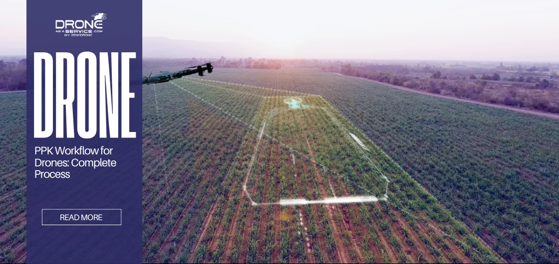
Agriculture
PPK is an essential part of today’s precision agriculture, particularly during crop health analysis or targeted spraying. Precise treatment applications (e.g., fertilizers, pesticides, etc.) depend on geospatial accuracy. Prescription maps using PPK make spray routes more accurate and efficient. On top of that, PPK makes larger crop surveys and GNSS comparisons more reliable over time.
The Bottom Line
For many industries, drone positioning accuracy determines overall operational efficiency and success. However, factors like satellite drift and ionospheric effects can affect even GNSS data.
Scenarios like these are where PPK is indispensable. While RTK allows for time-sensitive work, PPK is more deliberate. It accounts for variables like error margins, allowing the drone to collect the data since the processing comes later.
Absolute accuracy has never been more valuable in industries worldwide. However, when end users and stakeholders also need flexibility and legal defensibility, PPK is the gold standard.