Every farmer knows that some parts of the field consistently perform better than others. The key question is why these differences occur and how they can be identified earlier.
Traditional crop health monitoring usually involves in-person surveys, which require physically walking in the fields and checking up on the crops, but the “boots on the ground” method can only cover so much territory, and there are limits to the human eye, therefore missing early signs of problems or issues with the crops.
This is where NDVI mapping comes in. For farmers and agronomists looking to improve field management, multispectral mapping provides the detailed crop data needed to make informed choices. By utilizing multispectral drone services, today’s agriculture has transitioned from reactive to proactive. Many agricultural operations now combine NDVI analysis with multispectral drone services to better understand field variability and vegetation performance across large farms.
This guide reflects commonly applied NDVI mapping workflows used in precision agriculture and crop health monitoring projects. It also answers questions like why it should be a staple in agriculture and how multispectral drone services can transform crop management strategy.
Modern multispectral drone services allow farms and agricultural companies to monitor crop performance across hundreds of acres in a single drone survey. Using a multispectral imaging drone equipped with calibrated sensors, NDVI mapping transforms raw spectral data into actionable insights for crop health monitoring, irrigation planning, and nutrient management.
What is NDVI?
NDVI stands for Normalized Difference Vegetation Index. It is the most widely used vegetation index in precision agriculture and forms the foundation of modern crop health monitoring systems. It senses two specific bands of light: red and near-infrared.
Plants interact with light in specific ways. Healthy plants absorb red light, and in turn, their cell structure reflects near-infrared (NIR) light; meanwhile, plants that are stressed often absorb less red light and so reflect less NIR. Unlike standard cameras, NDVI relies on sensors that capture multiple light bands.
The NDVI has a scale to explain what is causing these plants to be stressed. Below is a table of the scale:
| NDVI Scale | Explanation |
| -1 to 0 | Indicates water, clouds, or snow |
| 0 to 0.2 | Represents bare soil, rocks, or infrastructure |
| 0.2 to 0.4 | Suggests sparse or stressed vegetation |
| 0.4 to 0.6 | Indicates moderately healthy vegetation |
| 0.6 to 0.9 | Represents dense, highly vigorous crop canopies |
NDVI mapping turns invisible light reflectance data into a clear, colour-coded mapping where green usually indicates health and red means stress.
This level of detail supports agricultural remote sensing programs that help farmers identify irrigation issues, nutrient deficiencies, and disease pressure before visible symptoms appear.
Why NDVI Matters for Modern Farmers
The value of NDVI lies in its ability to support faster and more informed farm decisions. Here are some reasons why NDVI provides measurable operational benefits.
-
Early Detection
The biggest advantage: time. NDVI mapping can often identify problems 7 to 14 days before visible symptoms appear, giving agriculturalists and farmers a head start in preventing issues before they severely impact yields. With UAV-based multispectral imaging, growers can now monitor field variability at a resolution and frequency that was previously impossible with satellite data alone
-
Precision Application
Instead of randomly blanket-spraying an entire field, farmers can use NDVI data to create prescription maps. This allows them to apply sprays only where needed
-
Cost Saving
Multispectral drone services reduce the amount of chemicals and water used due to precision application, and farmers can significantly lower their costs.
| Benefit | Impact |
| Early plant stress detection | Prevent yield loss |
| Precision fertilizer application | Reduce input costs |
| Large field coverage | Faster monitoring |
| Data-driven decisions | Improved farm management |
-
Yield optimization
Addressing problems and issues early on means that more plants and crops reach their full yield potential.
-
Environmental Benefits
Due to targeted applications, this means there are fewer chemical runoffs and better soil health.
-
Scalability
A single multispectral drone can cover hundreds of acres in a single flight, meaning farmers can scale crop monitoring without the need to hire more manpower.
-
Data-driven Decisions
NDVI helps in enabling farmers to decide on issues backed with data; optimizing inputs, reducing risks, and improving yields.
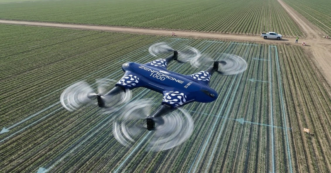
Technology Behind NDVI: Multispectral Imaging Drones
To be able to create an accurate NDVI map, it needs specialized multispectral imaging drones equipped with high-resolution spectral sensors. A drone with multispectral camera capabilities that uses a set of specialized sensors. These sensors capture five or more specific bands of light, including ones for NDVI: red and near-infrared. This differs significantly from standard drones that can only detect RGB (Red, Green, Blue) lights.
Comparison: Standard vs. Multispectral Drones
| Feature | Standard Drone (RGB) | Multispectral Drone |
| Bands Captured | RGB only (3 bands) | RGB + NIR + Red Edge (5+ bands) |
| Visual Capabilities | Visible light only | Visible + Invisible light spectrums |
| Primary Use | Photos, videos | Scientific analysis |
| Can it create NDVI? | No | Yes, |
| Best For | Marketing visuals | Precision agriculture |
This is why using drone multispectral imaging ensures that the data is accurately calibrated.
Accurate drone data collection is essential for creating reliable prescription maps that guide variable-rate application of fertilizers and pesticides.
Meaning, this gives more consistent results over time, allowing farmers a map created in one month to a map created in another, regardless of slight changes in light.
How NDVI Mapping Works: Step by Step
Step 1: Flight Planning
The process begins with defining the field boundaries, scheduling flights, setting altitude, and image overlap. For multispectral drone mapping, a high overlap (typically 74-80%) is required to ensure it is accurate.
Step 2: Data Collection
The multispectral drone takes off and flies the planned flight. It captures hundreds and thousands of images. Every time the shutter triggers, the captured images record each spectral band (Red, Green, Red Edge, NIR, etc.).
Step 3: Procession and Orthomosaic Creation
After the flight, the data is uploaded to software that stitches these images together, creating a single high-resolution map. Radiometric calibration is also done during this step, using a light sensor to correct for the sun angle and cloud cover.
This process ensures that the spectral reflectance data remains consistent across different flights, allowing for accurate time-series analysis of crop development.
Step 4: NDVI Calculation
The software then applies an NDVI formula: (NIR – Red) / (NIR + Red). The results are then based on their numerical scale and converted into a colour gradient map for easy interpretation.
Step 5: Analysis and Prescription
Finally, farmers analyze the map, identifying stress zones which are then used to generate prescription files.
What NDVI Reveals About Your Crops
The NDVI mapping provides a health check on fields, but the interpretation of this data is key. NDVI detects the stress, but the pattern of that stress often has hidden causes.
| Issue | What NDVI Shows | Actionable Insights |
| Nitrogen Deficiency | Yellowing or lower values | Apply targeted fertilizer application |
| Water Stress | Irregular Patterns of low NDVI values | Adjust irrigation or check blocked emitters |
| Disease Pressure | Concentrated hotspots of low values | Scout specific areas immediately |
| Planting Issues | Linear gaps or rows | Assess planter performance and plan for potential replanting |
| Soil Variability | Patterns of soil type changes | Soil sampling and amendments |
| Weed Pressure | Patches with different spectral signatures | Apply targeted herbicide to weed patches |
| Drainage Problems | Elongated or low-value patterns that follow the natural flow of water | Consider installing drainage |
NDVI vs Other Vegetation Indices
It is best known for its index, but it’s not always the best tool for every job. Multispectral drone services often employ a variety of indices depending on the crop stage and type.
| Index | Name | Best Use Case |
| NDVI | Normalized Difference Vegetation Index | Best for general health, biomass, and early season |
| NDRE | Normalized Difference Red Edge | Best during mid-late season, and for dense canopies |
| GNDVI | Green NDVI | Best for water and nitrogen content detection |
| SAVI | Soil Adjusted Vegetation Index | Best during the Early season and for sparse vegetation |
| SVI | Chlorophyll Vegetation Index | Best for chlorophyll content estimation |
| EVI | Enhanced Vegetation Index | Best for high biomass and reduces saturation |
Always keep in mind that recognizing and choosing the right vegetation index is essential for advanced users; combining multiple indices through multispectral data analysis provides deeper insights into crop physiology and soil conditions.
Real-World Applications by Crop Type
The utility of a drone with multispectral camera technology on crop health monitoring varies across different agricultural sectors. Here are some examples for real-world applications:
Corn and Soybeans
By pinpointing the exact moment for nitrogen application and flagging early disease stress, NDVI mapping can help farmers move away from broad field guesses to a more precise yield mapping.
Wheat and Small Grains
Drone surveys can act as early-warning crop health monitoring systems for rust and powdery mildew. This gives growers enough information to protect their margins and timing for a great harvest.
Vineyards
Managing vineyards is all about balance, and using drone multispectral services allows for selective harvesting and efficient irrigation that protects vines from frost and water stress.
Orchards
Instead of looking at the whole grove, drones with multispectral cameras can zoom in on an individual tree’s health to see if there are any nutrient deficiencies before they impact the quality of other trees.
Rice
Rice farmers utilize data from vegetation indices that are captured by multispectral drones. These data help in monitoring water levels and nitrogen status, regulating crop growth
Cotton
Drone services give data-driven insights that help in estimating boll distribution and determine the exact timing for defoliation to streamline the harvest process.
Limitations of NDVI
To maintain trust and authority in precision agriculture, it’s important to know the limitations of NDVI mapping and multispectral drone data to avoid misinterpretation:
Cannot Identify Specific Problems
NDVI only shows current plant stress detection. Unfortunately, it cannot know the difference between the cause of the stress, whether pests, disease, or nutrient deficiency.
This is why remote sensing for agriculture must always be combined with ground-truthing to verify the underlying cause of crop stress.
Saturation in Dense Canopies
NDVI presents thick mature vegetation displays limited variation due to signal saturation, losing its ability to show variation.
Soil Background Interference
Usually, in early seasons, loose and bare soil can skew NDVI readings, which makes the crops seem less healthy than they actually are.
Atmospheric Conditions
Heavy clouds, haze, and changing sun angles have a great effect on the data accuracy of drone surveys. This oftentimes needs proper calibration.
Requires Calibration
Drones with multispectral cameras require radiometric calibration. If not calibrated, data may be inconsistent between flights.
Not a Replacement
Despite the growing trend with drone mapping services, ground surveys are still essential to verify the specific cause of the stress identified on the map.
When to Use NDVI (And When Not To)
Selecting the right environment is important so that the data is accurate. Below is a breakdown of some of the best and worst scenarios for NDVI:
| Best Scenarios for NDVI | Poor Scenarios for NDVI |
| Uniform crops with good coverage | Dense, mature canopies |
| Early to mid-season growth stages | Early season with a lot of bare soil |
| Clear Skies and consistent lighting | Cloudy or hazy conditions |
| General health screening | When specific identification is needed |

Future of NDVI and Multispectral Drones in Agriculture
The precision agriculture drones industry is rapidly evolving. We are seeing a shift from simple mapping to predictive analysis.
- AI-Powered Analysis: There will be more automated stress detection and classification
- Real-time Processing: Even during drone flights, a map can now be generated
- Integration with other Data: Drone data will be able to combine with soil sensors, weather data, and satellite imagery.
- Machine Learning Models: There will be a more advanced yield prediction, and it can identify specific diseases
- Long-term Monitoring: Drones will be able to compare seasons and track a more detailed field history over the years.
Organizations working with large agricultural operations often rely on professional multispectral drone services to capture consistent NDVI data and support long-term crop monitoring programs. Accurate drone mapping allows growers to make faster, data-driven decisions that improve yield performance and reduce operational costs.
These are just some of what the future for NDVI mapping and drone mapping services may hold. The technology continues to evolve, expanding its potential applications.
Conclusion
NDVI mapping has become a key tool in modern precision agriculture, helping farmers monitor crop health across large areas quickly and efficiently. By using multispectral drone technology, growers can detect plant stress earlier and make more informed management decisions. Although NDVI cannot identify the exact cause of crop issues, it highlights problem areas that require further inspection. As drone technology continues to advance, data-driven farming practices will become even more precise and efficient. Companies like Drone As A Service (DAAS) provide professional drone mapping solutions that help agricultural operations leverage NDVI data for smarter crop management and improved yields.
FAQs
1. What is NDVI in agriculture?
NDVI (Normalized Difference Vegetation Index) is a vegetation index used to measure crop health by analyzing how plants reflect red and near-infrared light. It helps farmers quickly identify healthy and stressed vegetation across large fields.
2. How do drones create NDVI maps?
Drones equipped with multispectral cameras capture images in red and near-infrared bands. Mapping software processes this data using the NDVI formula to produce color-coded maps showing crop health variations.
3. Why is NDVI mapping useful for farmers?
NDVI mapping helps farmers detect crop stress earlier than visual inspection. This allows them to take action sooner, improve yields, and apply fertilizers or water more efficiently.
4. Can NDVI identify the exact cause of crop stress?
No, NDVI only shows where plant stress exists. Farmers must combine NDVI data with field scouting to determine whether the issue is caused by pests, disease, water stress, or nutrient deficiency.
5. When is the best time to use NDVI mapping?
>NDVI works best during early to mid-season crop growth when vegetation differences are easier to detect. Clear weather conditions also help produce more accurate multispectral data.