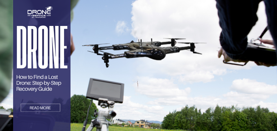
How to Find a Lost Drone: Step-by-Step Recovery Guide
TL;DR
This guide explains how to locate a lost drone using step-by-step recovery methods, including professional techniques used in commercial drone operations.
- Check flight logs immediately
- Do not turn off the controller
- Use GPS & telemetry data
- Map the crash zone using terrain
- Perform structured ground search
- Use professional drone recovery support if needed
What Causes a Drone to Get Lost?
A drone gets lost when signal loss interrupts navigation before Return-to-Home or landing logic completes. The initial step in reducing the search area is understanding the root cause.
Signal interference & connection loss
Electromagnetic interference from power lines, cell towers, or dense urban structures can sever the connection between the controller and the receiver. When the signal is lost, the drone cannot receive manual inputs.
GPS lock failure
Drones rely on satellite positioning to hold their place in the sky. If the GPS module fails or the drone flies into a “GPS shadow” (such as a canyon or between tall buildings), the aircraft may drift with the wind, leading to a flyaway.
Battery depletion & wind drift
Flying against strong headwinds depletes the battery faster than estimated. In case the battery hits critical levels while the drone is far away, it will enter a forced landing sequence at its current position instead of returning home.
Pilot error vs autonomous flight failure
While many incidents are attributed to pilot orientation loss, autonomous flight failures—such as a corrupted waypoint mission or improper Return-to-Home (RTH) settings—can cause the drone to land in unintended locations.
Takeaway: Most drones are lost due to signal loss combined with battery or GPS failure.
Lost Drone Recovery Methods
What to Do Immediately After Losing a Drone
In commercial drone recovery workflows, these steps are executed immediately to preserve telemetry data and reduce asset loss. Execute these steps immediately upon losing visual or digital contact. Time is one of the critical factors in saving battery life for recovery signals.
Stay calm and stop flying commands
Do not panic or randomly move the control sticks. Random inputs can push the drone further away or disarm the motors mid-air if the connection momentarily re-establishes.
Do not power off the controller
The remote controller contains the last known telemetry data. Leaving it powered on guarantees that you do not lose the connection when the drone goes over an obstruction or when you approach a crash site.
Take a screenshot of the last map view
Take a screenshot on your flight app. This preserves the precise trajectory and location marker in case the application crashes or the tablet battery runs out.
Check Return-to-Home (RTH) status.
Check whether the RTH failsafe was activated. In case the drone initiated RTH, estimate the flight time back to home point compared to the remaining battery percentage to determine where it landed short.
Sync flight logs to the cloud
When using apps such as DJI Go or automated flight control software, sync the flight records immediately. This supports the data to be analyzed in detail on a bigger screen.
How to Find a Lost Drone Using Flight Logs & GPS
Flight logs provide the most accurate data for recovery. They strip away guesswork by providing exact coordinates and system status at the moment of disconnection.
Last known GPS coordinates
Access the flight log and locate the final data entry. Enter longitude and latitude in Google Maps or a handheld GPS unit. Navigate to this exact point as your primary search origin.
Altitude, speed & direction analysis
Analyze the drone’s velocity and heading at the moment of signal loss. If the drone was traveling 15 m/s North at an altitude of 50 meters, and the connection was cut, the momentum would accelerate beyond the position taken by the recorded GPS position.
Understanding failsafe behavior (RTH, auto-land)
Determine what failsafe setting was active: “RTH,” “Hover,” or “Landing.” If set to “Landing,” the drone is likely directly below the last GPS point. If set to “Hover,” it likely drifted with the wind until the battery died.
Takeaway: Flight logs can narrow a search area from kilometers to a focused impact zone.
How to Map the Crash Area Using Terrain Data
Standard maps are two-dimensional (2D), whereas drone crashes happen in a three-dimensional (3D) space. Topographical data is used to narrow down the search area, particularly in rugged areas.
Plot home point & last signal
Using a map, plot a line between the Home Point and the Last Known Location. This is the flight path. Trace any obstacles encountered in this line which might have blocked the signal.
Account for terrain elevation
Compare the last reported altitude of the drone and the ground elevation of the coordinate. In case the drone was reported to be at 30 meters altitude, and the terrain is rising by 40 meters ahead, the drone likely struck the slope.
Predict descent and collision points
Calculate the glide slope in case the battery dies. Drones do not fall directly; they fall drifting. Combine wind speed with descent rate to plot a “cone of uncertainty” where the drone likely landed.
Takeaway: Terrain elevation analysis can eliminate large low-probability search areas early.
Ground Search Techniques That Actually Work
Once you arrive at the calculated coordinates, switch to a systematic physical search. Random walking is inefficient and often leads to missing the device.
Grid-based search method
Divide the search area into 10×10 meter grids. Walk each grid line systematically. This ensures 100% coverage of the high-probability zone before expanding outward.
Listening for beeps or LEDs
Many drones have a “Find My Drone” feature that flashes LEDs and pulses the motors to create a loud beeping sound. Activate this feature only when you are in the immediate vicinity to conserve the remaining battery.
Searching trees, rooftops, and slopes
Drones often get caught in tree canopies or land on flat roofs. Use binoculars to scan high points. A drone in a tree may not be visible from directly underneath due to foliage.
Takeaway: Structured grid searches consistently outperform random movement in professional recoveries.
Using Another Drone to Locate a Lost Drone
Deploying a second aircraft can provide a vantage point that is impossible to achieve from the ground, particularly in dangerous or inaccessible terrain.
When aerial search works best
Use an aerial search for cornfields, dense forests, marshes, or rooftops. A downward-facing camera can spot the contrast of the drone’s body against the natural environment.
How to fly search patterns
Program an automated lawnmower grid pattern in low altitude(20-30 meters). Review the footage at a high-resolution monitor after landing instead of using just the live feed.
Safety considerations
Keep Visual Line of Sight (VLOS) with the search drone. Do not risk the second plane flying into the same interference zone that had led to the initial loss.
Takeaway: Aerial searches are most effective when flown methodically at low altitude with post-flight footage review.
How to Find a Lost Drone Without a Tracker
In case the drone does not have GPS or the battery separates in the collision, the recovery is carried out based on trajectory analysis and visual inspection.
Telemetry-based prediction
Even without a live tracker, the controller stores the last telemetry. Use the heading and wind direction to estimate a drift vector. The drone will be downwind of the last known position.
Visual landmark tracing
Re-fly the path mentally using the video cache (if available). Identify the last distinct landmark visible in the feed—such as a specific tree, rock formation, or building—and start the search there.
Community & local assistance
In commercial operations or urban areas, notify local community groups. Posting the flight path and description on local forums can yield results from residents who may have found the device.
Takeaway: If telemetry data is incomplete or corrupted, recovery accuracy decreases and the search area expands significantly.
Can You Find a Drone After the Battery Dies?
Yes, using last GPS point
Once the battery is dead, the location of the drone will not change unless acted upon by some external forces. The coordinates that were taken right before the power outage are accurate.
Descent modeling
If the battery died mid-air, the drone auto-landed. Knowing the wind speed in the descent phase determines the distance of the drift between the loss of power and the ground.
Terrain & wind analysis
A dead drone will not emit sound or light. Recovery depends on precise mapping of the crash location with reference to the terrain elevation and wind direction recorded in the flight logs.
When to Use Professional Drone Recovery Services
For high-value assets or critical data loss, attempting a DIY recovery is too risky or inefficient.
Commercial inspections & surveys
In the event that a drone goes missing during critical infrastructure surveys (e.g. power lines, bridges), professional recovery teams are allowed the safety clearance and tools to retrieve the asset without affecting operations.
BVLOS operations
Beyond Visual Line of Sight (BVLOS) operations cover vast distances. Professional teams utilize specialized tracking devices and long-range planes to find drones lost kilometers apart with the pilot.
High-value or industrial drones
Industrial platforms carrying LiDAR or multispectral sensors represent a significant investment. Specialized recovery services ensure the hardware is recovered with minimal secondary damage.
Takeaway: Professional drone services reduce downtime, data loss, and compliance risks.
How to Prevent Losing a Drone in the Future
Prevention is the most effective form of recovery. Implementing strict operational protocols reduces the probability of flyaways.
Pre-flight checks
Calibrate the IMU and the compass prior to flight. Ensure RTH altitude is set higher than the tallest obstacle in the flight zone.
Proper RTH altitude
Adjust the Return-to-Home altitude to at least 30-50 meters above the tallest local structure. This eliminates the possibility of the drone crashing into buildings or trees during automated return.
Battery management
Adhere to the “30% rule.” Plan to land when the battery reaches 30%. Never push a battery to 0% as voltage sag can cause a sudden power cut.
Fleet monitoring & service support
For commercial fleets, utilize fleet management software that tracks real-time telemetry and logs. Established support agreements ensure rapid response if an asset goes down.
Conclusion
Losing a drone doesn’t have to mean permanent loss. With structured recovery methods and professional drone services, most drones can be recovered efficiently and safely. Always follow local aviation and safety regulations when conducting drone recovery, especially near restricted or populated areas.
This guide is based on professional drone recovery workflows used in commercial drone operations, inspection missions, and BVLOS flights where asset recovery and data integrity are operational priorities.
FAQS
Can drones be tracked after a crash?
Yes, provided the battery is still attached and has charge. If the battery ejects upon impact, tracking stops, and you must rely on the last known coordinates.
How accurate is the last GPS location?
Consumer GPS is typically accurate within 1-3 meters. However, signal multipath in urban areas (signals bouncing off buildings) can decrease accuracy to 5-10 meters.
Should I report a lost drone?
In many jurisdictions, pilots are required to report lost drones if they pose a hazard to aviation or people, or if the drone weighs over a specific threshold (e.g., 250g or 55lbs depending on regulations).
Is drone insurance helpful?
Yes. Many hull insurance policies cover “flyaways” provided you can submit the flight logs proving it was not due to pilot negligence.