Exploring the Range of Drone Services Across Virginia
TL;DR
Drone services in Virginia provide accurate aerial data for surveying, mapping, and infrastructure inspection.
Industries use drones for planning, environmental analysis, and monitoring projects with greater speed and safety.
Overall, drone technology improves efficiency, reduces risk, and supports better decision-making across Virginia.
Surveying and infrastructure inspection have changed significantly with modern technology, especially with the rise of drone services in Virginia. Expensive aircraft or personnel-led crews were the primary way to get precise topographic data. Today, drone services in Virginia are doing the heavy lifting for both engineering and land development across the state.
The demand for aerial drone services in Virginia is growing from the coast to the mountains. But these services go far beyond simple aerial photos. Today’s operators use advanced drone technology in Virginia, including tools like LiDAR scanning, thermal imaging, and 3D imaging, to analyze terrain, track construction, and perform infrastructure assessment with pinpoint accuracy, safely, and in a fraction of the time.
This article explains the types of commercial drone services in Virginia, how they work, and how different industries use them. Consider this guide as a resource for understanding what unmanned aerial systems (UAS) can do and how businesses are actually using professional drone services in Virginia.
What are Drone Services?
Drone services involve using unmanned aerial systems (UAS) to collect visual, spatial, and geospatial data for planning, inspection, and analysis. Commercial drone services in Virginia go far beyond recreational photography. These professional teams rely on enterprise-grade hardware and specialized sensors for remote sensing to capture the critical data that drives engineering, construction planning, and environmental projects.
Commercial drones are adaptable aerial platforms equipped with specialized sensors. Depending on the job, operators providing drone services in Virginia might attach a high-resolution camera for visual inspections, a LiDAR scanner to map the ground straight through heavy tree cover, or a multispectral camera to check plant health. Because teams can easily swap out these payloads, aerial data collection is faster and much easier to repeat over time.
In the past, land mapping a dense forest or checking a high-voltage tower took a lot of time and involved real physical risk. Surveyors previously required extensive field access through thick brush just to get a line of sight, and inspectors actually had to climb the towers. Drones change the equation entirely. Operators stay safely on the ground while the aircraft pulls the exact data they need from above. It’s no longer just about snapping pictures from the sky; it’s about utilizing drone technology in Virginia for gathering complex data safely and efficiently.
Drone services use advanced aerial technology to collect accurate, scalable, and efficient data for modern surveying and analysis.
What Types of Drone Services Are Available in Virginia?
Across the state, drone services are used to support surveying, infrastructure monitoring, planning, and monitoring needs across multiple industries. These aerial drone services in Virginia cover a lot of ground, built specifically to support the daily work of land developers, civil engineers, and environmental consultants. Here’s a breakdown of the main types of drone services in Virginia.
Surveying and Mapping Services
When it comes to drone technology in Virginia, aerial surveying leads the pack. Operators use photogrammetry and LiDAR scanning to map the ground and build highly precise 3D surface models.
- 3D Imaging: 3D imaging creates detailed digital representations of the sites. This significantly improves efficiency for teams who need to calculate dirt volumes or check structural details without having to spend all day in the field.
- Aerial Mapping: Drones now have photogrammetry that takes thousands of overlapping photos and stitches them together into one massive, high-res digital map. This provides a high-resolution bird’s-eye view that allows teams to zoom in on even the smallest site details.
- ATLA Surveys: While there is still a need for a “boots on the ground” method, commercial drone services in Virginia add a layer of visual proof that traditional methods just can’t match. the result: it spots tricky property encroachments that might be hidden for those standing at eye-level.
- Boundary and Easement Documentation: Drone services across Virginia are hands-down the fastest way to get a clear look at how property lines sit across the Virginia landscape. This top-down view makes it easy for everyone to see exactly where legal boundaries meet real-world features like fences and buildings.
- Topographic Mapping: A requirement for planing drainage and/or foundations is the knowledge of the exact “lay of the land”. By using LiDAR lasers to pierce through shadows and brush, drones can create a precise map of every slope and elevation of the site.
Instead of spending days walking every inch of a property, use drones with high-res cameras and lasers to build an exact digital replica of the site. Drone-based surveying enables faster and safer data collection while maintaining high spatial accuracy.
Planning, Engineering, and Land Development Support
Before breaking ground on land development, there’s a need for a rock-solid plan. Drone data supports early-stage planning by providing accurate site information.
- Site Planning: Drones, architects take their blueprints and lay them directly over high-res aerial photos of the actual site. It’s the easiest way to see exactly how a new project will fit into the neighborhood before anything gets built.
- Feasibility Studies: Trying to figure out if a piece of land is actually worth building on? Aerial drone services in Virginia fly the site to spot hidden terrain issues and access points right away, helping in making big decisions faster.
- Rezoning Support: Getting on the same page at a zoning board meeting is tough when it’s just pointing at flat blueprints. 3D models and panoramas actually show the public what’s coming, clearing up confusion and making planning much easier.
- Road and Parking Design Assistance: Data taken from drones gives engineers the real-world layout they need to plan parking lots and driveways that actually make sense. They also help in capturing the full layout of the roads, enabling architects and engineers to plan a smooth traffic flow.
Drone data simplifies complex planning into clear insights, enabling faster and more informed decisions. It lets teams and professionals spot potential headaches long before the first shovel hits the dirt.
Environmental and Elevation-Related Services
The landscape changes constantly, from flat coastlines to rolling mountains. Drone services in Virginia make it easy to handle the rigorous environmental analysis needed to navigate such diverse terrain.
- Elevation Models: Advanced drone mapping to create precise 3D models of a site’s exact surface levels. It provides a precise terrain model that helps predict water flow accurately.
- Floodplain Analysis: Figuring out flood risks in low-lying areas requires hyper-accurate elevation data to get it right. Drones capture those vital vertical measurements, making it simple to model flood scenarios and map out safe boundaries.
- Wetland Identification: Protecting ecological resources like wetlands is a big deal, and our specialized drone sensors make spotting them much easier. By analyzing soil moisture and plant health from above, drones help environmental teams stay compliant without having to wade through the mud.
- Erosion and Sediment Control: Keeping construction runoff in check isn’t just good practice; it is strictly required by law. By providing regular aerial check-ups on silt fences and sediment basins, drones can make sure everything is working right and keep the site out of trouble.
Getting pinpoint elevation data straight from the sky has completely changed the game for managing water and protecting the environment. It is the smartest way to keep land development projects safe, compliant, and moving forward. To stay aligned with official regulations and safety standards, many professionals also follow guidelines provided by the Federal Aviation Administration (FAA).
Key Takeaway: Drone-based environmental data helps manage risks, ensure compliance, and protect natural resources effectively.
Utility, Water, and Drainage Analysis
Keeping the essential utilities running smoothly takes serious planning and constant upkeep. Professional drone services in Virginia give utility teams the clear, top-down perspective they need to manage utility inspections effectively.
- Utility Location: Drones are used to map surface indicators of utilities, such as manholes and/or valves, and with this, they create a digital overlay that helps crews locate infrastructure more efficiently.
- Storm Drainage Analysis and Design: Keeping stormwater under control is a massive priority for any civil engineering project. Drone-based topographic data helps engineers easily map out water flow paths and design drainage systems that actually keep the site dry.
- Water and Sewer Planning: When running new municipal lines, there’s a need to see exactly what’s in the path across both public and private properties. The drone’s aerial maps highlight everything from steep drops to hidden streams, making it easier to plan the perfect route without any surprises.
- Stream Restoration Support: Bringing a natural waterway back to life means the need to know every curve and bank of the current stream. Drones fly over to capture those exact baseline conditions, giving data needed to design the restoration and track its success over time.
Drone analysis enables accurate utility planning by providing real-world terrain and infrastructure insights. It completely understands the terrain before laying a single pipe or cable.
Inspection and Monitoring Services
Drone inspections are rapidly increasing across Virginia because they keep teams safe and operations running without a hitch. Checking assets from the sky means nobody has to put themselves in harm’s way just to get a good look.
- Telecom and Tower Inspections: Drones fly around cell and radio towers to snap high-res photos of every single bolt, cable, and unexpected bird’s nest. This provides a detailed view of the structure’s condition without requiring manual climbing to make a dangerous, time-consuming climb.
- Structural and Roof Inspections: Getting up on a steep residential roof or a massive commercial building is an unnecessary risk. Drones can safely capture detailed images of every shingle and HVAC unit, fully assessing the wear and tear with both feet firmly on the ground.
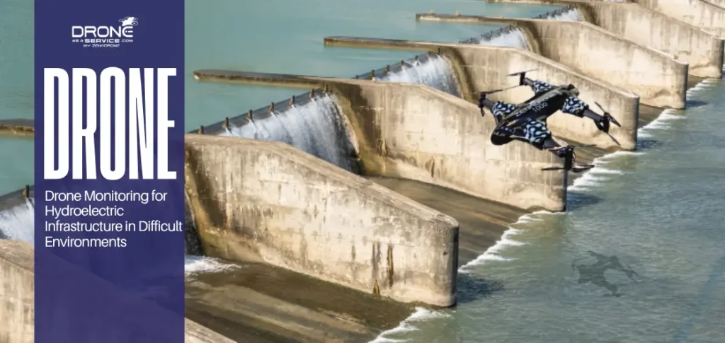
- Energy and Infrastructure Inspections: Critical infrastructure like bridges and solar farms need constant monitoring to catch tiny defects before they become expensive disasters. Drones use thermal sensors and high-powered zoom cameras to easily spot everything from overheating electrical panels to hairline concrete cracks.
Drone inspections improve safety and efficiency by eliminating the need for risky manual checks.
Aerial Photography and Visual Documentation
Data is incredibly important, but sometimes stunning visuals are needed to truly tell the story of a project. Drones capture high-quality imagery that makes an immediate, undeniable impact across Virginia.
- Construction Documentation: Drones capture regular aerial shots to build a clear, visual timeline of a project from start to finish. This overhead perspective is the perfect way to keep stakeholders in the loop, verify progress, and quickly settle any disputes.
- Real Estate Visuals: Ground-level photos simply don’t do justice when trying to showcase massive parcels of land or sprawling commercial properties. Drones provide a bird’s-eye view that instantly shows buyers exactly how close a site is to major highways and local amenities.
- Media and Marketing Imagery: Drones capture high-resolution visual documentation that helps destinations, golf courses, and institutions really stand out. This elevated viewpoint is an eye-catching way to market a space and draw people in long before they actually visit.
High-quality aerial visuals improve communication, documentation, and project visibility. It keeps communication open and provides indisputable proof of exactly what is happening on the ground.
Which Industries Use Drone Services in Virginia?
In Virginia, drone services have become essential operational tools across multiple industries. they have become a fundamental part of the regional economy. From the rolling hills of the Piedmont to the bustling corridors of Northern Virginia, various sectors are leaning on unmanned aerial systems (UAS) and drone technology in Virginia to sharpen their data and streamline their daily workflows.
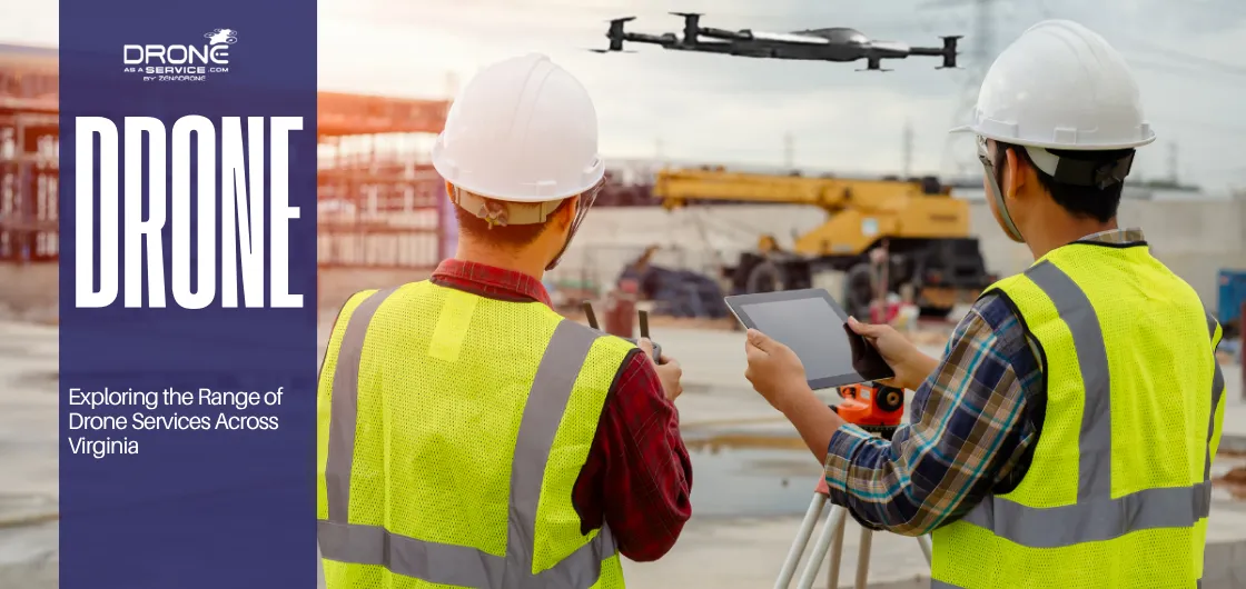
Construction and Infrastructure
The construction sector relies heavily on drone technology in Virginia to quickly calculate stockpile volumes and track daily earthmoving progress. By layering digital blueprints directly over high-resolution aerial maps, site managers can catch grading errors before they turn into expensive mistakes.
Real Estate and Land Development
Professional aerial surveys act as a crucial risk mitigation tool for land developers by revealing hidden drainage issues and tricky topographical shifts before a property purchase is finalized. On the residential side, real estate agents use these sweeping elevated views to sell the surrounding neighborhood and showcase a property’s true context.
Energy and Utilities
Utility providers use remote aerial patrols to safely inspect miles of transmission lines and pipelines that were once only reachable by foot or expensive helicopter crews. Whether teams are searching for storm damage or using thermal imaging to evaluate solar panels, drones help keep the grid running without putting technicians in danger.
Agriculture and Environmental Management
Modern farmers use advanced multispectral cameras to detect hidden crop stress days before it becomes visible to the naked eye, allowing for highly targeted irrigation and precision fertilizer application. Environmental firms rely on this exact same technology to accurately track coastal erosion along the Eastern Shore and monitor the progress of mountain reforestation projects.
Public Infrastructure and Telecom
Local governments utilize detailed drone data to safely assess the structural integrity of public facilities and bridges without needing to shut down traffic. In the telecom world, these aerial inspections have largely replaced dangerous manual tower climbs to ensure communication networks remain fully operational and secure.
Key Takeaway: Drone technology supports multiple industries by improving accuracy, reducing costs, and increasing efficiency.
Key Virginia Cities Supporting Drone Service Operations
Since drone flight teams are inherently mobile, providers don’t need an office on every corner to cover the entire state. Instead, operators offering aerial drone services in Virginia station themselves in a few strategic hubs that allow them to easily deploy equipment and crews to surrounding regions.
- Williamsburg: Williamsburg serves as a strategic operational hub for coastal and eastern Virginia projects.
- Manassas: Manassas serves as a central hub for supporting West Virginia infrastructure and development projects.
- Waynesboro: Waynesboro acts as a vital access point for projects in the mountainous western regions.
Key Takeaway: Strategic city hubs enable efficient deployment of drone services across Virginia.
How Do Drone Services Improve Planning and Decision-Making?
Drone data enables faster, evidence-based decision-making by providing accurate and reliable insights. and the real value of drone services in Virginia goes beyond just having impressive technology. It is about giving professionals the high-quality insights they need to make smarter, more confident choices.
- Accurate Data Collection: Making good decisions happens when there’s solid data backing them up. Drones capture thousands of precise data points from the sky, creating highly accurate terrain models that traditional ground sampling just cannot match.
- Visual Verification: It is practically impossible to argue with a crystal-clear aerial map during a planning meeting. This objective, overhead view reveals exactly what is happening on the ground, eliminating guesswork and keeping the entire project team on the same page.
- Risk Reduction: Catching a hidden drainage issue or a shifting slope early on can save a development from disaster. Drone surveys highlight these critical red flags before major work begins, helping managers protect their budgets and their workers.
- Faster Assessments: Because a drone can launch and map a massive site in just a few hours, teams no longer have to wait days for traditional survey results. This rapid turnaround allows managers to finalize feasibility studies and issue progress reports in record time.
Long-term Planning Support: The digital maps created by these flights serve as a perfect historical baseline for projects that span decades. Whether engineers are watching a landfill settle or ecologists are tracking new forest growth, they can easily compare current conditions against past data to see exactly what has changed.
Why Drone Services Are Increasingly Important Across Virginia
The massive shift toward aerial drone operations in Virginia is a direct response to the state’s unique geography and booming development.
Diverse Terrain
Hiking through everything from the muddy Chesapeake Bay tidal zones to the steep Appalachian ridges is exhausting and slow. Drones give a reliable, uniform way to collect site data without having to battle the actual ground conditions.
Historic and Regulated Areas
Virginia is packed with sacred historical sites and fragile ecosystems that require a completely hands-off approach to surveying. Flying drones over these locations can help in mapping out protected wetlands and heritage properties without disturbing the soil.
Infrastructure Growth
As more people move to the state, the demand for new neighborhoods, roads, and utility lines skyrockets. Commercial drone services in Virginia help make this rapid expansion possible by dramatically speeding up the complex surveys needed.
Environmental Compliance Needs
Strict rules around stormwater management and ecological protection mean local developers must maintain flawless project documentation. Aerial data provides the undeniable visual proof teams need to easily meet strict federal and local environmental standards.
Key Takeaway: Drone services are essential for managing Virginia’s diverse terrain and supporting rapid infrastructure growth.
Conclusion
In summary, drone services in Virginia play a critical role in modern surveying, inspection, and land development by providing accurate, efficient, and safe data collection. With strategic hubs such as Williamsburg, Manassas, and Waynesboro serving as critical staging points, it enables experts and professionals to deploy mapping, surveying, and inspection services statewide.
This growing accessibility allows major sectors to integrate advanced aerial systems into their operations. Applying these showcases that high-resolution data collection has a direct contribution to safer, more efficient, and highly accurate planning. As unmanned aerial systems (UAS) continue to grow, it’s clear to see that there will be an established industry standard for a more comprehensive site analysis.