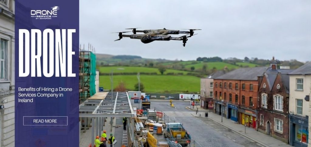
Drone as First Responder (DFR) Program and Its Benefits
Emergency response is changing quickly as new technology reshapes how first responders operate. In many high-priority calls, patrol cars can take around eight minutes to arrive, and every second during that wait can put both victims and responders at greater risk.
A Drone as First Responder (DFR) program addresses this challenge by deploying unmanned drones that are strategically stationed within a community. When a 911 call comes in, a drone is launched right away, sending live video and real-time data to the command center and the responding officers. This DFR technology gives teams crucial aerial insights within minutes, allowing them to assess the situation before arriving on scene.
Through a well-organized DFR operation process, responders can act faster, safer, and with better information. As this DFR initiative expands, it represents a major step forward in public safety, one that combines speed, awareness, and innovation to save lives.
What Is the Drone as First Responder (DFR) Program?
A Drone as First Responder (DFR) program uses drones as the first units on scene when an emergency call arrives. Instead of dispatching a person or vehicle first, a connected drone takes off automatically. Equipped with high‑definition cameras, thermal imaging, and AI analytics, it streams real‑time video but mission planners must consider range planning strategies when deploying around cities.
For example, the Chula Vista Police Department in California pioneered this approach in 2018. In their system, drones are stationed on rooftops around the city. When a 911 dispatcher is alerted to an incident, an Autel drone automatically launches from its docking station and flies to the site.
The live footage gives officers crucial intel before they arrive — including suspect locations, fire spread, traffic conditions, or other hazards. In short, DFR shifts drones from post-incident investigation to proactive first-response, significantly improving safety and efficiency.
How the DFR Program Works
DFR operations follow a streamlined, automated workflow so drones can respond in seconds. The basic steps are:
- Emergency call received: A 911 or emergency dispatch triggers the system.
- Automated drone launch: Drones housed in “drone-in-a-box” docking stations nearest the call site immediately take off. These unmanned pads protect and recharge drones until needed.
- Live video and data stream: High-definition and thermal video feeds instantly stream to the command center and to officers en route. First responders see exactly what the drone sees.
- Assessment and dispatch: Command staff (often using AI-assisted analytics) assess the live scene. They can see suspect movements, fire hotspots, victims, and more in real time. Based on this intel, they direct ground units’ tactics and resources.
- Drone returns for recharge: Once the mission is over, the drone either lands on-site on command or autonomously returns to its dock to recharge, ready for the next call.
This end-to-end process, from a call coming in to video in dispatch and then decision-making, is highly automated. In practice, it means drones often arrive at an incident faster than any ground unit. The human dispatcher or drone tele-operator watches the live feed often enhanced by FPV drone flight systems and helps guide responders. This model requires strategic placement of drone stations so coverage is citywide, but it works seamlessly when set up correctly.
Drones in automated “drone-in-a-box” docking stations are kept on standby for rapid deployment. In a DFR system, these stations let drones take off on their own within seconds of a 911 call and send live video to dispatch as they fly over.
Key Technologies Powering the DFR Program
Several cutting-edge technologies enable DFR systems to work effectively:
Artificial Intelligence (AI) & Machine Learning
Advanced AI allows drones to fly autonomously and aids operators in threat detection. Modern DFR programs increasingly use AI for things like automated navigation, object recognition, and pattern detection. Experts note that DFR is moving toward greater automation and AI integration, which will create even faster, more effective responses.
Beyond-Visual-Line-of-Sight (BVLOS) Capabilities
DFR often requires drones to fly beyond the operator’s visual range and over people. Normally, these are restricted under standard Part 107 rules. However, many agencies have obtained FAA waivers or new authorizations. In fact, recent rule changes are making long-range autonomous drone operations easier for public safety. Having BVLOS clearance means a drone can cover many miles quickly without human spotters.
Automated Docking Stations
Also called drone-in-a-box systems, these stations store the drones, recharge their batteries, and manage automatic takeoff and landing. This setup keeps each unit ready around the clock. When a call is received, the system sends a signal to the nearest dock, and the drone launches right away. After completing its flight, it returns to the station, lands safely, and recharges in preparation for the next deployment.
High-Resolution Cameras (Optical and Thermal)
DFR drones have advanced sensors that can take clear, reliable pictures in any setting. The optical HD camera takes clear pictures during the day, and the thermal camera can find heat sources even through smoke, fog, or thick plants.
This technology can help find people who are lost in the woods or find places in buildings where fires are hot. These sensors work together to give responders a constant, accurate view of what’s going on on the ground, which helps them act quickly and safely.
5G and High-Speed Connectivity
Many DFR systems use 5G or specialized communication links to send high-bandwidth video in real time. In a German 5G emergency drone project, drones automatically flew beyond visual line of sight (BVLOS). They streamed live 4K video over 5G to the control center before any fire trucks departed. High-speed networks ensure minimal delay in getting drone footage to decision-makers.
Together, these technologies let DFR drones launch within seconds of a dispatch, gather rich data, and safely return, all largely without human pilot intervention.
Major Benefits of the Drone as First Responder (DFR) Program
Cities and departments using DFR report significant gains across multiple areas. Key benefits include:
| Benefit Category | Description |
|---|---|
| Rapid Response Times | Drones arrive in ~3–4 minutes—nearly twice as fast as patrol cars—providing the first visual assessment and enabling quicker, lifesaving decisions. |
| Improved Situational Awareness | Real-time aerial views show suspect movement, fire spread, traffic, and hazards, helping command teams allocate resources safely and efficiently. |
| Officer & Public Safety | Drones assess dangerous scenes before personnel enter, reducing risk. In many non-critical cases, drone footage prevents unnecessary officer dispatch and supports de-escalation. |
| Cost-Effective Operations | Drones cost far less to operate than helicopters or multiple ground units, reduce unnecessary dispatches, and let officers focus on high-priority calls. |
| Community Trust & Transparency | Real-time data, documented responses, and published DFR performance metrics improve transparency, reduce privacy concerns, and strengthen public trust. |
In summary, by arriving quickly with on-scene intelligence, drones help solve incidents more safely, swiftly, and efficiently.
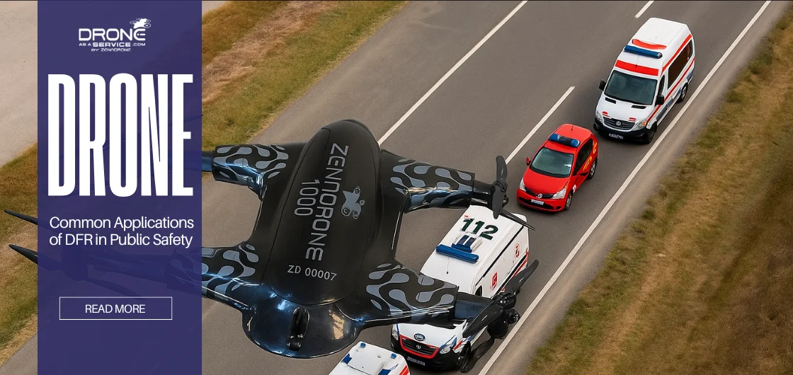
Common Applications of DFR in Public Safety
Drones as first responders have proven useful across a wide range of emergency scenarios:
Search and Rescue Missions
DFR drones can rapidly scan vast areas in wilderness or large-scale searches. Equipped with thermal cameras, they detect human heat signatures day or night. This capability dramatically cuts search time for missing hikers or stranded victims. For instance, a thermal-equipped drone can find a person lost in a dense forest within minutes, which might take hours on foot.
Traffic Accident Response
A drone can fly overhead in seconds when a serious crash occurs. The live aerial view helps dispatchers see which lanes are blocked, identify injured parties, and spot secondary hazards (fire, leaking fluids). This allows traffic control crews to adjust signals and ambulances to choose the best approach paths. As one example explains, drones “reach the scene quickly and provide a comprehensive aerial view to assess the extent and severity of the incident.”
Fire and Disaster Management
During building fires, wildfires, floods, or storms, DFR drones give incident commanders a realtime picture of danger zones. A thermal-imaging drone can locate hotspot flames hidden by smoke or trees.
Drones map damage and find survivors in debris fields after disasters (hurricanes, earthquakes, avalanches). High-resolution surveys from above inform where to send crews or supplies. The City of Chula Vista and others use drones at disaster onset for such assessments, saving precious response minutes.
Law Enforcement Support
In crimes in progress or violent incidents, drones provide live overwatch. They can track suspects on the move, monitor perimeters, and even broadcast deterrent warnings (lights, speakers). Aerial drones have been used to surround barricaded suspects or scan large party disturbances.
In one case study, officers noted a drone’s “live feed helped avoid sending a patrol” to a domestic dispute scene, preventing unnecessary risk. In practice, DFR drones support everything from active shooter calls to disturbances, quickly identifying threats and informing tactical plans.
Additional applications are emerging, like medical payload delivery (e.g., drones carrying AEDs or naloxone to a cardiac arrest or overdose scene in seconds) and monitoring public events or crowds. The bottom line is that DFR drones can help responders anytime they need a fast aerial perspective.
Case Studies and Real-World Examples
Several U.S. cities have demonstrated the tangible benefits of DFR:
| Location / Agency | Key Findings & Impact |
|---|---|
| Chula Vista, CA (CVPD) | The pioneer of DFR since 2018, with drones responding to over 20,000 emergency calls by mid-2025. Average drone arrival time: ~3.5 minutes vs. ~8 minutes for patrol units. Drone footage has aided safer, data-driven decisions, canceled thousands of unnecessary vehicle dispatches, supported over 3,000 arrests, and improved officer safety. |
| Fremont, CA | Launched a joint police-fire DFR program in 2024. Drones deploy citywide on 911 calls and often arrive within minutes. Real-time feed helps distinguish urgent vs. routine situations. Uses unified command software (DroneSense) and multiple rooftop stations. Described as a “force multiplier” for safety and resource allocation. |
| Other Agencies (NV, MD & beyond) | Agencies including Sparks NV, Valley of Fire PD (NV), and Montgomery County MD operate DFR units. Over 1,500 U.S. law enforcement agencies had drone programs by 2020, with rapid expansion since. Common results include improved situational awareness, reduced risk, and smarter ground response due to faster drone arrival. |
These real-world cases underscore DFR’s impact: drones are already proven to slash response times, give clear tactical intel, and keep officers safer.
The first-generation DFR drone used by the Chula Vista Police Department sits on its launch pad, always ready for dispatch. Since the program began in 2018, these Autel EVO II drones have responded to more than 20,000 calls, giving officers valuable real-time awareness that helps them manage incidents more effectively and safely.
Training and Integration for First Responders
The teams that run and support drone operations also need to get a lot of training before they can start a DFR program. Most agencies have special UAS units made up of certified drone pilots and police or fire personnel who have been trained to use them. There are often both sworn officers and civilian staff on these teams.
For instance, the Elk Grove Police Department in California has a UAS program with 30 FAA-certified drone pilots who work there. Patrol officers are taught to be visual observers and help pilots during missions. This hands-on, cross-trained method makes sure that every flight is safe, follows the rules, and works as well as possible.
Agencies also rely on experienced partners and practical resources. Drone manufacturers often work closely with police and fire departments to develop solutions that fit local needs. There are specialized courses and certifications for public safety drone use.
For example, PublicSafetyUAS offers a 32-hour “Drones for First Responders” course that helps departments stand up a DFR program and train pilots. The National Fire Protection Association provides online modules on using drones for fire response and safety. Hands-on training and exercises matter too.
Simulation tools and events like the RISE DFR Village give teams a chance to practice real-world scenarios in a controlled setting. These partnerships, courses, and drills help agencies choose the right DFR technology, shape a clear DFR operation process, and run safer, more effective DFR initiatives.
In practice, new DFR programs emphasize ongoing learning. Officers undergo advanced training for BVLOS operations and emergency scenarios. Manufacturers like DroneSense or Autel host workshops on using the equipment and software.
The goal is seamless integration: field teams know how to interpret its feed and combine it with their tactics when a drone is on scene. With the right training and collaboration, drones become an extension of the first responder toolkit.
Challenges and Considerations
Despite its promise, DFR programs face several challenges that planners must address: Investing in Resources: To start a DFR program, you need to pay for tough drones, docking stations, command software, and staff training up front. Smaller agencies often look for grants or work with other nearby jurisdictions. A lot of agencies say that the long-term safety and efficiency benefits make the initial cost worth it.
Operational Limits
Drones have finite endurance (typically 20–40 minutes of flight) and are affected by weather (high winds, rain) or GPS issues. Planners must position stations densely enough to cover key areas within range. They also need backup plans (e.g., quick swap to a second drone) for critical incidents. Data management is another consideration: high-res video requires secure networks and storage. Many programs encrypt their video streams and use secure servers to protect data.
Regulatory Compliance
The FAA’s current rules make it hard for a lot of DFR flight profiles, like BVLOS, flights over people, and nighttime operations, to happen without getting special permission from an agency.
For example, teams usually need a Certificate of Authorization or a Part 107 waiver to do things like that. You need to make a good DFR program to show the people in charge that you have clear ways to run your business, strong safety rules, and ways to lower risk.
Policy changes in 2024 are starting to lift some of the restrictions. Some BVLOS operations are now allowed, but only if certain conditions are met. It can still take a long time to get approvals, and you usually need to know a lot about technology and keep good records to do it. Agencies should plan for that time and think about hiring people who know a lot about rules to help them get through it.
Public Perception and Privacy
People often worry about privacy when drones fly overhead, and community concern can stall programs if it is not addressed. Agencies solve this by being transparent about when and how DFR is used, for example limiting flights to active emergencies rather than routine surveillance, and by publishing policies and flight records for public review.
Departments hold community meetings, invite feedback, and share performance data to show how drones help save lives and speed responses. The Elk Grove Police Department, for example, highlights openness and resident input as central to its DFR work. Clear rules, regular public engagement, and strict data-retention policies build trust and reduce the chance of misuse.
By carefully planning around these challenges, public safety agencies can responsibly harness the benefits of DFR technology.
The Future of Drone as First Responder Programs
AI-driven, autonomous drones will enhance emergency response with faster deployment, smarter insights, and seamless smart-city integration.
| Future Trend | Description |
|---|---|
| AI-Driven Autonomous Fleets | Drones will increasingly fly themselves using onboard AI to detect people, vehicles, and hazards in real time. Autonomous positioning will allow drones to pre-deploy at high-risk areas before emergencies occur. |
| Smart City Integration | Future DFR systems may connect with traffic sensors, gunshot detectors, and building alarms. This enables automated drone launches based on real-time citywide sensor inputs. |
| DFR 3.0 Ecosystem | According to experts like Rahul Sidhu (Flock Safety), DFR 3.0 will combine cloud-connected drones with real-time crime centers, ALPRs, and other technologies to speed response and improve coordination. |
| Expansion Across Departments | DFR will extend beyond police. Fire, EMS, disaster response, and search-and-rescue agencies will use drones for rapid situational awareness and resource allocation. International trials (e.g., UK police) already show early success. |
| Advancements in Drone Hardware | Better batteries, enhanced sensors, and stronger communications networks will support large-scale autonomous drone fleets, making DFR more reliable and widely deployable. |
| Global Adoption & Standardization | As regulations evolve, DFR programs are expected to expand worldwide. Routine use of drones as first-arrival “mobile sensors” will make emergency response faster, safer, and more efficient. |
| Community Trust & Operational Maturity | With improved training, transparent communication, and clear operating processes, DFR will become a trusted and standard element of emergency response systems globally. |
Public Awareness and Community Engagement
For DFR programs to thrive, the public must understand and accept their use. Many agencies proactively educate citizens about the benefits. This can include demonstrations at community events, explanatory videos, and press coverage of success stories. People are more likely to see drones as lifesavers than nuisances when they are shown how they can help in real-life situations, like how a drone saved a life in a car crash or found a lost child.
It’s just as important to have transparency initiatives. For instance, some departments, like Montgomery County, MD, have public online dashboards that show how often drones flew, how long it took to respond, and what happened. Others hold town hall meetings to explain policies and gather feedback. As the Police Chief magazine notes, sharing success stories and inviting input demonstrate that the drone program is “a resource dedicated to enhancing public safety” rather than secret surveillance.
Many cities are involving community groups as they develop their drone policies. Agencies make it clear what data is collected, how long it is stored, and how it is used. They also point out specific safeguards, such as keeping a drone’s camera aimed at the horizon while in transit to avoid recording private areas, or only streaming video during active emergencies. Building this kind of transparency helps earn public trust and reduces resistance. As the Elk Grove Police Department explains, “Building strong community relationships is essential to the success of our DFR program.”
A well-implemented outreach program helps the public see drones as allies in safety. Over time, successful DFR operations and transparent practices make drones a trusted, expected part of modern emergency response.
Conclusion
The Drone as First Responder (DFR) program is one of the most important new technologies for keeping people safe in recent years. By sending drones ahead of ground units, agencies can get a good idea of what’s going on right away, respond faster, and make things safer for both officers and the public.
Real-world DFR initiatives in cities like Chula Vista and Fremont prove that this approach is not just a concept on paper. It is already reshaping how emergencies are managed every day. While there are challenges such as regulatory limits and community concerns, the direction forward is clear. With continued progress in technology, specialized training, and open communication with the public, DFR programs are set to become a key part of modern emergency response. Drones are no longer just tools for observation.
Through DFR technology, they are becoming true first responders, delivering critical and life-saving information when every second counts.