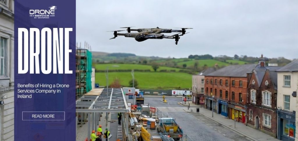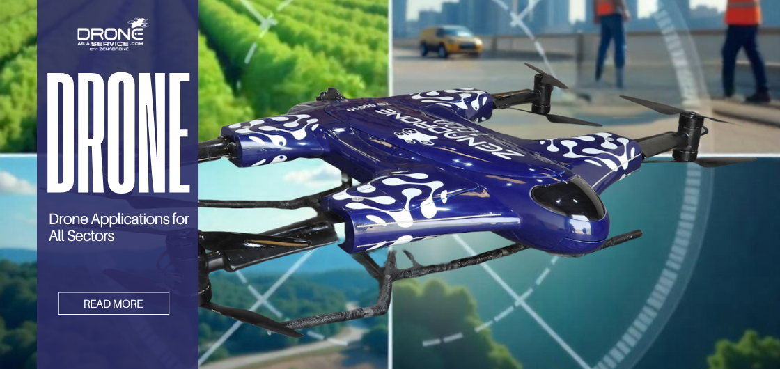
Drone Applications for All Sectors
Drone applications refer to the practical uses of drones (unmanned aerial vehicles) across various industries and sectors. These applications leverage drones’ abilities to capture aerial data, perform inspections, deliver goods, or monitor environments—tasks that were once expensive, risky, or time-consuming for humans.
This guide details how drones are rapidly reshaping industries today and explores the most impactful UAV applications.
Integration of Drones with GIS Technology
Because drones fly at lower altitudes than traditional aircraft, they can capture data with centimeter-level precision.
Geographic Information System (GIS) processes that information into actionable maps, such as 3D point clouds and digital terrain models, further enhanced by the capabilities of advanced mapping sensors. Also, it georeferences the data, locking in exact locations, which eliminates the guesswork from surveying and planning.
Key use cases in agriculture, construction, and infrastructure
The combination of drone and GIS technology is highly valuable across various industries.
- Agriculture: Farmers can now easily see their problem areas because, with GIS, crop health can be layered within field boundaries. As a result, it allows farmers to apply pesticides only to the affected areas.
- Construction: Since drones can produce 3D models for comparison with the initial GIS plans, they can quickly spot errors and avoid delays.
Infrastructure: When drones inspect bridges and pipelines, they flag the exact locations of any issues. Then GIS maps this information onto blueprints, helping teams plan maintenance and keep assets in good condition for an extended period.
Precision Farming with Drones
Drone applications are now being modernized. By supporting precision farming, drones improve crop yields, optimize resource allocation, and make farming more efficient and sustainable.
Crop health monitoring and precision spraying
Multispectral sensors on drones can see things that the human eye can’t. This information is used to make Normalized Difference Vegetation Index (NDVI) maps that show how healthy crops are.
At the same time, drones can spray crops accurately. Farmers can use fewer chemicals because they know exactly where they are needed. Hence, it also helps them lessen chemical exposure while producing healthier fields.
Irrigation management and soil analysis
Drones not only monitor and treat crops but also help manage irrigation and soil health. Thermal cameras can detect areas with water stress or uneven watering. Soil maps show where nutrients are lacking, allowing farmers to apply water and fertilizers only where they are needed.
Zenadrone 1000 for precision agriculture and large-scale farm operations
If it is about tough farming work, the ZenaDrone 1000 is a great choice. Thanks to its long flight time, you can make field monitoring easier than ever. Its high-capacity spraying system covers large areas accurately, helping farmers boost productivity and get the most from their investments.
Drones in Smart Cities
Smart cities still rely on continuous, real-time data to efficiently manage complex urban systems. UAV applications provide crucial aerial intelligence necessary for management.
Drones have changed how cities manage urban planning, public safety, and utility maintenance, making jobs faster, safer, and more efficient.
Optimal Site Selection and Asset Deployment
Drones help determine optimal project locations by creating detailed 3D models of urban landscapes. In identifying the most efficient locations, these drones help speed up the planning process and support more sustainable development.
Urban Planning
It’s important to understand the basic components of drone applications for successful city integration. And with drone mapping, critical information, such as detailed land-use analysis, is obtained to help guide sustainable zoning.
Drones also provide real-time data that helps identify congestion points, enabling citywide optimization and making the city more responsive and efficient.
Smart City Management
Drones are important devices for monitoring and inspecting utilities like water pipes and electrical grids, which keep urban services running smoothly. Drones assist in waste management by tracking and optimizing collection routes and enhancing public safety by providing rapid aerial surveillance. Altogether, these UAV applications provide a continuous, reliable eye for the authority.
ZenaDrone IQ Nano
Built for agility and precision, especially for densely populated areas. Its compact, lightweight design makes it ideal for continuous urban monitoring missions.
ZenaDrone’s IQ nano’s quiet operations and advanced navigation support discreet surveillance, which makes it excellent for quick deployment in public safety missions and local environmental monitoring.
Smart Supply Chain Applications
In the logistics sector, a major shift is driven by new applications of drone technology. Drones are helping global supply chains run faster, more resiliently, and more efficiently.
They offer services from the last mile to urgent delivery needs.
Healthcare
In medical logistics, drones are used for rapid medical transports by delivering urgent medicines, vaccines, and lab samples faster than normal. Flying over congested roads, they’ve significantly improved the response times of medical emergencies. Serving as a critical advantage, especially for remote areas.
Disaster Management
In natural disasters, crisis response must be immediate. Drones assist first responders in conducting aerial assessments in order for them to have situational awareness, which helps them act quickly and safely. They also provide safe and accurate supply drops in affected areas.
Delivery Services
Logistic companies use drones in their delivery networks, specifically for last-mile logistics and fast food delivery. The shift made the supply chain more reliable and sustainable. Other providers also offer drones as applications as a service for scalability.
Zenadrone solutions for reliable supply chain operations
Zenadrone offers dependable autonomous drones for today’s supply chains. Transporting packages and essential supplies fast and efficiently, while ensuring they reach the right place. We provide the technology you need for smooth, high-volume deliveries.
Mapping, Tracking, and Monitoring
Drones are unmatched when it comes to large-scale surveillance, security, and long-range industrial inspections. With their long flight times and advanced sensors, they provide reliable coverage where traditional methods fall short.
Crowd Management and Control
In monitoring large public gatherings and sporting events, drones give the security teams a clear view. They provide high quality and an elevated perspective for security. This real-time aerial feed helps identify risks, guide crowd movement, and ensure quick access for emergency responders.
Security and Surveillance
Modern perimeters are now heavily reliant on drones, especially in patrolling sensitive sites and detecting intrusions. UAVs’ applications are also fundamental for supporting border operations; basically, a cost-effective layer of defense.
Wildlife and Forest Monitoring
For conservationists, drones are a game-changer; they utilize these devices to monitor endangered species at a distance without disturbing their natural habitat. Also, to track populations and monitor forests for any health issues, and detect threats like poaching.
Military Applications
Military drone applications are critically focused on reconnaissance, intelligence gathering, and target acquisition. The drones’ long endurance and real-time surveillance give ground forces an immediate situational awareness of the battlefield.
Oil and Gas Pipeline Monitoring
Inspecting miles of pipeline across remote terrain can be time-consuming, dangerous, and expensive, but drones have made this easier. Equipped with thermal and optical sensors, drones can easily cover vast distances quickly.
These applications of drone technology can detect leaks, erosion, and encroachments. Note that the capability of these drones during long missions depends heavily on the UAV’s maximum flight range.
Zenadrone 1000 for long-range industrial inspections
It is built for endurance, with a powerful battery and robust flight management system. ZenaDrone 1000 can support extended long-range missions. Making it a superior platform for gas and oil pipeline inspections. The drone significantly reduces the time, cost, and risk that are associated with traditional methods.
Zenadrone 1000
For demanding commercial operations, the Zenadrone 1000 is designed for you.
Features
It’s compact and lightweight, can easily be handled, and rapidly deployed. Fitted with advanced smart navigation, it can easily maneuver confined spaces. Also, it can integrate seamlessly with high-definition optical cameras for surveillance.
Benefits
Also known as a versatile drone, which is ideal for smart city management and urban surveillance. It can monitor surrounding areas with minimal operational footprint. Also, it delivers critical, real-time data quickly and efficiently.
ZenaDrone IQ Nano
Known for its agility and precision, especially for densely populated areas, is the ZenaDrone IQ Nano.
Features
It’s compact and lightweight, can easily be handled, and rapidly deployed. Fitted with advanced smart navigation, it can easily maneuver confined spaces. Also, it can integrate seamlessly with high-definition optical cameras for surveillance.
Benefits
Also known as a versatile drone, which is ideal for smart city management and urban surveillance. It can monitor surrounding areas with minimal operational footprint. Also, it delivers critical, real-time data quickly and efficiently.
Challenges of Drone and GIS Applications
The mass adoption of drone technology still faces hurdles, even though it has been modernized.
Regulatory restrictions, privacy concerns
Different regions have complex rules and can vary globally. Public concerns about aerial surveillance often restrict commercial drone operations. Hence, it is essential to have enough knowledge and follow the necessary protocols before deploying a drone.
Battery limitations, weather impact
Current battery technology continues to limit drone endurance and payload capacity. High winds and heavy rain can significantly shorten flight duration by minutes. Thus, it is advisable to choose a drone that can deal with these concerns without compromising the operational goal.
Top Benefits of Drone Applications
Drones have revolutionized operations across multiple sectors by offering speed, precision, and accessibility. One of the biggest advantages of drone applications is cost efficiency—reducing the need for manual labor and expensive equipment for inspections, mapping, or surveillance.
Another major benefit is enhanced safety. Drones can reach hazardous or hard-to-access locations, keeping human workers out of danger. They also deliver real-time data and high-resolution imagery, allowing organizations to make faster and more accurate decisions.
From agriculture to construction and energy, drone technology improves productivity, ensures better monitoring, and supports smarter planning—making it a valuable asset for both small businesses and large enterprises.
Future Recommendations
In the future, there should be some addressing of regulatory and technological gaps in UAV applications to truly unlock their full potential. Governments need to strive towards standardized global operational guidelines. Industries should put effort into focusing on battery longevity and enhanced weatherproofing.
For drones to grow further, they need better integration with existing infrastructure, using AI, automation, and 5G networks.
Trends in Drone Applications
The course of drone technology points toward an increasingly autonomous future.
AI-driven automation and predictive analytics
AI will manage complex flight operations autonomously, minimizing human input while providing predictive maintenance insights from sensors.
Drone swarming and collaborative missions
Multiple drones will work together as a synchronized unit on large-scale tasks faster and more efficiently.
Urban air mobility (passenger drones, heavy cargo drones)
The development of large, certified drones will redefine transportation through urban aerial mobility, including passenger transport and heavy-lift operations in modern cities..
Conclusion
The many drone applications discussed here confirm that the technology has a revolutionary impact. Drones are essential for optimizing agriculture, logistics, security, and smart city infrastructure. They are safe, efficient, and sustainable; truly the key to a better future.
And the Zenadrone 1000 and ZenaDrone IQ Nano put us closer to that future, as both drones can provide powerful and reliable systems that shape the next generation of drones.
FAQs
What are drones used for?
Drones are primarily used for aerial surveying, precise and detailed monitoring, and delivering packages, which has transformed industries by providing cost-effective aerial data collection.
What are the most common applications of drones today?
The usuals are the drone map sites, survey lands, capture photos, and monitor crops, becoming an essential tool in various construction and agricultural operations.
How do drones improve efficiency in business and industrial operations?
Drones streamline inspection and maintenance through automation and real-time information, which spot problems early and maximize productivity.
What industries benefit the most from drone technology?
Major industries, including construction, energy, farming, and public safety, benefit most from UAVs.
What are the main advantages of using drones for delivery and logistics?
They’re faster, cheaper, and sustainable, by easily skipping traffic, which reduces costs and carbon emissions.
Are drones safe to use commercially?
Yes, as long as you follow regulations like FAA Part 107, commercial drones are safe to use.
What are the legal requirements for operating drones in different regions?
Legal requirements may differ by region, but most require certified pilots, registered aircraft, and strict observance to ensure safety; so it’s best to research before heading out.
Can drones be used in harsh weather or extreme environments?
Although some drones can handle harsh conditions, severe weather such as high winds, heavy rain, and extreme temperatures reduces battery life, destabilizing flight, which poses risks.
What privacy or security concerns are associated with drone use?
Unauthorized surveillance and securing high-resolution data are major concerns associated with drone use, making clear regulations and encryption protocols necessary to secure privacy and safety.
What is the future of drone technology across various sectors?
The future of drone technology will lie in AI-driven autonomy, with swarm coordination and Urban Air Mobility (UAM) to expand complexity and become integral to modern infrastructure and daily services.