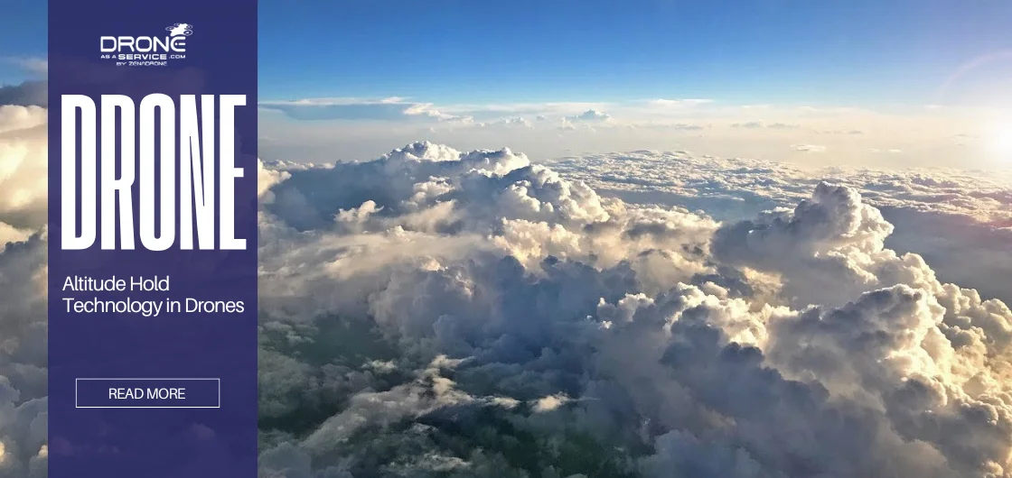
Altitude Hold Technology in Drones: Stability, Control, and Flight
Before technological developments, drones were viewed as niche gadgets. Today, it is widely used across various industries. As a result, they have transformed photography, mapping, agriculture, and emergency management. This transformation has made flight accuracy in drones critical for both professional and recreational users.
As technology develops, there is an increasing demand for reliable drone stability and precision drone flying. Reliable flight performance is essential for aerial imaging, inspecting infrastructure, and delivering packages effectively.
Today, manufacturers and operators both focus on developing accurate flight control systems.
What is Altitude Hold Technology?
Altitude Hold Technology enables a drone to maintain a consistent altitude automatically, simplifying operation for the pilot. It makes flying safer and makes the drone easier to control. Today, drone altitude hold is a standard part of most modern drones to keep them stable, especially under challenging conditions.
With drone altitude hold, pilots can focus on precision drone flying without needing to adjust the throttle. It also makes it more stable to achieve flight accuracy in drones. No matter your experience level, you can get steady, professional results.
How Altitude Hold Technology Works
Today’s altitude hold systems use advanced sensors and smart flight controls. They allow stable drone flight. Automatic altitude control enables pilots to focus more on navigation tasks instead of manually adjusting the throttle.
Sensors Involved: Barometers, GPS, Ultrasonic, and LiDAR
Altitude Hold Technology utilizes various sensors to determine the altitude at which a drone is operating.
- Barometers assess air pressure to estimate variations in altitude.
- Global Positioning System (GPS) modules calculate altitude based on geographic coordinates, which is particularly advantageous for outdoor operations.
- Ultrasonic sensors determine the distance between the drone and the ground, making them especially effective for maintaining stable low-altitude hovering.
- LiDAR sensors send out laser pulses to find the exact distance to objects or the ground. They help the drone stay steady in tricky environments.
Advanced sensors help drones figure out their exact position in the sky. These sensors make sure flights stay smooth even under challenging conditions.
Detecting and Maintaining Altitude Automatically
The altitude hold system checks the drone’s height using its sensors. Afterwards, it compares it to the level the pilot set. If the height changes, the system brings the drone back to the right level automatically.
Integration with Flight Control Systems
The sensor and the flight control system work together so the drone can adjust quickly and smoothly. Together, both keep the drone at the right height.
Automatic Throttle Adjustments
Altitude Hold Technology automatically adjusts the throttle. It keeps the drone stable and level.
Drone altitude hold works by using smart sensors, precise flight controls, and automatic speed changes. These features make flying easy and dependable. Furthermore, automatic altitude control helps drones fly smoothly and stay on track.
Drone altitude hold works by using smart sensors, precise flight controls, and automatic speed changes. These features make flying easy and dependable. Furthermore, automatic altitude control helps drones fly smoothly and stay on track.
Benefits of Altitude Hold for Drone Stability
Maintaining a steady altitude is key to using drones safely and efficiently. Altitude Hold Technology lets drones stay at the same height, making them easier to fly and work better. The drone altitude hold feature handles tasks such as land surveying and capturing clear aerial photographs.
The primary advantages of this feature include the following:
Enables Drones to Hover Steadily in One Spot
Drones that maintain a consistent altitude are capable of hovering directly above a designated target area. Stable drone flight enhances the precision of data collection and reduces the risk of positional drift during critical measurement procedures.
Reduces Pilot Workload During Complex Maneuvers
The drone altitude hold function enables pilots to concentrate on navigation rather than continuously adjusting the drone’s height.
Minimizes Sudden Altitude Drops and Potential Crashes
Drone Altitude Hold Technology enables drones to monitor their altitude and automatically adjust to maintain a consistent height. It helps them retain stable drone flight.
Supports Smooth and Consistent Aerial Photography
Keeping your drone at a steady altitude helps you capture clear, high-quality footage. Altitude Hold Technology stabilizes the camera and reduces image blur, thereby facilitating the capture of high-quality images in challenging conditions.
In short, Altitude Hold Technology helps drones stay at the same height. Thus, making it easier for them to achieve stable drone flight and precision drone flying during shooting.
Enhancing Flight Control Through Altitude Hold
Drone altitude hold makes the drone easier to control. It helps flights become more precise and efficient. Automatic altitude control lets pilots focus on flying, collecting data, or filming instead of constantly adjusting the height. This feature contributes to safer flight accuracy in drones.
Here’s how altitude hold enhances drone control:
Allows Precise Lateral and Forward Movements
With a steady altitude, drones can move sideways and forward with better accuracy. Precise measurements matter for mapping, inspecting infrastructure, and monitoring mining sites.
Improves Navigation During Inspections and Surveys
The drone altitude hold feature allows operators to position drones more precisely and keep them stable. It makes data gathering more accurate without repeated flights.
Helps Maintain Consistent Speed and Altitude Simultaneously
Optimal drone performance is achieved when it operates at a consistent altitude and velocity. Stable drone flight makes it easier for the operator to control and produces more precise data and images.
Makes Flying Drones Easier for Beginners
Many new pilots struggle with throttle control. When you have a drone altitude hold, it keeps the same height on its own. It lets beginners focus more on steering and using the camera, making flying easier and more enjoyable.
Flight Safety With Altitude Hold System
Drone safety is essential for all users. Altitude Hold Technology allows drones to maintain a consistent altitude, thereby reducing safety risks and improving precision drone flying.
Adding altitude hold to drones makes flying them safer in several important ways:
Reduces the Risk of Accidents in Crowded or Challenging Areas
Drones equipped with drone altitude hold technology are less likely to collide with obstacles or individuals. This capability is particularly advantageous for land surveys, energy inspections, and various industrial applications.
Prevents Sudden Descents That Can Damage Equipment
Automatic altitude control helps keep your drone steady, even in strong winds, to protect your drone and its payload.
Supports Safe Indoor and Outdoor Operations
Drone altitude hold keeps the drone steady, whether it is flying inside or outside. This drone stability is essential for collecting accurate data in different places and types of work.
Enhances Reliability in Professional Drone Applications
Industries that use drones require reliable control and predictability. Drone altitude hold stabilizes the drone, making the operation more straightforward. As a result, users can rely on the drone more and feel more confident when flying it. Consequently, this allows operators to focus on precision drone flying, thereby delivering high-quality results.
Altitude Hold Technology is essential for keeping drone flights safe and steady. It helps prevent accidents and stops the drone from dropping suddenly. It also works well both indoors and outdoors, making drones more dependable.
The extra drone stability and control help protect both the equipment and the people nearby. It allows for precision drone flying in many professional situations.
Given these reasons, drone altitude hold is essential for safe and efficient drone use.
The Role of Altitude Hold in Aerial Imaging and Videography
To capture sharp, professional images and videos, you need more than just a good camera. Steady flight control is essential. Altitude hold technology enhances stability and flight accuracy in drones. It allows pilots to focus on capturing the desired shot without constant altitude adjustments.
Drone altitude hold in aerial photography and videography has the following functions:
Enables Smooth Camera Panning and Tracking Shots
Altitude hold technology keeps the drone at a steady height, so it’s easier to fly smoothly and follow your subject. It makes it simple to capture cinematic shots and smooth motion. It’s invaluable for real estate, landscape, and industrial videos.
Maintains Consistent Framing for High-Quality Images
With automatic altitude control, your subject stays in frame while you film. This feature keeps the drone steady, making it easier to capture sharp, professional images. You can concentrate on your work without having to worry about a bumpy flight.
Reduces Motion Blur Caused by Sudden Altitude Changes
If a drone changes altitude quickly, you may see shaky footage or motion blur. Drone altitude hold helps prevent these problems. This feature lets you take clear photos and smooth videos, even when flying in tricky situations.
Helps Capture Stable Shots in Windy Conditions
Wind gusts can make drones unstable and reduce image quality. Using altitude hold helps keep the drone steady and improves your images.
Producing aerial photos and videos requires quality and reliability in drones. Drone altitude hold helps users achieve stable drone flight, thereby making camera movements smoother. It also helps in keeping the camera well-framed, decreases motion blur, and allows drones to handle wind.
This feature lets operators achieve flight accuracy in drones with less effort. It also makes it easier and safer to capture high-quality visuals in many situations.
Key Applications in Industrial and Commercial Sectors
An altitude hold system helps industrial and commercial drones work better. With this technology, operators can manage complex tasks more precisely, safely, and efficiently.
Here are some ways altitude hold is used in industrial and commercial drones.
Land Surveying and Mapping with Precise Altitude
When surveying and mapping, keeping a steady altitude helps you collect accurate topographical data. Drones use an altitude hold system to hover in place. It allows them to provide precise measurements and reliable geospatial results across a range of industries.
Infrastructure Inspections of Bridges, Towers, and Pipelines
When drones inspect large or tall structures, they need to remain stable and steer clear of obstacles. The altitude hold system helps drones fly smoothly while checking bridges, towers, pipelines, and other key sites. It reduces risks for both people and equipment.
Agriculture Monitoring for Crop Health and Irrigation Planning
Drone stability at a steady altitude helps when surveying large farm fields. By flying at the same height, they collect even images and multispectral data.
Search and Rescue Operations Requiring Precise Hovering
During emergencies, drones need stability when searching for missing people or inspecting dangerous areas. The Altitude Hold System lets them hover in one spot.
Altitude Hold Technology in Beginner-Friendly Drones
Altitude Hold Technology helps keep the drone at a steady height, making flying easier. It improves stability and flight accuracy in drones. This way, new pilots can focus on steering and exploring without worrying about the throttle.
How does altitude hold function in beginner-friendly drones?
It Simplifies Flight Controls for First-Time Pilots
Automatic Altitude Control lets drones stay in one spot with very little manual input. This stable drone flight makes it easier to practice moving and turning the camera without worrying about controlling the height.
It Reduces Anxiety and Potential Crashes During Training
Sudden drops or crashes can be avoided when the drone is at a steady height. Beginners can practice safely with drone altitude hold. It can also help in improving their flying skills as it gives them more control.
It Encourages Faster Learning and Skill Development
Automatic altitude control lets beginners focus on navigation, speed, and getting comfortable with their environment. This feature makes learning easier and helps users build skills for both recreational and semi-professional precision drone flying.
Makes Drones More Accessible to Hobbyists and Enthusiasts
It is easier to use drones with altitude hold technology. Hence, even hobbyists can fly them. Even if you do not have enough experience, drone altitude hold can keep your drones steady. It will help you take photos, explore, or survey around.
The altitude hold system helps beginners learn to fly drones with stable drone flight and control their height automatically. It reduces the chance of crashes, makes the controls more straightforward to use, and allows for precision drone flying.
As a result, new pilots can build confidence and improve their skills. With steady automatic altitude control, drones are safer, more enjoyable, and easier for everyone to use.
Challenges and Limitations of Altitude Hold
Altitude hold technology, as with any manufactured improvement, is not perfect. When operators understand its limits, it will help them fly safely and know what to expect when operating drones.
Here are some of its challenges and limitations:
Sensor Errors in Extreme Weather Conditions
Bad weather, like strong winds, heavy rain, or sudden changes in temperature, affects the sensors in the altitude hold system. Drones become less stable when faced with interference.
Difficulty Maintaining Altitude Over Uneven Terrain
When drones fly over different types of ground, sensors that use sound or light to measure distance might not work well. Stabilized drone flight can be difficult if the ground level changes quickly.
Increased Battery Consumption
Changing altitude often makes the motors work harder and can shorten flight time. When planning missions, operators should remember this to help the battery last through the entire job and keep things safe.
Not a Replacement for Skilled Manual Control
Despite the accuracy and ease that drone altitude hold provides, pilots still need skill. You still need to steer around obstacles and use manual control and good judgment during emergencies.
What these challenges teach us is that technology cannot fully replace a pilot’s skills. Learning these challenges and limitations allows us to understand drone flying better.
Future Developments in Altitude Hold Technology
With the improvements in altitude drone technology, altitude hold systems are now integrated with AI, machine learning, and advanced sensors. These novel features will assist drones further and expand their utilization in various industries.
Here are some of the future developments within the altitude hold technology:
Integration with AI and Machine Learning for Smarter Control
AI and machine learning go hand in hand with altitude hold technology. With this, improvements in predictability and reactivity are in place. It is helpful for sudden environmental changes.
The combination will also make drone flight more adaptive and reduce pilot input. It also improves precision drone flying even during harsh conditions.
Advanced Obstacle Detection to Improve Drone Stability
Spotting and avoiding obstacles as they happen will be more possible with future systems using LiDAR, ultrasonic sensors, and computer vision. These tools help in achieving stable drone flight.
Use in Autonomous Drone Deliveries and Logistics
Automatic altitude control lets drones handle tasks like deliveries, inventory checks, and inspections on their own. When drones can reliably hold their altitude, they navigate more accurately and carry payloads safely. It makes fully automated logistics possible.
Enhancements in Battery Efficiency and Sensor Precision
Next-generation Altitude Hold Technology is being improved to use less power and provide more accurate altitude measurements. These updates help drones fly longer, work more efficiently, and handle more challenging missions while maintaining drone stability.
In the near future, improvements within the Altitude Hold Technology will turn drones into more innovative, safer, and more efficient equipment. Features like AI, machine learning, detection, automatic altitude controls, and more will improve drone stability and precision drone flying. Consequently, these changes will welcome new uses for drones in industries.
Tips for Using Altitude Hold Effectively
Pilots can get the most out of drones by making use of best practices for effectiveness. Using these methods for altitude hold technology will help make flights smoother and safer for everyone.
The following are some tips for effective altitude hold use:
Calibrate Sensors Before Each Flight for Accuracy
Accurate sensor readings are key for any altitude hold system. Through calibration of barometers, LiDAR, and ultrasonic sensors before takeoff, drones can achieve stable drone flight. It will also help you avoid sudden changes.
Use in Combination with GPS for Best Results
Combining GPS and drone altitude hold will make the equipment more accurate, especially during outdoor flying. This setup supports precision drone flying through a reduction in drifting. It also makes way for stable drone flight even over long distances or in challenging areas.
Avoid Relying Solely on Altitude Hold in Windy Conditions
Strong winds can make it hard for drones to stay at the right height. Even with drone altitude hold, keep an eye on the weather. Be ready to adjust the controls yourself to keep the flight steady.
Combine with Other Flight Modes for Optimal Performance
Combining altitude hold with position hold, waypoint navigation, or follow-me mode helps make your flights more efficient. This combination allows the drone to move smoothly and deliver professional results in many situations.
Conclusion
Modern drones now employ Altitude Hold Technology. Its integration has made way for drone stability, ease, and safety. As such, this feature makes drones more reliable in any situation.
Altitude hold systems are essential for all types of drones. Industries like surveying, energy, mining, agriculture, and emergency response rely on this technology for obtaining accurate data. Hobbyists and beginners also find it easier to control their drones and enjoy learning.
As drone technology improves, pilots can use drone altitude hold to fly more efficiently and with greater confidence. Hence, they should take advantage of this technology to enhance their operations.
In the coming years, altitude hold technology will make drone operations more innovative, safer, and more precise. Automatic altitude control will only get better. AI, sensors, batteries, and autonomous flight will continue to improve.
These features will likely lead to new possibilities in precision drone flying. Consequently, developments in this area should continue to improve flight accuracy in drones.
In summary, Altitude Hold Technology has become a key feature for reliable and high-performing drone operations. Organizations seeking scalable and professional solutions should utilize Drone as a Service (DaaS) by Zenadrone to maximize the benefits of drone technology. The following services are offered:
- Advanced flight performance and stability
- Precision mapping and terrain or elevation models
- Construction, infrastructure, and inspection services
- Agriculture and farm monitoring
- Integration of advanced artificial intelligence and sensor technologies
Enhanced drone accuracy and altitude control contribute to improved project outcomes. Reach out and discover how our expert drone solutions can elevate your projects. We help make your missions smarter, safer, and more precise.
FAQS
Which flight mode is best for beginners?
If you are new to flying drones, start with Altitude Hold or Stabilized Mode. These settings keep the drone steady and at the same height, so you can focus on steering instead of controlling the speed.
Can flight modes replace manual piloting skills completely?
Flight modes are helpful, but they do not substitute for a pilot’s skill or judgment. In emergencies, challenging situations, or bad weather, pilots must still control the drone on their own.
What is the most accurate mode for mapping and surveying?
For the most accurate mapping and surveying, use waypoint or mission-based flight modes along with GPS and altitude control. These features stabilize flight paths, maintain consistent altitude, and enable repeatable data capture. They are also key to getting precise results.
Why does GPS sometimes drift in open areas?
GPS hold might drift if satellite signals are weak, if there is magnetic interference, or if the wind is strong. Even in open spaces, the signal can sometimes be inconsistent. For the best results, keep altitude control steady and make sure your sensors are calibrated.
How do flight modes affect battery usage and flight time?
Advanced flight modes use more battery because the drone is constantly changing its motors and sensors to stay steady. These modes make flying smoother and help pilots avoid mistakes.
Do all drones come with waypoint or mission modes?
Waypoint and mission modes are usually found on mid-range and professional drones. On the other hand, beginner models usually only have simple features that keep the drone steady or at the same height.
How often should drone sensors be calibrated for stable flight?
Calibrate the sensors before your first flight. You should also calibrate the drone after updating its software or when flying in a new place. Doing this helps the drone fly smoothly and dependably.
Is it safe to run long autonomous missions in waypoint mode?
Yes, but carefully. Check that your drone has enough battery, a strong GPS signal, obstacle detection, and a working return-to-home feature. Watch your drone during the flight in case something unexpected comes up.