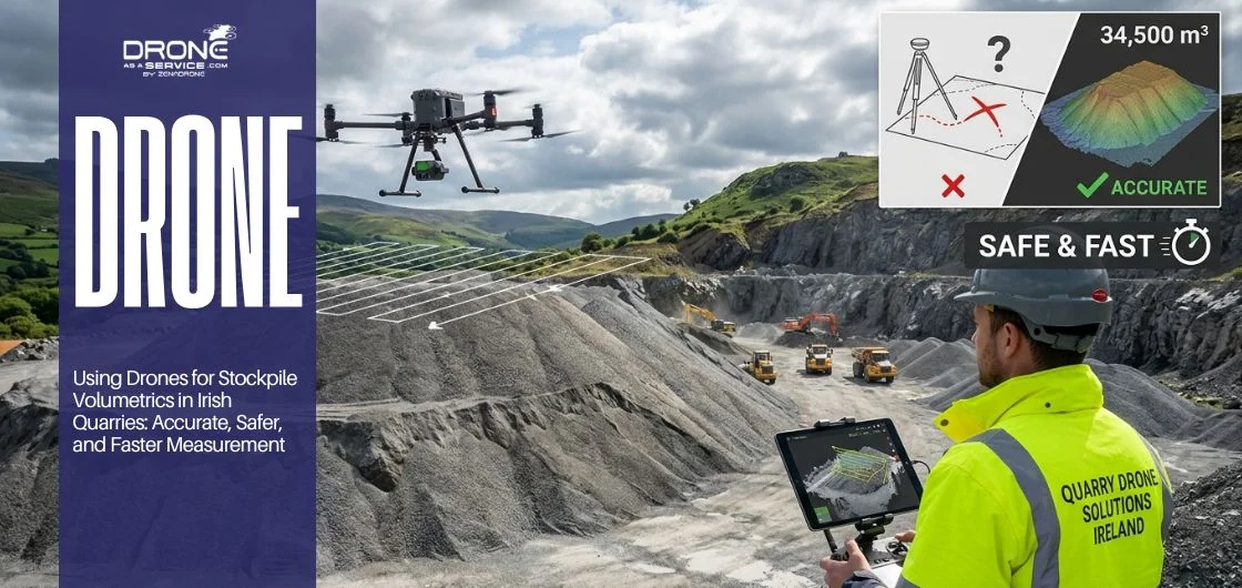
Irish quarries lose real money every year from inaccurate stockpile measurements. Drone-based 3D mapping fixes that problem directly.
It cuts survey time from days to hours, removes the safety risk of climbing unstable stockpiles, and delivers volume data accurate enough for commercial billing and compliance reporting. Most operations recover the cost within a single survey cycle.
If your quarry still relies on manual ground surveys, you are paying more and getting less.
Introduction: The Hidden Cost of Inaccurate Stockpile Measurements
Every quarry operator in Ireland knows that profitability hinges on the accuracy of the numbers behind each stockpile. When those numbers are wrong, the financial fallout is immediate and difficult to recover from.
Traditional surveying methods have served the industry for decades, but they now carry an undeniable burden of inefficiency, inconsistency, and risk. Operators who still rely on GPS rovers and manual ground measurements are losing time, money, and competitive ground.
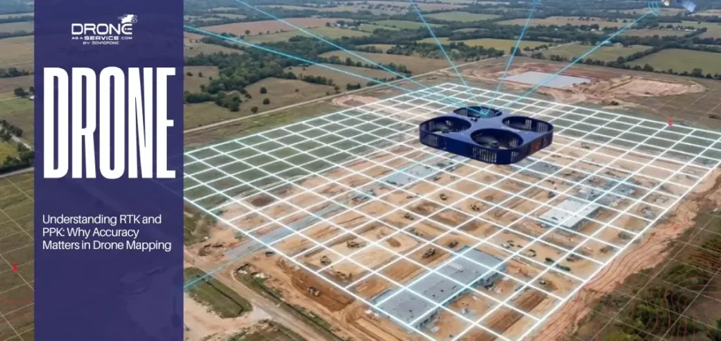
Drone-based 3D mapping and volumetric surveying now offer a practical solution that delivers faster results, sharper accuracy, and a safer environment for every survey team. This is not a future concept; it is an active shift already reshaping how Irish quarries operate today, especially with the rise of drone surveying in Ireland.
Why Stockpile Measurement Is a Critical Challenge in Irish Quarries
Stockpile volumetrics sit at the heart of every quarry operation in Ireland. Yet accurate measurement remains one of the most persistent failures the industry faces today. Pile shapes shift continuously throughout the working day, and no two manual assessments seem to produce the same result.
Irish weather makes this challenge significantly harder than it looks on paper. Rain, low visibility, and strong winds turn what should be a routine task into costly and unreliable guesswork. These conditions expose every weakness in traditional surveying methods with brutal consistency.
A 2% to 5% error in stockpile volume may appear minor at first glance. Over a full operational cycle, however, that margin destroys real and measurable revenue. Incorrect billing, weakened inventory confidence, and poor logistics planning all trace back to this single breakdown.
Irregular pile geometries make manual calculations unreliable from the very start. No standard formula can account for the unpredictable shapes that heavy machinery and weather create together over time. Quarry managers need measurement tools that match the true complexity of what they face on site every day.
Modern quarry operations move at a pace that conventional methods simply cannot sustain. The industry needs faster, more accurate, and more reliable ways to measure to stay competitive. Losing ground in measurement accuracy means losing ground in profitability, operational planning, and long-term market positioning.
The Operational and Financial Consequences
The business impacts of inaccurate stockpile data extend well beyond a single incorrect invoice. Revenue leakage from miscalculated volumes quietly erodes margins across months and quarters.
Material handling becomes inefficient when inventory figures lack credibility. Quarry managers find it harder to forecast output, allocate resources, or maintain trust with clients when the underlying data is unreliable.
In regulated quarry operations, measurement inaccuracy also carries compliance risk. Regulators in Ireland hold operators to specific reporting standards, and data that cannot withstand scrutiny creates unnecessary legal exposure for the business.
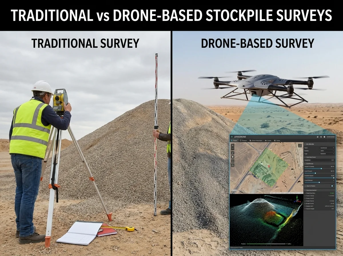
Traditional vs Drone-Based Stockpile Surveys: A Direct Comparison
Traditional stockpile surveys rely on GPS rovers, total stations, manual ground-point collection, and hand-calculated volume estimates to produce results. A single-site survey often consumes one to three full working days before any usable data reaches the quarry manager. That time cost alone makes traditional methods a serious liability in fast-moving quarry environments.
Survey teams must physically climb and traverse unstable stockpile surfaces to collect each individual data point. With only a limited number of measurement points available, the resulting volume estimate carries a significant and compounding margin for error. That margin grows quietly across operational cycles and inflates the financial risk for the entire business.
Drone-based surveying replaces this entire process with a faster, safer, and far more precise alternative. Drones capture high-resolution overlapping aerial images across every square metre of the stockpile surface without any physical access requirement. Photogrammetry software then processes those images into a precise 3D terrain model that forms the reliable foundation for accurate volumetric analysis.
The operational contrast between both approaches is stark and measurable across every key performance factor. The table below presents a direct side-by-side comparison for quarry managers evaluating their options:
| Factor | Traditional Survey | Drone-Based Survey |
|---|---|---|
| Time | One to three full days | Completed within hours |
| Safety | Requires manual stockpile access | Fully remote with no physical access |
| Accuracy | Sample-based volume estimates | Full surface model with complete coverage |
| Data Output | Basic written estimates | Detailed 3D digital terrain models |
The drone-based approach produces a complete digital twin of the entire quarry stockpile environment on every deployment. That model supports precise, repeatable volumetric analysis on demand and provides a permanent visual record for future operational comparison. Quarry managers gain a data asset that compounds in value with every successive survey completed.
Step-by-Step: How Drone Volumetric Surveys Work in a Real Quarry
A professional drone volumetric survey follows a structured workflow from the very first site visit through to final report delivery. Each stage builds directly on the last to produce a reliable, audit-ready output that quarry managers can act on with full confidence. Understanding each stage helps operators appreciate why this approach delivers results that traditional methods simply cannot match.
Stage 1: Site Assessment and Flight Planning
The survey team begins with a thorough assessment of the stockpile layout, active safety zones, and prevailing local weather conditions on site. They design the optimal drone flight path to achieve complete surface coverage without gaps, blind spots, or missed measurement areas. This foundation determines the accuracy and reliability of every subsequent stage in the process.
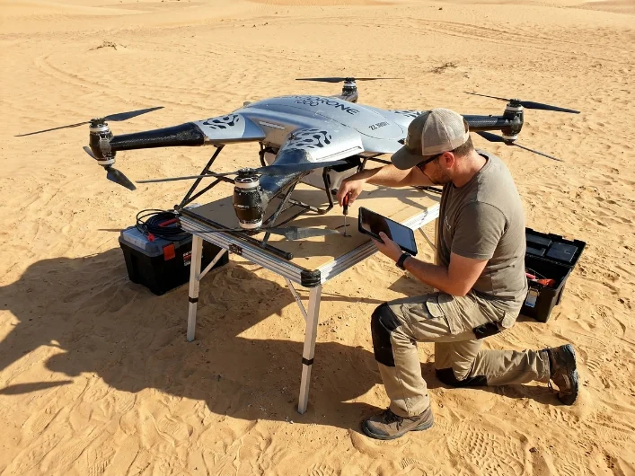
Stage 2: Drone Data Capture
The drone flies the planned route and captures hundreds of high-resolution overlapping images from multiple angles across the full stockpile surface. Each image carries embedded georeferenced data that provides precise positioning for every point the camera records during flight. This systematic data capture approach eliminates the sampling limitations that undermine traditional ground-based survey methods.
Stage 3: 3D Model Generation
Photogrammetry software processes all captured images and stitches them into a dense and highly detailed point cloud. The software then builds a complete 3D surface model that represents every contour, slope, and variation across the stockpile with exceptional fidelity. This digital reconstruction forms the core asset that drives all subsequent volumetric calculations.
Stage 4: Volume Calculation
The system calculates cut and fill volumes, stockpile heights, and full material distribution across the entire site with precision. Quarry managers receive figures they can trust completely for billing, logistics planning, inventory reporting, and regulatory compliance purposes. Accurate volume data at this stage eliminates the guesswork that costs Irish quarry operations real money every operational cycle.
Stage 5: Reporting and Delivery
Clients receive comprehensive volume reports, CAD-compatible files, 3D visual models, and historical comparison datasets in a single structured package. This complete data output supports faster, evidence-based decision-making at every level of quarry management without delay. The entire process concludes with a permanent, referenceable record that grows more valuable with every subsequent survey.
A mid-sized Irish quarry reduced its survey time from two full working days to just two hours by adopting this exact workflow. Reporting consistency improved significantly, data accuracy increased, and management gained reliable inventory figures for the first time. That measurable operational outcome reflects the true and immediate value this approach delivers to Irish quarry businesses today.
Key Benefits of Drone Stockpile Surveys for Irish Quarries
Drone-based stockpile surveys deliver measurable improvements across every dimension of quarry management in Ireland. These benefits are not theoretical projections or vendor promises; operators across the country already report tangible and repeatable results from adopting this approach. Each benefit listed below addresses a real operational challenge that traditional surveying methods consistently fail to resolve.
Higher Accuracy
Full-surface scanning eliminates the estimation gaps that sample-based traditional methods always leave behind on every survey. Quarry managers receive volume data they can trust completely for billing, compliance reporting, and long-term production planning. This accuracy improvement sits at the core of the entire value proposition that drone surveying delivers.
Faster Decision-Making
Near real-time data availability allows quarry managers to adjust production plans without costly delays between survey and decision. When accurate figures arrive within hours rather than days, the business responds faster and more confidently to every operational challenge. Faster data turnaround accelerates better decisions across every other management function on site.
Improved Safety
Survey teams no longer need to climb wet, unstable, or hazardous stockpile surfaces to collect measurement data. Eliminating that physical risk reduces workplace incidents and strengthens overall site compliance with Irish health and safety regulations directly. Safer surveying methods protect both the workforce and the operator from regulatory scrutiny and legal liability.
Operational Efficiency
Drone surveys generate minimal site downtime because quarry operations continue without interruption during the entire data capture process. The survey runs in parallel with active production rather than displacing it for hours or days at a stretch. This efficiency protects daily output targets while still delivering the measurement accuracy the business requires.
Better Inventory Control
Accurate and consistent tracking of material inflow and outflow supports reliable stock management at every point in the operational cycle. Managers gain a clear, real-time picture of what the site actually holds at any given moment throughout the working week. Strong inventory control removes the guesswork that drives poor resource allocation and client disputes in quarry operations.
Stronger Forecasting
Historical 3D data from repeated drone surveys builds the analytical foundation that management needs for confident production trend forecasting. Each completed survey adds to a growing and increasingly valuable record that directly informs future operational planning decisions. This compounding benefit grows stronger with every survey cycle the operator completes.
ROI: Is Drone Stockpile Surveying a Sound Investment?
For any Irish quarry operator evaluating the business case, the return on investment from drone-based 3D mapping is both measurable and achievable within a short operational timeframe. Savings arrive from multiple directions simultaneously across the full operational cycle rather than from a single isolated improvement. The financial case for this investment strengthens with every quarter of consistent deployment.
Reduced labour costs, fewer errors requiring costly rework, smarter material allocation, and faster reporting cycles all contribute to a strong and compounding financial return. A quarry that improves stockpile accuracy by just 3% to 4% annually recovers significant material value that traditional estimation errors quietly absorb across the year. That recovered value translates directly into improved margins without any increase in production volume or headcount.
When operators combine reduced manpower requirements with faster reporting turnarounds, drone surveying frequently covers its full cost within a single operational cycle. The payback period is clear, defensible, and well within the financial planning horizon of any serious quarry business operating in Ireland today. This is precisely the kind of investment that delivers both immediate operational returns and lasting strategic advantage for the long term.
Addressing Common Concerns from Quarry Operators
Quarry managers across Ireland raise similar practical questions when they first evaluate drone surveying. Each concern has a direct and honest answer rooted in real operational experience.
Irish Weather Conditions
Professional drone survey providers build scheduling flexibility into every contract from the outset. Modern survey-grade drones handle light wind and mist without compromising data quality, and providers reschedule quickly when conditions require it. Irish weather presents a manageable variable, not a barrier.
Data Accuracy for Business Use
Survey-grade drone systems combined with professional 3D mapping software produce volumetric outputs that Irish quarry operators already trust for commercial reporting and financial planning. Ground control points and rigorous processing protocols keep accuracy within margins that traditional methods simply cannot match.
Implementation Costs
Most drone survey providers in Ireland offer per-survey pricing models that scale to the size and frequency of the operation. A smaller quarry does not need to commit to a large capital outlay to access this technology. The pricing structure makes it accessible and financially sensible at almost any operational scale.
Integration with Existing Systems
Standard drone survey outputs are compatible with CAD, GIS, and quarry management platforms. Integration into existing workflows is straightforward, and the transition does not disrupt current operations. Operators simply gain richer, more reliable data flowing into systems they already use.
Choosing the Right Drone Survey Provider in Ireland
Selecting the right partner for drone surveying in Ireland is itself a critical decision that shapes the quality of every dataset the quarry receives. The right provider functions as a long-term data partner, not merely as an operator with a drone.
Look for licensed and insured operators with direct, documented experience in quarry environments. Prioritise providers who deliver high-quality 3D models, detailed volume reports, and professional photogrammetry tools as standard deliverables for every project.
Treat the absence of sample reports or verified case studies as a serious warning sign. Weak regulatory compliance, unrealistic accuracy claims, and limited post-processing capability are all disqualifying factors that indicate a provider is not ready for the technical demands of quarry surveying.
The best providers understand the operational pressures that quarry managers face. They communicate clearly, meet agreed timelines, and produce outputs that integrate seamlessly into the business workflows that depend on accurate stockpile data.
Frequently Asked Questions
Get Accurate Stockpile Volumes for Your Irish Quarry
Stop losing revenue to inaccurate stockpile measurements. Our IAA-authorised drone survey teams deliver precise 3D volumetric data that Irish quarry operators trust for billing, inventory management, and compliance reporting. From flight planning and data capture through to processed volume reports and CAD-compatible deliverables, we handle every stage of the process. With proven quarry experience across Ireland, we know exactly what your operation needs to measure accurately, stay safe, and make faster decisions.