Both technologies generate 3D models. Both fly on drones. Both cost real money. But they fail in completely different situations, and picking the wrong means flying the same site twice.
Why The Question Is Harder Than It Looks
The debate usually starts the same way: someone on a project team has heard that LiDAR is more accurate, another person notes it costs four times as much, and a third points out that photogrammetry “worked fine on the last job.” None of them is wrong. All of them are missing context.
The truth is that LiDAR and photogrammetry are not competing products; they do different things. They are fundamentally different sensing approaches that happen to produce overlapping outputs. LiDAR fires pulses of laser light and measures return time.
Photogrammetry extracts 3D geometry by comparing image overlaps. One is active sensing; one is passive. That single distinction drives almost every practical difference between them.
Getting this choice wrong does not just mean slightly worse data. It can mean a bare-earth model full of voids under a forest canopy, or a €12,000 LiDAR mobilization on a flat construction site where a €400 photogrammetry flight would have done the job in an afternoon. The stakes are real.
Most teams that get this decision consistently right are not flying their own equipment; they are working with professional drone services that have logged enough site hours to know which sensor fails first on which terrain.
Before choosing a sensor, define your worst-case data need. Not the average case, the scenario where wrong data causes rework. That edge case usually reveals which technology you actually need.
Accuracy: The Whole Truth
The standard claim “LiDAR is more accurate” is true in many situations and misleading in others. It needs unpacking.
LiDAR systems, when properly calibrated and flown with high-quality GNSS/IMU equipment, routinely achieve vertical accuracy of 2–5 cm over open terrain. That consistency holds across a wide range of conditions. The sensor does not care whether it is overcast or sunny, whether the ground is reflective or dark.
Photogrammetry, under controlled conditions with well-distributed ground control points (GCPs) and sufficient image overlap, can achieve vertical accuracy comparable to LiDAR on flat, open sites.
The difference is that photogrammetry accuracy is more sensitive to environmental variables. Shadow, surface texture, cloud cover, and GCP placement all affect the result. Consistency is harder to guarantee across sites.
The projects that suffer most are not the ones with tight budgets; they are the ones that needed high-accuracy data and did not realize it until the model returned incorrect results.
The practical implication: if you are delivering a dataset to a client with a contractual accuracy tolerance and cannot control site conditions, LiDAR provides a more predictable result. If you have good conditions and proper survey control, photogrammetry can hit the same target at a lower cost.
“Accuracy is not a single number. It is a function of site conditions, equipment calibration, and the validation method. Neither technology is automatically superior.”
One area where LiDAR holds an unambiguous advantage: complex vertical structures. Powerline mapping, bridge underdecks, and rocky outcrops with deep occlusion are genuinely difficult for photogrammetry.
LiDAR can capture return data from multiple pulse echoes, a capability called multiple returns, which lets it record both the tree canopy surface and the ground beneath it in a single pass.
Terrain And Vegetation: The Real Differentiator
If there is one factor that should drive most decisions, it is this: can you actually see the ground from above?
Photogrammetry builds its 3D model from what the camera can see. If the ground surface is hidden beneath the tree canopy, the model will represent the canopy top, not the terrain beneath it. For a corridor survey under open sky, that is fine.
For a flood risk model in a wooded valley, you will get a digital surface model that tells you the elevation of treetops, not the ground your water will actually flow across.
LiDAR does not have this problem in the same way. The laser pulses penetrate gaps in vegetation, even in relatively dense cover, and some reach the ground.
Post-processing classification algorithms then separate ground returns from vegetation returns, producing a bare-earth digital terrain model (DTM) that photogrammetry simply cannot match in forested areas.
A road design team needed accurate cross-sections through a section of mature mixed woodland alongside a proposed highway expansion. Photogrammetry had been used on the cleared sections and worked well. For the forested stretch, LiDAR was mobilized separately. The difference in deliverable quality was significant: the photogrammetry model showed a smooth canopy surface, whereas the LiDAR revealed complex terrain with drainage channels and variable slopes, which would have materially affected the cut-and-fill calculations.
The flip side: LiDAR’s vegetation-penetration advantage diminishes in extremely dense, low-lying vegetation such as thick scrub or elephant grass, where even laser pulses struggle to detect a ground return. No technology solves every terrain problem perfectly.
Terrain Types And Which Method Handles Them Better
| Terrain type | LiDAR | Photogrammetry | Recommended |
|---|---|---|---|
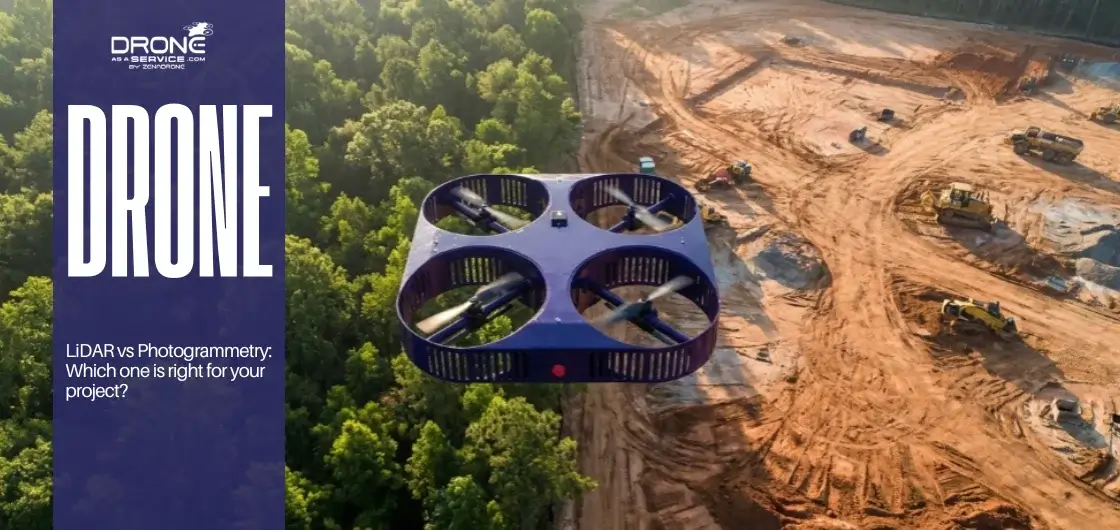
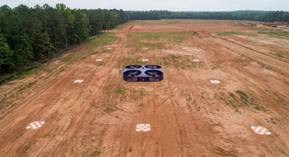
| Open flat ground, minimal vegetation | Reliable | Strong, cost-effective | Photogrammetry |
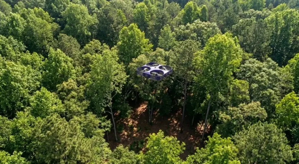
| Mature tree canopy, forest floor mapping | Ground returns possible | Canopy only, no ground | LiDAR |
| Active construction site (bare earth) | Works well | Great visual detail + speed | Photogrammetry |
| Flood plain modeling, riparian zones | Essential for DTM accuracy | Unreliable under reeds/shrubs | LiDAR |
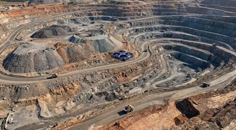
| Rocky open terrain, quarry faces | Reliable | High texture detail, cost advantage | Photogrammetry or hybrid |
| Urban mapping rooftops, facades | Handles occlusion better | Blind spots behind structures | LiDAR or hybrid |
| Agricultural field mapping | Overkill for most uses | Sufficient, rapid, affordable | Photogrammetry |
Lighting, Weather, And The Hidden Flight Risks
This is an area where the difference between the two technologies is not just technical; it is operational. It affects scheduling, crew availability, and whether you can hit a project deadline in a rainy season.
Photogrammetry needs light. Specifically, it needs consistent, even illumination without harsh shadows that obscure surface detail or create areas of varying exposure within a single image.
Ideal conditions are overcast skies with diffused light, which helpfully means direct sun is not required. But midday direct sun on a reflective surface (a fresh concrete slab, a still water body, a metal roof) can cause saturation or specular reflection, destroying the photogrammetric matching algorithm’s ability to identify tie points between overlapping images.
It also means that a site with significant topographic relief, deep valleys, and tall structures will almost always have shadowed areas that cannot be resolved in a single flight. Additional flights at different sun angles, or ground-level photography to fill shadow zones, add time and cost.
LiDAR operates on its own light source. It is almost entirely indifferent to ambient illumination. You can fly at dusk, you can fly under overcast skies, and in some sensor configurations, you can fly at night.
For infrastructure inspection on operational assets, such as bridges, powerlines, and rail corridors, where daytime flight windows are restricted by traffic or activity, this is a significant operational advantage.
If your project site has variable cloud cover or tight completion windows, LiDAR reduces the risk of weather-related delays. Photogrammetry flights scrubbed due to poor conditions create downstream pressure on processing and delivery timelines.
Neither technology handles heavy rain well — water droplets interfere with LiDAR returns and ruin image quality. Wind affects both, though image blur from wind is more damaging to photogrammetry workflows than LiDAR point density.
Data Processing: The Overlooked Cost Driver
Data acquisition is only half the story. What happens after the drone lands matters as much as what happens during the flight, and the two technologies impose very different demands on your team and your timeline.
Photogrammetry Processing
Photogrammetric workflows involve structure-from-motion (SfM) processing, aligning thousands of overlapping images, identifying common feature points, and building a dense 3D point cloud from those matches.
Software like Agisoft Metashape, Pix4D, or DJI Terra handles this automatically, but it is computationally intensive. A large dataset, say, 3,000 images from a 200-hectare survey, can take 12 to 24 hours to process on a well-equipped workstation. Larger projects can take days.
The skill required to run the software is relatively accessible. The skill required to recognize when the output is wrong and fix it is less common. Poorly distributed GCPs, insufficient image overlap, or featureless surfaces (flat water, bare sand) all create processing artifacts that a non-specialist may miss entirely before the data reaches the client.
LiDAR Processing
LiDAR produces point clouds directly, without the SfM reconstruction step. In that narrow sense, initial data generation is faster. But LiDAR processing has its own complexity: trajectory processing (fusing GNSS and IMU data to reconstruct the sensor path accurately), point cloud classification (separating ground, vegetation, and buildings), and noise filtering all require specialist knowledge and software tools such as LAStools, TerraSolid, or Trimble Business Center.
Classification errors in LiDAR data are particularly consequential. A poorly classified dataset that incorrectly tags low vegetation as ground will produce a DTM with systematic elevation errors that may not be obvious until the data are used in a hydraulic model or a cut-and-fill calculation.
The takeaway: both workflows require skilled people at the processing stage. Neither is plug-and-play at professional accuracy levels. Factor processing time, software licensing, and specialist labor into any realistic project cost comparison.
Cost: Beyond The Sensor Price Tag
The cost difference between LiDAR and photogrammetry is real and significant, but it is frequently framed too narrowly. Comparing sensor prices misses the bigger picture.
A capable drone-mounted LiDAR system, sensor integration, GNSS base station, and post-processing software represent a materially higher capital investment than an equivalent photogrammetry setup. That gap has narrowed over the past five years as LiDAR hardware costs have dropped, but it has not closed. Where the comparison becomes less straightforward is at the project level.
Consider a photogrammetry survey on a vegetated site that requires three flight attempts due to shadow and cloud cover, followed by a reprocessing cycle because GCP coverage was insufficient in one area, followed by a partial LiDAR mobilization because the client ultimately needs accurate ground elevation under the trees anyway.
The “cheaper” option has now cost more in time, flight costs, and relationship capital with the client.
Cost Comparison
| Cost factor | LiDAR | Photogrammetry |
|---|---|---|
| Equipment/mobilization | Higher | Lower |
| Flight time (typical survey) | Comparable or faster | Comparable |
| Weather-related re-flights | Rarely needed | More common risk |
| Processing software/licenses | Higher specialized cost | Moderate cost, wider access |
| Specialist processing labor | High — LiDAR classification expertise | Moderate — SfM skills more widespread |
| Rework risk (poor conditions) | Low | Moderate to high |
| Total cost for simple open site | Often higher than needed | Cost-effective |
| Total cost for complex/vegetated site | Better value (fewer iterations) | Can escalate with rework |
The honest guidance: for small, straightforward, open sites, photogrammetry is almost always the more economical choice. For complex terrain, vegetation, or high-stakes accuracy requirements, the premium for LiDAR typically pays for itself in reliability.
What You Actually Get From Each Method
Not all project needs are the same, and the technology choice should be driven in part by what your client or downstream workflow actually requires.
Photogrammetry’s native outputs are visually rich: high-resolution orthomosaics (georeferenced aerial images), textured 3D mesh models, and point clouds derived from image matching.
If a client wants to see the site in photorealistic detail, track construction progress visually, or produce presentation-quality 3D renders, photogrammetry delivers outputs that LiDAR simply cannot match on visual quality. The camera captures color and texture; the laser does not.
LiDAR’s outputs are geometrically precise: dense, accurately classified point clouds; digital terrain models (DTMs); and digital surface models (DSMs). These are the inputs to engineering design software, hydraulic models, infrastructure inspection tools, and volumetric calculations.
They are not visually impressive to a non-technical audience; a grey point cloud carries less impact in a stakeholder presentation than a photorealistic orthomosaic, but they are more geometrically trustworthy in demanding analysis workflows.
This means the deliverable question is not just technical. What does the client need to see, and what does the engineering workflow need to compute? These are sometimes the same answer. Often, they are not, which is where hybrid approaches become genuinely useful rather than just an upsell.
Choosing Between LiDAR and Photogrammetry
Choose LiDAR When
-
▸
Vegetation or tree canopy covers the site -
▸
Bare-earth DTM is a required deliverable -
▸
Nighttime or low-light flight is necessary -
▸
High-accuracy elevation is contractually specified -
▸
Corridor mapping (powerlines, rail, roads) -
▸
Flood risk or hydraulic modeling is the end use -
▸
Vertical structures with significant occlusion -
▸
Re-flights due to weather cannot be tolerated
Choose Photogrammetry When
-
▸
The site is open with minimal vegetation -
▸
Visual outputs (ortho, 3D model) are primary -
▸
Progress monitoring on construction sites -
▸
Budget is constrained on a well-conditioned site -
▸
Agricultural mapping or crop health surveys -
▸
As-built documentation of structures -
▸
Stakeholder presentations requiring visual realism -
▸
High-frequency repeat surveys where the cost compounds
Hybrid Workflows: Worth It Or Overkill?
The answer depends entirely on what you need from the dataset. A hybrid approach flying LiDAR for terrain data and photogrammetry for surface texture is not a luxury or a belt-and-suspenders overcaution. On the right project, it is the most efficient path to a complete, usable dataset.
Consider a mining site volumetric survey. The client wants accurate stockpile volumes (a geometry problem, well-suited to LiDAR) and a visual progress record for project management reporting (a photography problem, well-suited to photogrammetry). Running both in a single mobilization costs less than two separate operations and produces a richer dataset than either alone.
Field Example — Open-pit Mine, Hybrid Mobilization
A mining operation needed quarterly volume calculations for active benches, along with a documentary record for regulatory reporting. A hybrid workflow — LiDAR for topographic modeling, photogrammetry for orthomosaic generation — was flown in a single day. The LiDAR data drove the volumetrics; the orthomosaics were included in the compliance reports. The total cost was 35% lower than running separate sequential flights.
Where hybrid approaches become overkill: small sites with straightforward needs. Adding LiDAR complexity to a routine construction progress survey because “it will be more accurate” often costs money and time without improving the client’s decision-making in any meaningful way.
Emerging software workflows are also making hybrid data integration more practical. Point cloud fusion — combining LiDAR geometry with photogrammetric color attribution to produce colorized point clouds — is now standard in most professional processing pipelines, and the results are both analytically rigorous and visually communicable.
Pre-flight Decision Checklist
Site Assessment
-
▸
Is there a tree canopy or dense vegetation over any area requiring ground elevation data? -
▸
Are there deep shadows, reflective surfaces, or water bodies that will affect image quality? -
▸
What is the topographic relief? Are there deep occlusions or vertical structures? -
▸
What are the anticipated weather and lighting conditions during the flight window?
Deliverable Requirements
-
▸
Is a bare-earth DTM required, or is a digital surface model sufficient? -
▸
Does the client need visual outputs (ortho, textured model) or geometric outputs (point cloud, DTM)? -
▸
Is there a contractual accuracy tolerance? If so, what is the validation method? -
▸
What software will the downstream team use, and is it compatible with the chosen format?
Operational Constraints
-
▸
What is the flight window? Is nighttime or dawn operation possible or necessary? -
▸
Is the project timeline tolerant of re-flight delays? -
▸
Is the budget appropriate for the chosen technology, including processing and QA? -
▸
Does the team have the processing expertise for the selected method?
Regulatory
-
▸
Are all flights planned in compliance with local aviation regulations? -
▸
Has the relevant authority, such as the Civil Aviation Authority, been consulted for operational approvals?
FAQs
Conclusion
LiDAR and photogrammetry are complementary tools, not competing ones. The right choice comes from understanding how each technology will work with your site and what your deliverables actually demand of the data.
Dense vegetation, the need for bare-earth models, tight flight windows, and demanding accuracy tolerances push toward LiDAR. Open sites, visual deliverables, cost-sensitive programs, and clear weather favor photogrammetry. Complex projects often benefit from both.
The professionals who get this consistently right are not the ones who have picked a favorite technology, they are the ones who ask the site the right questions before they choose the sensor.
Get Expert Guidance on LiDAR and Photogrammetry for Your Project
Choosing the right drone mapping technology depends on your terrain, timeline, and deliverable requirements. Our certified specialists have logged hundreds of site surveys across varied terrain types. We’ll assess your project, recommend the optimal approach, and deliver data that actually works for your workflow — whether that’s LiDAR for complex terrain, photogrammetry for visual clarity, or a hybrid solution for maximum value.