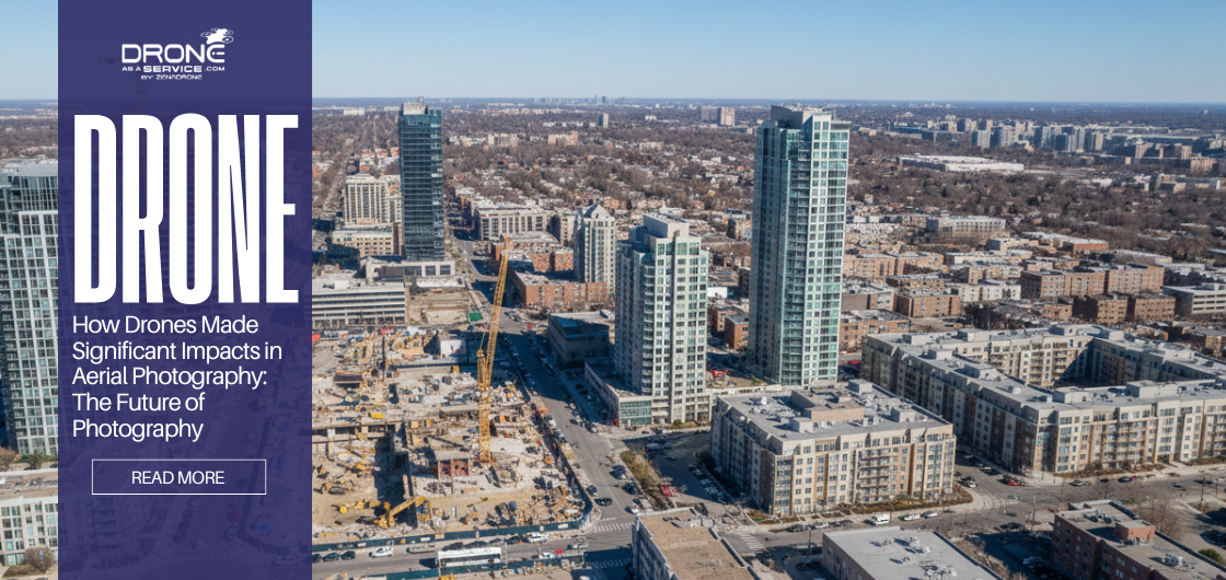
How Drones Made Significant Impacts in Aerial Photography
Introduction
Aerial photography is the art and science of capturing images of the Earth’s surface from an elevated perspective. Traditionally, photographers relied on balloons, kites, or aircraft, but today, drones have revolutionized the field. With high-resolution cameras, stability, and flexibility, drones allow photographers to capture stunning visuals that were once difficult, expensive, or impossible.
The evolution of aerial photography has opened new possibilities across industries, from real estate to construction, surveying, and media production. Whether it’s a sweeping landscape or detailed inspection of a building, aerial photography now provides unmatched perspectives.
In this guide, we’ll explore the history, types, applications, tools, and techniques of aerial photography, and show how modern drones are shaping its future.
What is Aerial Photography?
Aerial photography involves taking photographs of the Earth from a vantage point above ground. This can be done using planes, helicopters, balloons, kites, satellites, or increasingly, drones.
Unlike satellite imagery, which captures broad areas, aerial photography provides higher resolution, more control over composition, and the ability to focus on specific subjects. It is widely used for drone mapping, drone surveying, real estate, construction, environmental studies, and creative projects.
Platforms Used in Aerial Photography:
- Traditional Aircraft: Planes or helicopters with mounted cameras.
- Balloons & Kites: Early methods used for experimental photography.
- Drones / UAVs: Compact, cost-effective, and flexible tools for modern aerial photography.
Drones have made aerial photography more accessible, allowing professionals and enthusiasts to capture high-quality images without needing large budgets or specialized aircraft.
History & Evolution of Aerial Photography
Early Experiments: Balloons and Kites (1858–1890s)
Aerial photography began in the mid-19th century with experimental attempts to lift cameras into the air. In 1858, French photographer and balloonist Gaspard-Félix Tournachon (Nadar) captured the first known aerial photographs from a hot-air balloon over Paris. Although these original images no longer exist, Nadar’s work is widely recognized as the foundation of aerial photography.
Source: https://en.wikipedia.org/wiki/Nadar
In 1860, American photographer James Wallace Black, assisted by balloonist Samuel Archer King, captured the earliest surviving aerial photograph over Boston from a tethered balloon. This historic image demonstrated the practical potential of aerial imagery for documenting cities and landscapes.
Source: https://www.ncap.org/news/2024/brief-history-of-aerial-photography
During the late 19th century, photographers continued experimenting with alternative platforms such as kites, further expanding the possibilities of capturing images from above.
Source: https://en.wikipedia.org/wiki/Aerial_photography
The Aviation Era: Airplanes and Military Use (1900s–1940s)
The invention of powered aircraft marked a turning point in the evolution of aerial photography. In the early 20th century, airplanes replaced balloons and kites as the primary platform for capturing aerial images.
During World War I, aerial photography became a critical military tool for reconnaissance, mapping enemy positions, and strategic planning. The techniques developed during this period laid the groundwork for modern photogrammetry and large-scale mapping.
Source: https://www.ncap.org/news/2024/brief-history-of-aerial-photography
After the war, these advancements were adapted for civilian use, including cartography, urban planning, agriculture, and archaeology, significantly expanding the role of aerial photography beyond military applications.
If you take interest, you may love to read: How Drone LiDAR Reveals Hidden Ancient Landscapes?
Technological Advancements: Film to Digital Imaging (1950s–2000s)
In the decades following World War II, aerial photography benefited from rapid improvements in camera technology, aircraft stability, and film quality. Governments and research institutions began building large aerial image archives for land management, environmental monitoring, and infrastructure planning.
The transition from film to digital imaging in the late 20th century further improved image quality, storage, and accessibility, making aerial photography more efficient and widely usable across industries.
The Modern Era: Drones and UAV Technology (2010–Present)
The most significant transformation in aerial photography has come with the rise of drones (Unmanned Aerial Vehicles). Unlike traditional aircraft, drones offer a cost-effective, flexible, and safer way to capture aerial imagery at low altitudes.
Drones allow photographers to hover, maneuver precisely, and access locations that were previously difficult or impossible to reach. Today, drone-based aerial photography is widely used in real estate, construction monitoring, surveying, agriculture, environmental studies, and media production.
Source: https://time.com/longform/aerial-photography-drones-history/
As a result, drones are no longer just an alternative tool, they have become a standard platform in modern aerial photography, reshaping how aerial imagery is produced, analyzed, and consumed.
The transition from film to digital imaging in the late 20th century further improved image quality, storage, and accessibility, making aerial photography more efficient and widely usable across industries.
Read also: Benefits and Uses of Drone Photography and Videography
Types of Aerial Photography
Aerial photography can be categorized based on angle, altitude, and equipment.
1. Vertical Photography
- Camera is pointed straight down.
- Used primarily in mapping, surveying, and geographic studies.
- Ideal for creating orthophotos and topographic maps.
2. Oblique Photography
- Camera is angled to capture the subject from the side.
- Low Oblique: Slight angle, horizon not visible.
- High Oblique: Wider angle, horizon included.
- Often used in real estate, media, and promotional content.
3. Drone-Based Photography
- Offers flexibility and affordability.
- Can capture high-resolution images and videos at varying altitudes.
- Ideal for creative projects, inspections, or commercial applications.
Applications of Aerial Photography
1. Real Estate Aerial Photography
Aerial images provide buyers with unique perspectives of properties, showing layouts, landscaping, and nearby amenities. Real estate professionals use drones to create virtual tours and promotional videos, helping listings stand out online.
2. Construction Aerial Photography
Construction companies use drones to monitor site progress, inspect hard-to-reach areas, and document projects over time. This allows teams to identify potential issues early, improve efficiency, and share updates with clients.
3. Other Industries
- Mapping & Surveying: Generate accurate maps for urban planning or environmental studies.
- Agriculture: Monitor crop health using aerial imaging.
- Media & Entertainment: Capture cinematic shots for films, documentaries, and commercials.
4. Aerial Photography Services
Professional aerial photography services offer:
- High-quality images and videos.
- Commercial-grade drones and equipment.
- Expertise in flight planning, safety, and regulatory compliance.
Tools, Techniques & Best Practices
To capture exceptional aerial photos, consider:
Equipment:
- High-resolution drones (DJI, Autel, Skydio, ZenaDrone).
- Gimbal-stabilized cameras.
- Post-processing software for editing.
Techniques:
- Shoot during golden hour for best light.
- Maintain proper altitude and angles for composition.
- Use automated flight paths for consistency.
Safety & Legal Considerations:
- Follow FAA or local drone regulations.
- Avoid restricted areas or crowded spaces.
- Check weather conditions before flights.
Conclusion & Future Trends
Drones have transformed aerial photography, making it more accessible, efficient, and versatile. From real estate to construction, surveying, and creative industries, the applications are expanding rapidly.
Future trends include:
- AI-assisted image processing.
- Automated mapping and inspection.
- Ultra-high-resolution drone cameras for professional and commercial use.
The sky is truly the limit for aerial photography with drones.
Why Choose Drone as a Service (DaaS)?
At Drone as a Service (DaaS), we specialize in professional aerial photography solutions tailored to your needs.
Why choose us:
- Expertise: FAA registered drone pilots with years of experience.
- Advanced Equipment: Commercial-grade drones for high-quality images and videos.
- Versatile Services: Real estate, construction, surveying, and creative projects.
- Quick Turnaround: Fast delivery of processed images and videos.
- Cost-Effective: Professional quality without the overhead of traditional aerial platforms.
Ready to elevate your project with stunning aerial imagery? Contact DaaS today and let us bring your vision to new heights.
FAQ Section
What is the best drone for aerial photography?
High-resolution cameras, gimbal stabilization, and intelligent flight modes are key. Popular options include DJI Mavic, DJI Air 2S, ZenaDrone 1000 and Skydio 2.
How much do aerial photography services cost?
Prices vary by project type, drone equipment, flight duration, and post-processing requirements. Real estate shoots may start from $150, while large construction projects may cost more.
Can drones replace traditional aerial photography?
Drones are cost-effective and flexible for most projects, but some high-altitude or large-scale imaging still relies on traditional aircraft.