Drone Technology: Reshaping The Future Of Environmental Management

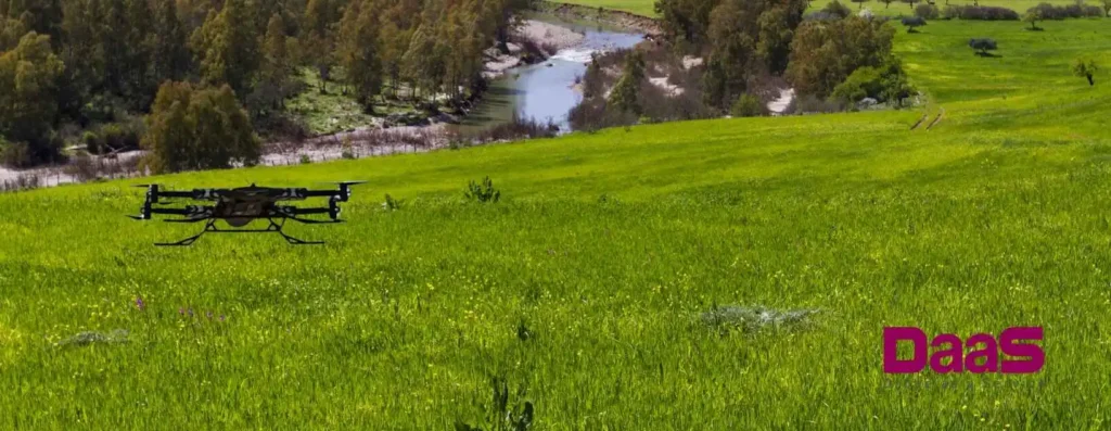
Drones are revolutionizing environmental management in unprecedented ways. These smart Unmanned Aerial Vehicles (UAVs) can fly autonomously for long periods, thereby covering larger areas in less time. Using AI, drones provide authorities with broader surveillance coverage quickly and efficiently.
Recent advancements in drone technology now make it an indispensable tool for social projects, search and rescue missions, and urban planning. The potential drones offer for preserving endangered plants and animals is substantial. However, conservationists face mounting challenges due to poaching, illegal logging, and urban development that hinder their goals of environmental preservation.
Environmental Research Is Critical For The Survival Of Society
Preventing environmental damage hinges critically on environmental science. Human activities that have led to disasters such as flash floods, hurricanes, droughts, and climate change necessitate an urgent response. If governments and scientists neglect to probe and mitigate these catastrophes, we face the enormous risk of mass extinction.
Conservation vitally requires monitoring species and maintaining real-time forest surveillance. Drone technology advancements provide authorities and governments valuable insights into forest conditions and wildlife. Drones offer conservationists a faster, more cost-effective way to perform tasks than traditional methods, making them especially suitable for remote areas.
Environmental studies explore the processes in water, air, land, soil, and living beings that contribute to environmental contamination or degradation. Yet, the reach of ecological research extends beyond vast forests and wild fauna; it concerns all societies across the globe. Issues like global warming, ozone layer depletion, forest reduction, energy resource scarcity, and the loss of global biodiversity affect us all.
Conservation establishes a standard for a safe, clean, and healthy natural ecosystem. It also addresses critical issues such as:
- Safe and clean drinking water
- Sanitary living conditions
- Clean and fresh air
- Land fertility
- Safe and edible food
- Proper land development for farming and housing
The Five Main Advantages Of Using Drones To Monitor The Environment
Conservationists leverage drones to gather vital environmental data from onboard cameras, thermometers, humidity and pressure sensors, wind gauges, and more. Regular data collection using drones eliminates the need for field personnel deployment.
Aerial data acquisition is paramount for conservationists to understand large land areas’ status clearly. Various types of drones designed for aerial photography offer five main benefits for environmental monitoring:
1. High-Resolution Photography
Drones, or Unmanned Aerial Vehicles (UAVs), capture high-resolution images to track environmental changes. They document deforestation, erosion, or shifts in vegetation. For instance, drones have become indispensable tools in evaluating forest fire damage, facilitating authorities in planning preventative measures and reforestation of the impacted areas.
Researchers and conservationists can transform these images into maps and 3D models of land areas, which is crucial for comprehending and reacting to environmental changes.
2. Monitoring Isolated Areas
Drones excel in environmental monitoring by accessing remote or challenging-to-reach locales. They can swiftly survey forests, lakes, or offshore locations, collecting data generally unattainable by foot.
Many isolated areas are home to potentially dangerous species. Drone-based monitoring enables conservationists to observe these areas and animals without proximity risks.
3. Real-Time Data
Drones gather and transmit data in real time, accelerating decision-making and the implementation of timely solutions to environmental problems. Real-time data helps identify environmental issues, prompting immediate action to mitigate potential problems. Drones fitted with specialized sensors can collect and forward air or water quality data to research centers.
4. Human Welfare
Drone technology advancements in environmental monitoring minimize risks to human safety. Drones can access potentially hazardous environments, eliminating human involvement. For instance, during wildfires, drones armed with water can extinguish fires in unreachable areas too dangerous for humans. In flash floods, drones can assess the damage and locate any stranded individuals needing rescue.
5. Efficiency
Drones are more cost-effective for environmental monitoring than manned aircraft or field sampling methods. Manned aircraft are expensive and require experienced pilots, while field sampling is labor-intensive and time-consuming. On the other hand, drones are relatively affordable, cover large areas quickly, and eliminate the need for costly equipment and manpower.
Drones’ Impact On Environmental Conservation Campaigns
Environmental conservation has seen a surge in the use of drones in recent years. High-resolution photos and videos taken from the sky by these Unmanned Aerial Vehicles (UAVs), are revolutionizing how environmentalists monitor and protect our surroundings.
UAVs actively track illegal poaching, monitor wildlife populations, and alert environmentalists to unlawful logging activities. Beyond tracking illicit activities, drones also monitor diverse biomes, including forests and wetlands. By providing accurate photos and recordings, drones aid conservationists in identifying and safeguarding critical regions.
Apart from their agricultural applications, drones play a crucial role in managing field operations. In the event of injuries, which are common in field operations, drones’ search and rescue capabilities prove invaluable. They assist field workers and border patrol guards by pinpointing their locations and delivering first aid. Further, drones guide injured workers to the nearest treatment center, often facilitating airlifts.
In recent years, UAVs have monitored climate change. Drones can help conservationists better understand the implications of climate change by gathering data on the following:
- Humidity
- Temperature
- Other environmental conditions
Drones are proving to be a beneficial tool for environmental conservation in general. Drones are assisting environmentalists in ways that were not feasible by delivering comprehensive photographs and videos. Conservationists and researchers can then devise ways to mitigate the effects with the gathered data.
Drones’ Role In The Future Of Environmental Research And Monitoring
Advancements in drone technology are increasingly valuable in environmental study and monitoring. Drones are becoming increasingly capable of giving valuable data to academics and environmental researchers as technology progresses.
Drones have enormous promise in environmental study and monitoring, and the possibilities are expanding. UAV technology is becoming indispensable for ecological study and monitoring as technology advances.


