Drone service use cases Ireland are expanding as businesses across several sectors adopt aerial technology to improve efficiency, safety, and the quality of operational data.
This article explores how drones are being used across construction, agriculture, energy, infrastructure, and other sectors in Ireland.
By reviewing real-world results and industry trends, decision-makers can see how drones support better resource management and more informed decisions.
Why Irish Businesses Are Using Drone Services
Irish businesses use professional drone services to solve logistical challenges, improve safety, and collect frequent aerial data at a lower cost than traditional methods.
The growing adoption of drones shows a clear trend: Irish businesses using drones are achieving higher levels of accuracy and visibility across their operations.
These aerial systems give businesses a flexible way to manage resources while working within Ireland’s unpredictable weather conditions.
The commercial applications of drones are driven by a need for rapid, high-quality data captured without disrupting daily workflows, a concept often clarified in professional drone services explained for businesses exploring how these operations work in practice.
By integrating the application of drone technology into standard procedures, firms are moving toward a more digitised and efficient future. This shift allows organisations to replace manual labour with automated systems that provide consistent and verifiable digital records for stakeholders.
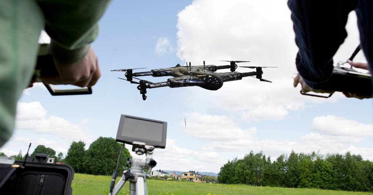
Professional operators provide a level of safety, planning, and reliability that informal or hobby-level flying cannot offer in a business setting.
Businesses utilise these services to mitigate risks associated with working at height or within hazardous industrial zones across the country. The move toward aerial data collection represents a fundamental change in how Irish enterprises manage their physical assets and sites.
Where Drone Services Are Being Used Today
Drone service use cases Ireland supports construction site monitoring, agricultural crop analysis, and the inspection of critical energy infrastructure.
This widespread drone aerial application has shifted from a niche interest to a standard business requirement for many domestic firms.
By providing a bird’s-eye view of operations, drones allow managers to see patterns that are invisible from the ground.
Construction and Civil Engineering
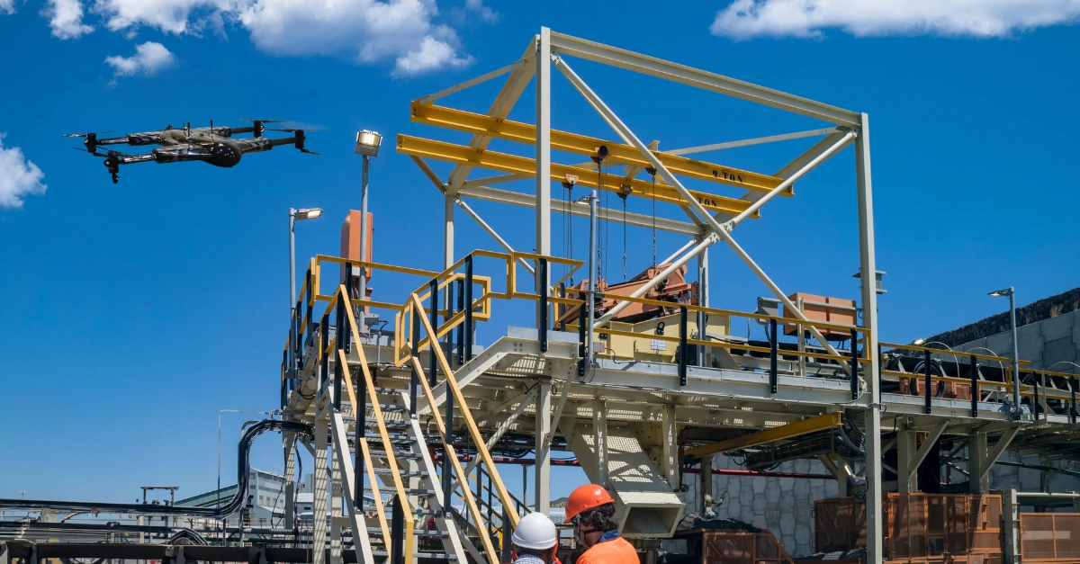
Many companies now rely on drone inspection services in Ireland to monitor construction progress and capture accurate aerial documentation throughout project phases. Construction teams use drones to maintain a consistent visual record of site progress without constant physical inspections.
This allows project leads to identify deviations from plans early, which prevents expensive rework and keeps construction timelines on track.
- •Volumetric measurements: Drones provide a fast way to calculate the volume of earthworks and stockpiles for accurate logistics.
- •Progress tracking: Frequent aerial captures allow for a direct comparison between build phases and the original architectural designs.
- •Site monitoring: Site managers review logistics and safety practices through real-time aerial visuals captured during flights.
These time-saving drone applications enable quicker release of capital and enhanced coordination between different teams of engineers on-site.
Detailed 3D models generated from drone data help stakeholders visualize the finished project within the context of the existing environment.
Such transparency improves communication between developers, contractors, and local planning authorities during the entire lifecycle of a project.
Agriculture and Land Management
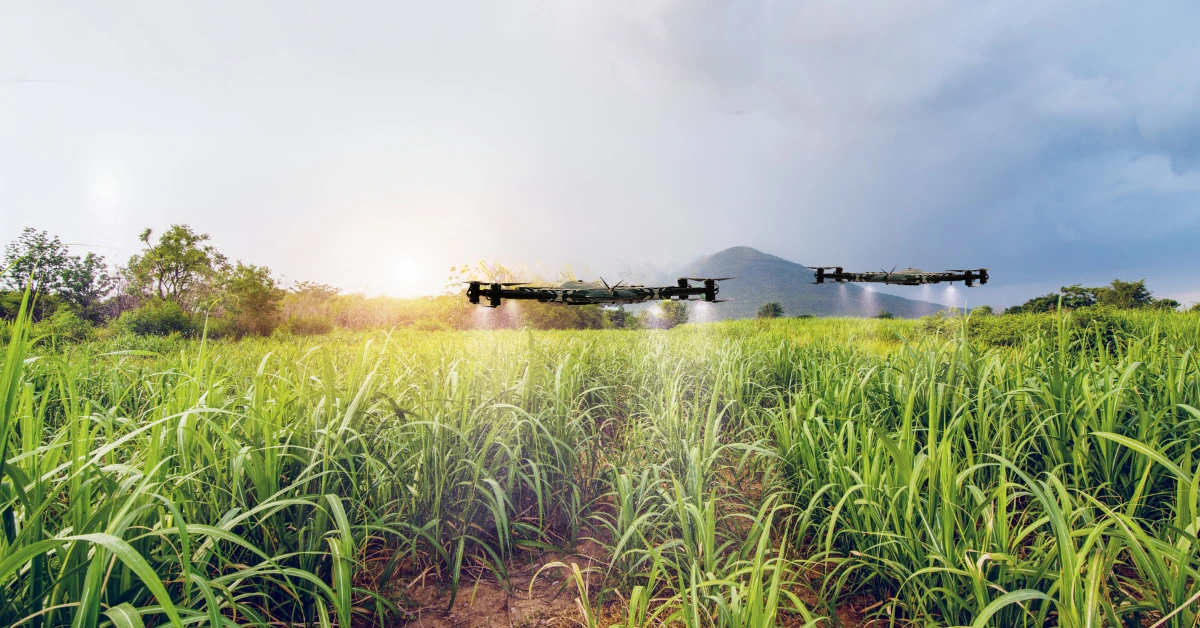
Drone applications in agriculture play an important role in the precision farming practices now used across much of the Irish countryside.
Drones allow farmers to monitor large and scattered fields with less physical effort and lower fuel costs. This approach gives farmers clearer insight into soil conditions and crop performance across different parts of a field.
- •Crop health assessment: Multispectral sensors can be used to identify blight or lack of nutrients before it can be seen by human eyes.
- •Livestock surveillance: Drones help monitor livestock in remote grazing areas, especially during calving season to promote welfare and safety.
- •Drainage mapping: Drones can be used to detect problems with soil moisture or blocked irrigation systems following severe rainfalls typical in Ireland.
These services lead to better decision-making with drones as farmers can apply treatments exactly where they are needed most.
By reducing the overall volume of chemicals and fertilizers used, agricultural businesses can improve their environmental sustainability and profitability.
Energy, Utilities, and Renewables
Drone applications in energy and utilities focus on maintaining asset reliability and keeping systems operating without interruption.
Inspecting high-voltage lines or wind turbine blades often requires a method that avoids costly power shutdowns.
Drones allow engineers to assess the condition of critical infrastructure without direct physical access.
- •Wind turbine inspections: Detecting hairline cracks or lightning strikes on blades from a safe distance while the unit remains stationary.
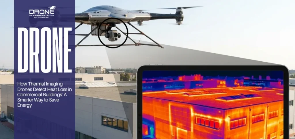
- •Solar array monitoring: Thermal sensors are used to locate faulty and non-functioning cells which are overheating and decreasing the total power of the system.
- •Grid maintenance: High-resolution imagery of pylons and insulators helps maintenance teams prioritize repairs based on the actual condition.
By using drones, utility companies gain clearer visual insights during inspections, allowing technicians on the ground to make faster and safer maintenance decisions.
This preventive maintenance approach minimises the risks of disastrous equipment breakdown and the expenses of emergency maintenance.
Infrastructure and Transport
Drone applications in infrastructure support the inspection and maintenance of roads, railways, and other public assets across Ireland.
Bridges, tunnels, and other publicly owned assets are in need of consistent condition checks to maintain public safety and the future structural integrity.
Drones can access areas under bridges or along steep embankments that are difficult or unsafe for human inspectors.
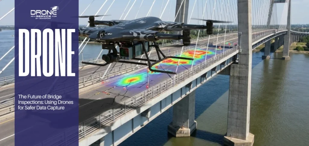
- •Bridge inspections: Access to inaccessible structural joints without costly scaffolding structures or special under-bridge inspection trucks.
- •Rail corridor surveys: Identifying the presence of vegetation on the tracks or track wear in long distances without disrupting the train schedule.
- •Coastal monitoring: Provides monitoring of erosion levels on susceptible shoreline to guide future engineering activities and coastal protection initiatives.
Using drones in all these activities minimizes the possible use of road closures or rail service disruption, which is beneficial to the population.
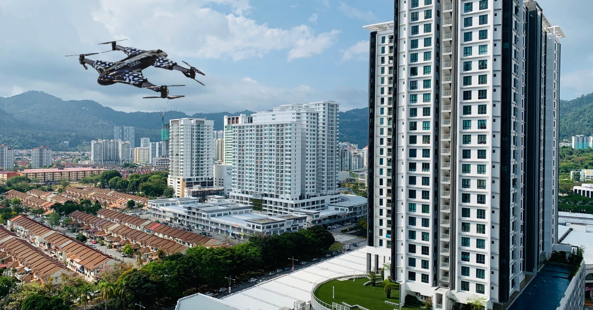
Property, Real Estate, and Insurance
Drone surveys for businesses in the property sector provide a fast way to assess the external condition of buildings.
This is especially useful for insurance assessors who need to review roof damage without climbing onto unsafe structures. Accurate aerial documentation speeds up the claims process and provides an objective record for both the insurer and the client.
Real estate professionals use high-quality aerial imagery to showcase the location and scale of commercial properties to potential investors.
These visuals highlight proximity to transport links and neighboring developments, which adds significant value to marketing brochures and listings.
Aerial surveys also allow for the inspection of gutters and chimneys on historic buildings where access is often restricted.
Environmental, Coastal, and Planning Work
Drone applications in environmental monitoring support both public and private environmental protection work across Ireland.
This includes inspecting landfills to ensure they comply with waste licensing regulations and assessing guarded habitats to check illegal activities.
Local authorities use this data to monitor land-use changes and confirm that new developments follow planning rules.
In surveying flood plains, environmental consultants rely on drones to map the flood plain and simulate the flow of water through a landscape during a surge.
This information is critical among developers who have to demonstrate that their projects will not contribute to the probability of flooding.
Drones are also a safe method of surveying hazardous waste sites or regions impacted by chemical spills during cleanup efforts.
Media, Marketing, and Tourism
Drones are applied in the tourism and media industry to capture the size and beauty of the Irish landscape to the world. Whether it is cinematic promotions of a tourism board of the region or social media posts of a luxury hotel, it will offer high-production value through aerial shots.
This technology has eliminated the necessity of costly helicopter rentals and has made high-end cinematography available to smaller businesses and attractions.
During major festivals and sport activities, event organizers also utilize drones to check on the crowd density and traffic flow in Ireland.
This data assists safety personnel in their real-time decision-making on site access and emergency responders planning on a public gathering.
The footage also can be used as a resource in marketing subsequent events to sponsors and the general public.
Common Business Benefits Across Industries
The ROI from drone services often appears through lower inspection costs, improved data quality, and safer working conditions.
Automated aerial inspection can assist companies to detect issues before they turn into major and expensive failures.
This kind of preventive monitoring helps Irish companies avoid costly emergency repairs and unexpected downtime.
Operational benefits common to all sectors include:
- •Risk Mitigation: Minimizing the requirement of work at height and access by staff into confined areas.
- •Data Integrity: Providing geo-tagged repeatable imagery that can be used as a legal and operational checkout of the site conditions.
- •Cost Efficiency: Completing in hours what traditionally took several days of manual surveying or complex equipment setup.
This enhancement to safety culture can result in reduced insurance premiums to those companies which show active risk management.
Practical Constraints and Compliance in Ireland
Drone operations in Ireland must account for Atlantic weather conditions, including strong winds and rainfall that can affect flight schedules. Heavy rain or strong winds can delay planned flights, so flexible scheduling is an important part of professional drone operations. These logistical expectations and timelines can only be managed with a clear communication between the drone operator and the business client.
Moreover, every professional activity should be performed in accordance with the regulations established by the Irish Aviation Authority (IAA).
These are pilots certification, compulsory registration of all airplanes, and gaining special permits to fly in limited airspace of urban areas. Hiring an uninsured or unlicensed operator may expose a business to a great legal responsibility and even fines by the authorities.
The operation in urban locations sometimes necessitates planning more than rural flights because of people and sensitive infrastructures.
Professional operators should perform extensive risk assessment and occasionally discuss the risk with local Gardai or municipal offices before performing a flight.
What Irish Businesses Look for in Drone Services
Irish businesses give priority to service providers that provide standardized actionable reports directly incorporated into available GIS or BIM software.
Businesses look for standardized formats of reporting that can easily be interpreted by non-technical stakeholders or regulators when choosing a service. The success of a drone mission is most defined by the quality of the final report.
Modern businesses expect aerial data that can integrate easily with tools such as GIS or Building Information Modeling (BIM).
This compatibility enables the engineers and planners to utilize the aerial data right away without having to transfer files and operate the proprietary software.
Lastly, businesses seek providers capable of demonstrating that they have an appropriate amount of commercial work public liability coverage.
The principles of long-term relationships between Irish companies and their drone service providers are trust and reliability.
Key Patterns Across Industries
The future of drone services is moving toward automated data analysis, improved sensors, and regular flight schedules for monitoring assets.
As sensor technology continues to improve, the ability to use artificial intelligence for automated defect detection will become a standard feature.
This will enable the businesses to handle large volumes of aerial data that does not necessitate human operators to manually scan the data.
Today, the most successful companies are the ones that consider the use of drones as an extension of their overall data strategy.
This integration enables a long-term perspective of asset health resulting into more sustainable and predictable business operations in the long run.
We are also witnessing a convergence of various sensor types like thermal data and LiDAR in a single flight. Such a multi-layered approach offers a more comprehensive view of the state of an asset, as compared to when individual sensors were used.
With the maturity of the technology, the costs of these advanced services will remain affordable to SMEs.
FAQs
Explore How Drone Services Can Work Across Your Industry
Connect with certified drone operators in Ireland who understand your sector and deliver accurate, compliant aerial data tailored to your business needs.